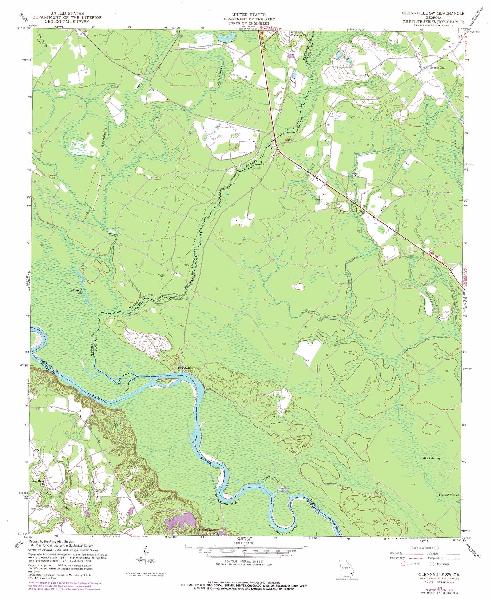
Glennville Sw Topo Map Georgia
To zoom in, hover over the map of Glennville Sw
USGS Topo Quad 31081g8 - 1:24,000 scale
| Topo Map Name: | Glennville Sw |
| USGS Topo Quad ID: | 31081g8 |
| Print Size: | ca. 21 1/4" wide x 27" high |
| Southeast Coordinates: | 31.75° N latitude / 81.875° W longitude |
| Map Center Coordinates: | 31.8125° N latitude / 81.9375° W longitude |
| U.S. State: | GA |
| Filename: | o31081g8.jpg |
| Download Map JPG Image: | Glennville Sw topo map 1:24,000 scale |
| Map Type: | Topographic |
| Topo Series: | 7.5´ |
| Map Scale: | 1:24,000 |
| Source of Map Images: | United States Geological Survey (USGS) |
| Alternate Map Versions: |
Glennville SW GA 1958, updated 1961 Download PDF Buy paper map Glennville SW GA 1958, updated 1976 Download PDF Buy paper map Glennville SW GA 2011 Download PDF Buy paper map Glennville SW GA 2014 Download PDF Buy paper map |
1:24,000 Topo Quads surrounding Glennville Sw
Reidsville West |
Reidsville East |
Deans Crossing |
Glissons Millpond |
Willie |
Altamaha |
Tison |
Glennville |
Glennville Ne |
Taylors Creek |
Altamaha Sw |
Altamaha Se |
Glennville Sw |
Glennville Se |
Walthourville |
Surrency |
Odum |
Jesup Nw |
Doctortown |
Ludowici |
K'Ville |
Ritch |
Jesup West |
Jesup East |
Bug Island |
> Back to 31081e1 at 1:100,000 scale
> Back to 31080a1 at 1:250,000 scale
> Back to U.S. Topo Maps home
Glennville Sw topo map: Gazetteer
Glennville Sw: Bends
Marrowbone Round elevation 13m 42′Strickland Bight elevation 12m 39′
Glennville Sw: Bridges
Lumber Bridge (historical) elevation 21m 68′Glennville Sw: Channels
Toms Creek elevation 12m 39′Yankee Reach elevation 11m 36′
Glennville Sw: Cliffs
Beards Bluff elevation 19m 62′Glennville Sw: Crossings
Beards Bluff Ferry (historical) elevation 12m 39′Glennville Sw: Dams
Cherokee Lakes Dam West elevation 22m 72′Kicklighters Pond Dam elevation 24m 78′
Glennville Sw: Islands
Stooping Gum Island elevation 13m 42′Glennville Sw: Lakes
Stafford Lake elevation 15m 49′Glennville Sw: Populated Places
Beards Creek elevation 44m 144′Noble elevation 21m 68′
Glennville Sw: Reservoirs
Cherokee Lakes elevation 28m 91′Cherokee Lakes West elevation 22m 72′
Kicklighters Pond elevation 24m 78′
Glennville Sw: Streams
Beards Creek elevation 12m 39′Delbos Bay elevation 17m 55′
Mushmelon Creek elevation 14m 45′
Glennville Sw: Swamps
Black Swamp elevation 15m 49′Hog Lake elevation 15m 49′
Mitchell Lake elevation 14m 45′
Glennville Sw digital topo map on disk
Buy this Glennville Sw topo map showing relief, roads, GPS coordinates and other geographical features, as a high-resolution digital map file on DVD: