Glennville Ne Topo Map Georgia
To zoom in, hover over the map of Glennville Ne
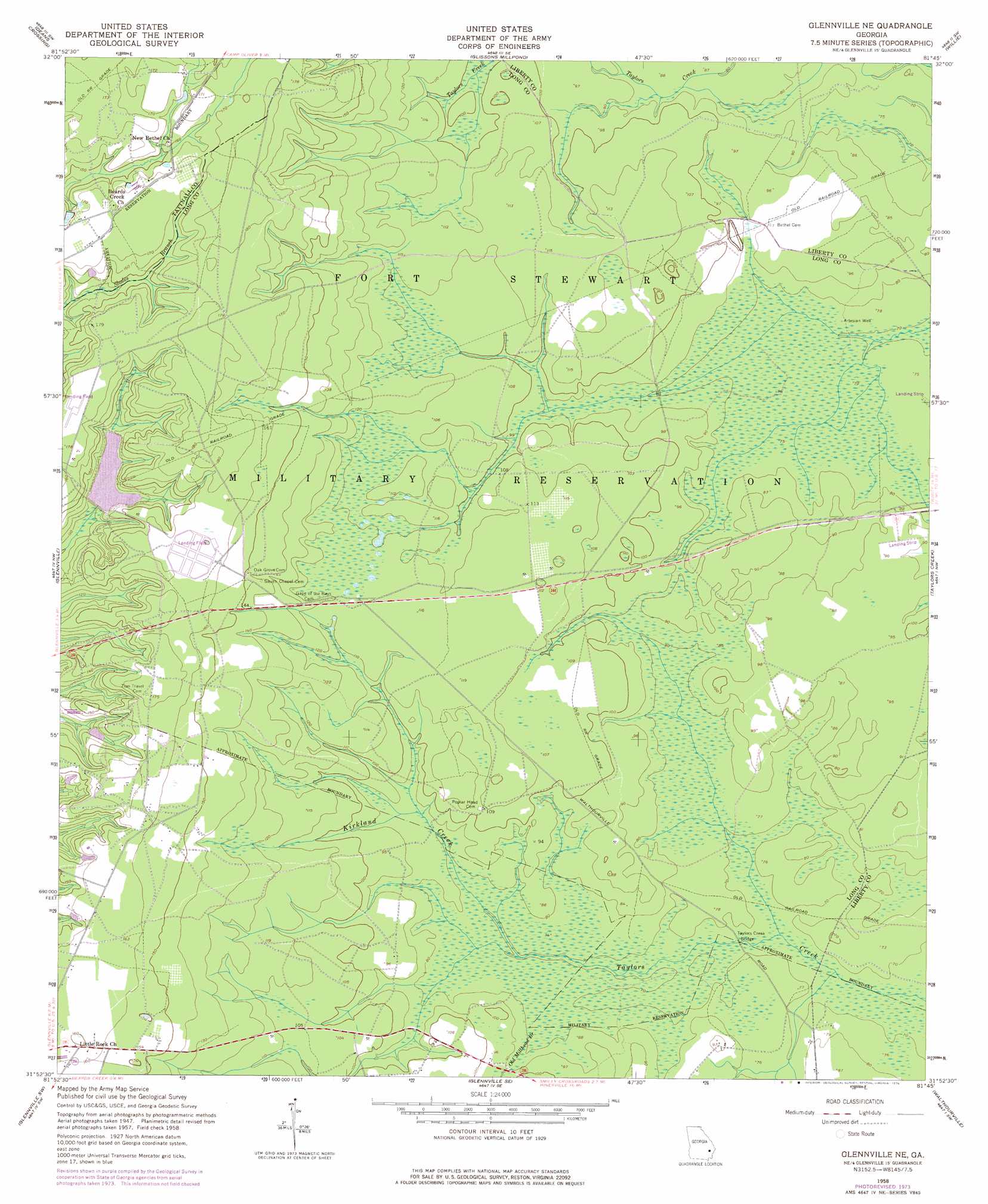
USGS Topo Quad 31081h7 - 1:24,000 scale
| Topo Map Name: | Glennville Ne |
| USGS Topo Quad ID: | 31081h7 |
| Print Size: | ca. 21 1/4" wide x 27" high |
| Southeast Coordinates: | 31.875° N latitude / 81.75° W longitude |
| Map Center Coordinates: | 31.9375° N latitude / 81.8125° W longitude |
| U.S. State: | GA |
| Filename: | o31081h7.jpg |
| Download Map JPG Image: | Glennville Ne topo map 1:24,000 scale |
| Map Type: | Topographic |
| Topo Series: | 7.5´ |
| Map Scale: | 1:24,000 |
| Source of Map Images: | United States Geological Survey (USGS) |
| Alternate Map Versions: |
Glennville NE GA 1958, updated 1961 Download PDF Buy paper map Glennville NE GA 1958, updated 1976 Download PDF Buy paper map Glennville NE GA 2011 Download PDF Buy paper map Glennville NE GA 2014 Download PDF Buy paper map |
1:24,000 Topo Quads surrounding Glennville Ne
Collins |
Claxton |
Daisy |
Groveland |
Lanier |
Reidsville East |
Deans Crossing |
Glissons Millpond |
Willie |
Letford |
Tison |
Glennville |
Glennville Ne |
Taylors Creek |
Trinity |
Altamaha Se |
Glennville Sw |
Glennville Se |
Walthourville |
Hinesville |
Odum |
Jesup Nw |
Doctortown |
Ludowici |
East Of Ludowici |
> Back to 31081e1 at 1:100,000 scale
> Back to 31080a1 at 1:250,000 scale
> Back to U.S. Topo Maps home
Glennville Ne topo map: Gazetteer
Glennville Ne: Bridges
Taylors Creek Bridge elevation 21m 68′Glennville Ne: Populated Places
Kent (historical) elevation 54m 177′Lida (historical) elevation 27m 88′
Smiley (historical) elevation 30m 98′
Strain (historical) elevation 27m 88′
Glennville Ne: Reservoirs
Strickland Pond (historical) elevation 21m 68′Glennville Ne: Streams
Kirkland Creek elevation 21m 68′Old Millhead Branch elevation 22m 72′
Glennville Ne digital topo map on disk
Buy this Glennville Ne topo map showing relief, roads, GPS coordinates and other geographical features, as a high-resolution digital map file on DVD: