Manor Topo Map Georgia
To zoom in, hover over the map of Manor
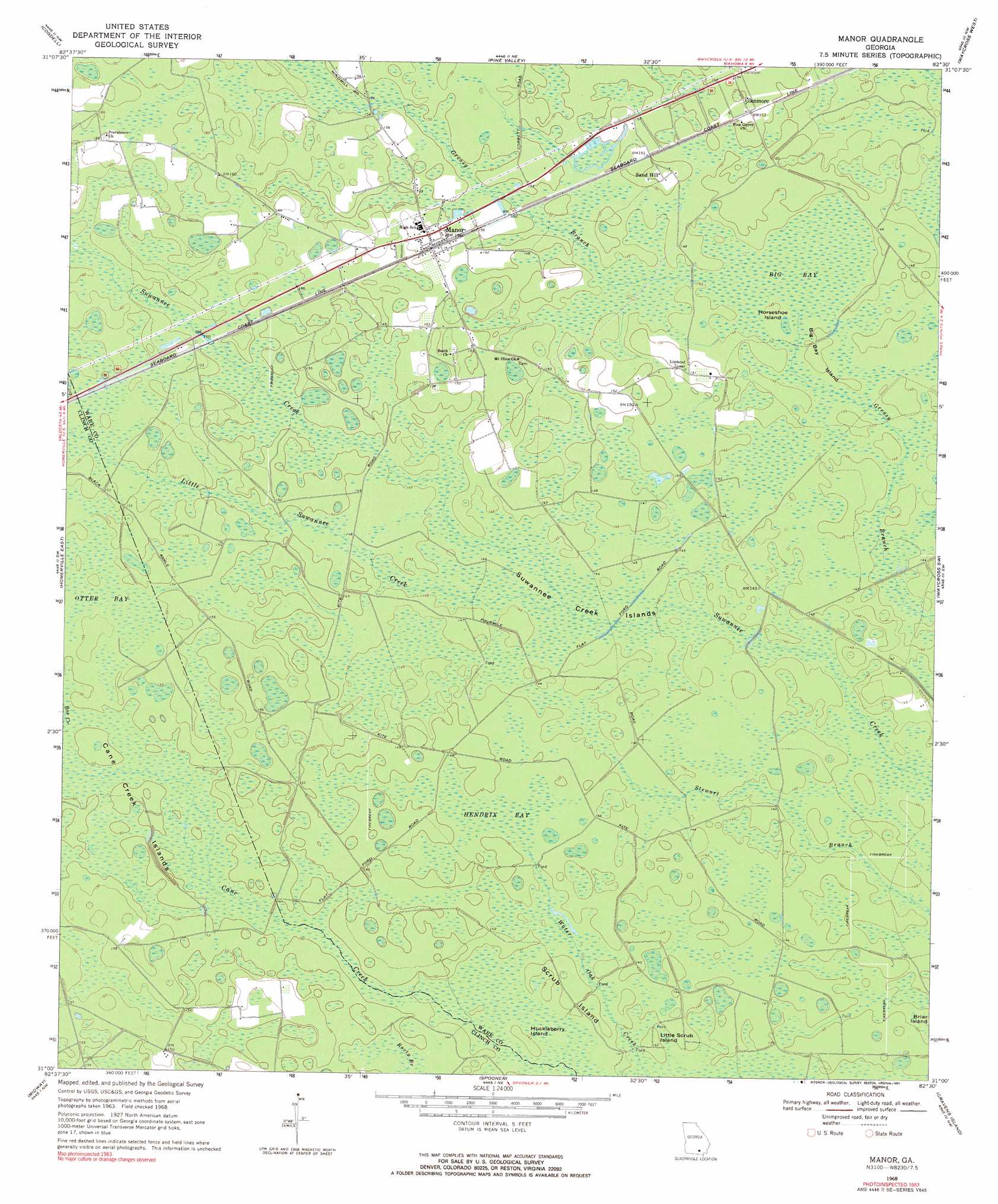
USGS Topo Quad 31082a5 - 1:24,000 scale
| Topo Map Name: | Manor |
| USGS Topo Quad ID: | 31082a5 |
| Print Size: | ca. 21 1/4" wide x 27" high |
| Southeast Coordinates: | 31° N latitude / 82.5° W longitude |
| Map Center Coordinates: | 31.0625° N latitude / 82.5625° W longitude |
| U.S. State: | GA |
| Filename: | o31082a5.jpg |
| Download Map JPG Image: | Manor topo map 1:24,000 scale |
| Map Type: | Topographic |
| Topo Series: | 7.5´ |
| Map Scale: | 1:24,000 |
| Source of Map Images: | United States Geological Survey (USGS) |
| Alternate Map Versions: |
Manor GA 1968, updated 1970 Download PDF Buy paper map Manor GA 1968, updated 1991 Download PDF Buy paper map Manor GA 2011 Download PDF Buy paper map Manor GA 2014 Download PDF Buy paper map |
1:24,000 Topo Quads surrounding Manor
Pearson |
Axson |
Talmo |
Dixie Union |
Blackshear West |
Sandy Bottom |
Cogdell |
Pine Valley |
Waycross West |
Waycross East |
Homerville West |
Homerville East |
Manor |
Waycross Sw |
Waycross Se |
Du Pont |
Midway |
Spooner |
Cravens Island |
Dinner Pond |
Thelma |
Headlight |
Colon |
The Pocket |
Billys Island |
> Back to 31082a1 at 1:100,000 scale
> Back to 31082a1 at 1:250,000 scale
> Back to U.S. Topo Maps home
Manor topo map: Gazetteer
Manor: Islands
Big Bay Island elevation 44m 144′Cane Creek Islands elevation 45m 147′
Horseshoe Island elevation 44m 144′
Huckleberry Island elevation 44m 144′
Little Scrub Island elevation 42m 137′
Scrub Island elevation 44m 144′
Suwannee Creek Islands elevation 44m 144′
Manor: Populated Places
Glenmore elevation 45m 147′Manor elevation 47m 154′
Sand Hill elevation 45m 147′
Manor: Streams
Little Suwannee Creek elevation 43m 141′Martha Branch elevation 48m 157′
Manor: Swamps
Big Bay elevation 44m 144′Hendrix Bay elevation 45m 147′
Otter Bay elevation 47m 154′
Manor digital topo map on disk
Buy this Manor topo map showing relief, roads, GPS coordinates and other geographical features, as a high-resolution digital map file on DVD: