Homerville West Topo Map Georgia
To zoom in, hover over the map of Homerville West
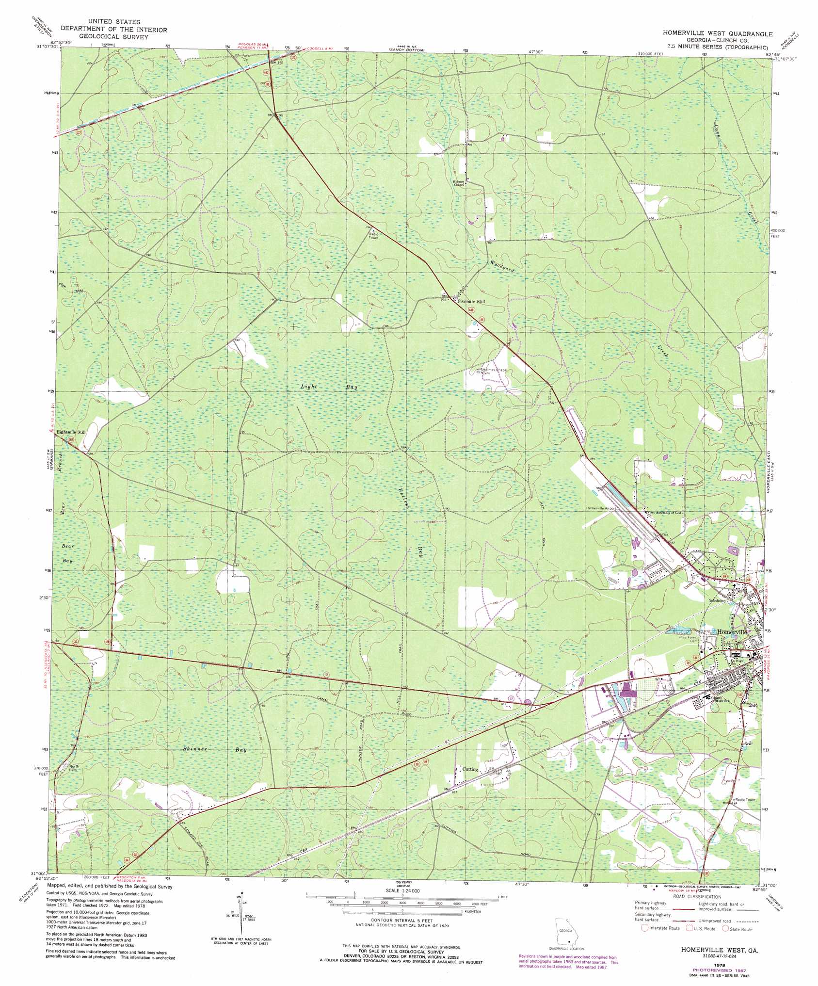
USGS Topo Quad 31082a7 - 1:24,000 scale
| Topo Map Name: | Homerville West |
| USGS Topo Quad ID: | 31082a7 |
| Print Size: | ca. 21 1/4" wide x 27" high |
| Southeast Coordinates: | 31° N latitude / 82.75° W longitude |
| Map Center Coordinates: | 31.0625° N latitude / 82.8125° W longitude |
| U.S. State: | GA |
| Filename: | o31082a7.jpg |
| Download Map JPG Image: | Homerville West topo map 1:24,000 scale |
| Map Type: | Topographic |
| Topo Series: | 7.5´ |
| Map Scale: | 1:24,000 |
| Source of Map Images: | United States Geological Survey (USGS) |
| Alternate Map Versions: |
Homerville West GA 1978, updated 1978 Download PDF Buy paper map Homerville West GA 1978, updated 1987 Download PDF Buy paper map Homerville West GA 2011 Download PDF Buy paper map Homerville West GA 2014 Download PDF Buy paper map |
1:24,000 Topo Quads surrounding Homerville West
Willacoochee |
Kirkland |
Pearson |
Axson |
Talmo |
Hastings Fish Pond |
Henderson Still |
Sandy Bottom |
Cogdell |
Pine Valley |
Lakeland |
Sirmans |
Homerville West |
Homerville East |
Manor |
Naylor |
Stockton |
Du Pont |
Midway |
Spooner |
Howell |
Haylow |
Thelma |
Headlight |
Colon |
> Back to 31082a1 at 1:100,000 scale
> Back to 31082a1 at 1:250,000 scale
> Back to U.S. Topo Maps home
Homerville West topo map: Gazetteer
Homerville West: Airports
Homerville Airport elevation 56m 183′Homerville West: Parks
Homerville and Clinch County Recreation Park elevation 53m 173′Homerville West: Populated Places
Cutting elevation 57m 187′Fivemile Still elevation 58m 190′
Gillicon elevation 55m 180′
Homerville West: Swamps
Bear Bay elevation 55m 180′Light Bay elevation 57m 187′
Skinner Bay elevation 55m 180′
Useless Bay elevation 57m 187′
Homerville West digital topo map on disk
Buy this Homerville West topo map showing relief, roads, GPS coordinates and other geographical features, as a high-resolution digital map file on DVD: