Sirmans Topo Map Georgia
To zoom in, hover over the map of Sirmans
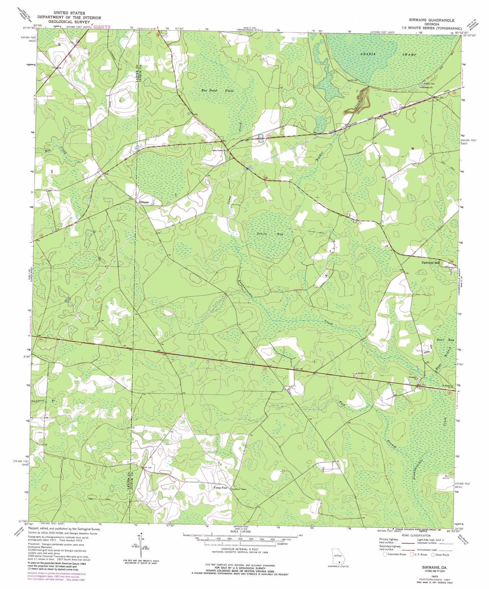
USGS Topo Quad 31082a8 - 1:24,000 scale
| Topo Map Name: | Sirmans |
| USGS Topo Quad ID: | 31082a8 |
| Print Size: | ca. 21 1/4" wide x 27" high |
| Southeast Coordinates: | 31° N latitude / 82.875° W longitude |
| Map Center Coordinates: | 31.0625° N latitude / 82.9375° W longitude |
| U.S. State: | GA |
| Filename: | o31082a8.jpg |
| Download Map JPG Image: | Sirmans topo map 1:24,000 scale |
| Map Type: | Topographic |
| Topo Series: | 7.5´ |
| Map Scale: | 1:24,000 |
| Source of Map Images: | United States Geological Survey (USGS) |
| Alternate Map Versions: |
Sirmans GA 1972, updated 1977 Download PDF Buy paper map Sirmans GA 1972, updated 1987 Download PDF Buy paper map Sirmans GA 2011 Download PDF Buy paper map Sirmans GA 2014 Download PDF Buy paper map |
1:24,000 Topo Quads surrounding Sirmans
Tenmile Bay |
Willacoochee |
Kirkland |
Pearson |
Axson |
Nashville East |
Hastings Fish Pond |
Henderson Still |
Sandy Bottom |
Cogdell |
Ray City |
Lakeland |
Sirmans |
Homerville West |
Homerville East |
Bemiss |
Naylor |
Stockton |
Du Pont |
Midway |
Indianola |
Howell |
Haylow |
Thelma |
Headlight |
> Back to 31082a1 at 1:100,000 scale
> Back to 31082a1 at 1:250,000 scale
> Back to U.S. Topo Maps home
Sirmans topo map: Gazetteer
Sirmans: Populated Places
Eightmile Still elevation 58m 190′Sirmans elevation 62m 203′
Sirmans: Streams
Bear Branch elevation 54m 177′Camp Creek elevation 57m 187′
Fish Branch elevation 54m 177′
Walker Creek elevation 57m 187′
Sirmans: Swamps
Bee Pond Flats elevation 61m 200′Devils Bay elevation 57m 187′
Sirmans digital topo map on disk
Buy this Sirmans topo map showing relief, roads, GPS coordinates and other geographical features, as a high-resolution digital map file on DVD: