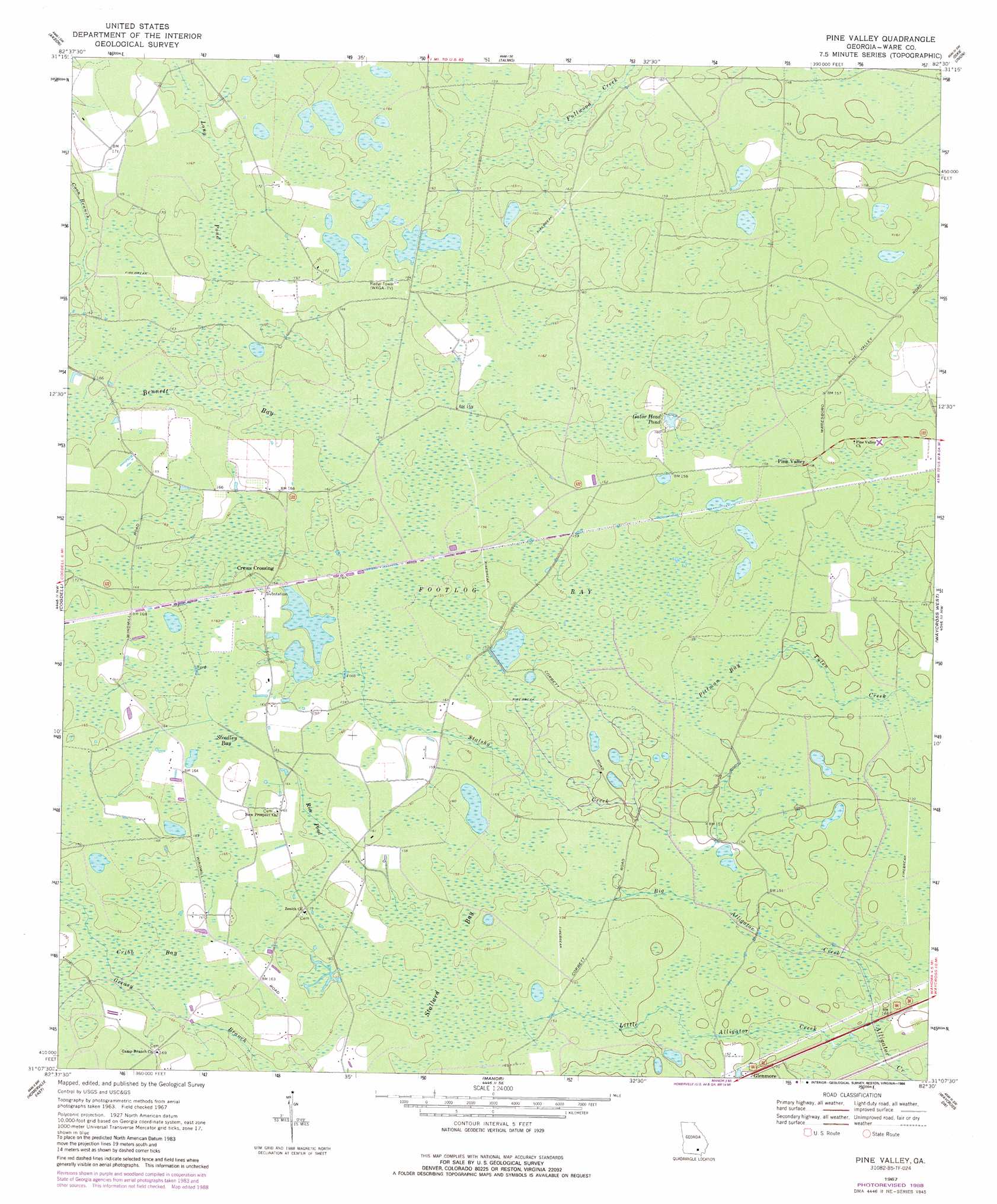
Pine Valley Topo Map Georgia
To zoom in, hover over the map of Pine Valley
USGS Topo Quad 31082b5 - 1:24,000 scale
| Topo Map Name: | Pine Valley |
| USGS Topo Quad ID: | 31082b5 |
| Print Size: | ca. 21 1/4" wide x 27" high |
| Southeast Coordinates: | 31.125° N latitude / 82.5° W longitude |
| Map Center Coordinates: | 31.1875° N latitude / 82.5625° W longitude |
| U.S. State: | GA |
| Filename: | o31082b5.jpg |
| Download Map JPG Image: | Pine Valley topo map 1:24,000 scale |
| Map Type: | Topographic |
| Topo Series: | 7.5´ |
| Map Scale: | 1:24,000 |
| Source of Map Images: | United States Geological Survey (USGS) |
| Alternate Map Versions: |
Pine Valley GA 1967, updated 1969 Download PDF Buy paper map Pine Valley GA 1967, updated 1988 Download PDF Buy paper map Pine Valley GA 2011 Download PDF Buy paper map Pine Valley GA 2014 Download PDF Buy paper map |
1:24,000 Topo Quads surrounding Pine Valley
Douglas South |
Wilsonville |
Beach |
Crawley |
Mershon |
Pearson |
Axson |
Talmo |
Dixie Union |
Blackshear West |
Sandy Bottom |
Cogdell |
Pine Valley |
Waycross West |
Waycross East |
Homerville West |
Homerville East |
Manor |
Waycross Sw |
Waycross Se |
Du Pont |
Midway |
Spooner |
Cravens Island |
Dinner Pond |
> Back to 31082a1 at 1:100,000 scale
> Back to 31082a1 at 1:250,000 scale
> Back to U.S. Topo Maps home
Pine Valley topo map: Gazetteer
Pine Valley: Lakes
Gator Head Pond elevation 48m 157′Pine Valley: Populated Places
Crews Crossing elevation 49m 160′Pine Valley elevation 47m 154′
Pine Valley: Streams
Big Alligator Creek elevation 44m 144′Little Alligator Creek elevation 44m 144′
Stalsby Creek elevation 44m 144′
Pine Valley: Swamps
Bennett Bay elevation 49m 160′Cribb Bay elevation 49m 160′
Footlog Bay elevation 47m 154′
Long Pond elevation 50m 164′
Pittman Bay elevation 47m 154′
Rice Pond elevation 48m 157′
Stallard Bay elevation 47m 154′
Steedley Bay elevation 49m 160′
Pine Valley digital topo map on disk
Buy this Pine Valley topo map showing relief, roads, GPS coordinates and other geographical features, as a high-resolution digital map file on DVD: