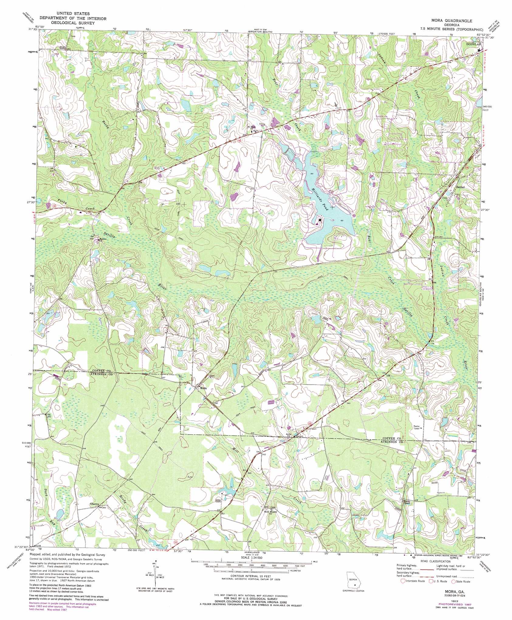
Mora Topo Map Georgia
To zoom in, hover over the map of Mora
USGS Topo Quad 31082d8 - 1:24,000 scale
| Topo Map Name: | Mora |
| USGS Topo Quad ID: | 31082d8 |
| Print Size: | ca. 21 1/4" wide x 27" high |
| Southeast Coordinates: | 31.375° N latitude / 82.875° W longitude |
| Map Center Coordinates: | 31.4375° N latitude / 82.9375° W longitude |
| U.S. State: | GA |
| Filename: | o31082d8.jpg |
| Download Map JPG Image: | Mora topo map 1:24,000 scale |
| Map Type: | Topographic |
| Topo Series: | 7.5´ |
| Map Scale: | 1:24,000 |
| Source of Map Images: | United States Geological Survey (USGS) |
| Alternate Map Versions: |
Mora GA 1972, updated 1987 Download PDF Buy paper map Mora GA 1977, updated 1977 Download PDF Buy paper map Mora GA 2011 Download PDF Buy paper map Mora GA 2014 Download PDF Buy paper map |
1:24,000 Topo Quads surrounding Mora
Fitzgerald East |
Osierfield |
Broxton North |
Broxton Ne |
Denton |
Ocilla East |
Ambrose |
Broxton South |
Douglas North |
Nicholls |
Alapaha |
Lax |
Mora |
Douglas South |
Wilsonville |
Tenmile Bay |
Willacoochee |
Kirkland |
Pearson |
Axson |
Nashville East |
Hastings Fish Pond |
Henderson Still |
Sandy Bottom |
Cogdell |
> Back to 31082a1 at 1:100,000 scale
> Back to 31082a1 at 1:250,000 scale
> Back to U.S. Topo Maps home
Mora topo map: Gazetteer
Mora: Dams
Holiday Beach Dam elevation 53m 173′Holiday Beach Dam North elevation 59m 193′
Mora: Lakes
Hilliards Pond elevation 55m 180′Mora: Populated Places
Bay Meadows elevation 56m 183′Bethel elevation 61m 200′
Mora elevation 76m 249′
Oberry elevation 73m 239′
Mora: Reservoirs
Holiday Beach Lake elevation 53m 173′Holiday Beach North Lake elevation 59m 193′
Mora: Streams
Bear Creek elevation 49m 160′Forky Creek elevation 54m 177′
Indian Creek elevation 48m 157′
Reedy Creek elevation 54m 177′
Mora digital topo map on disk
Buy this Mora topo map showing relief, roads, GPS coordinates and other geographical features, as a high-resolution digital map file on DVD: