Ritch Topo Map Georgia
To zoom in, hover over the map of Ritch
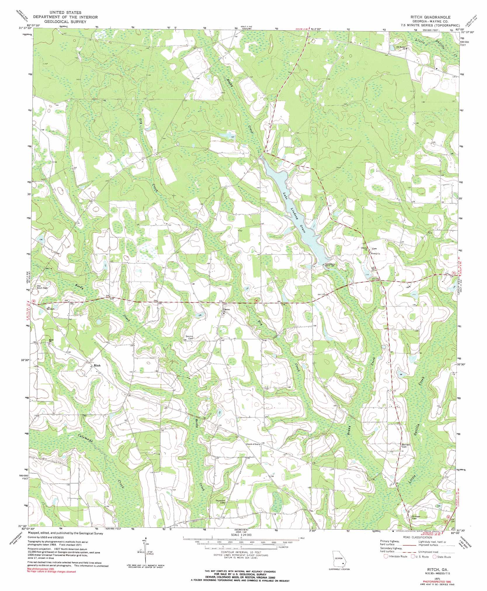
USGS Topo Quad 31082e1 - 1:24,000 scale
| Topo Map Name: | Ritch |
| USGS Topo Quad ID: | 31082e1 |
| Print Size: | ca. 21 1/4" wide x 27" high |
| Southeast Coordinates: | 31.5° N latitude / 82° W longitude |
| Map Center Coordinates: | 31.5625° N latitude / 82.0625° W longitude |
| U.S. State: | GA |
| Filename: | o31082e1.jpg |
| Download Map JPG Image: | Ritch topo map 1:24,000 scale |
| Map Type: | Topographic |
| Topo Series: | 7.5´ |
| Map Scale: | 1:24,000 |
| Source of Map Images: | United States Geological Survey (USGS) |
| Alternate Map Versions: |
Ritch GA 1971, updated 1973 Download PDF Buy paper map Ritch GA 1971, updated 1991 Download PDF Buy paper map Ritch GA 2011 Download PDF Buy paper map Ritch GA 2014 Download PDF Buy paper map |
1:24,000 Topo Quads surrounding Ritch
Baxley |
Altamaha Sw |
Altamaha Se |
Glennville Sw |
Glennville Se |
Alma Ne |
Surrency |
Odum |
Jesup Nw |
Doctortown |
Coffee |
K'Ville |
Ritch |
Jesup West |
Jesup East |
Mershon |
Patterson |
Screven |
Mckinnon |
Manningtown |
Blackshear West |
Blackshear East |
Patterson Se |
Hortense |
Browntown |
> Back to 31082e1 at 1:100,000 scale
> Back to 31082a1 at 1:250,000 scale
> Back to U.S. Topo Maps home
Ritch topo map: Gazetteer
Ritch: Populated Places
Ritch elevation 44m 144′Ritch: Reservoirs
Lake Lindsay Grace elevation 33m 108′Little Satilla Creek Structure Number Seven Lake elevation 32m 104′
Ritch: Streams
Boggy Creek elevation 23m 75′Dry Creek elevation 25m 82′
Ritch digital topo map on disk
Buy this Ritch topo map showing relief, roads, GPS coordinates and other geographical features, as a high-resolution digital map file on DVD: