Douglas North Topo Map Georgia
To zoom in, hover over the map of Douglas North
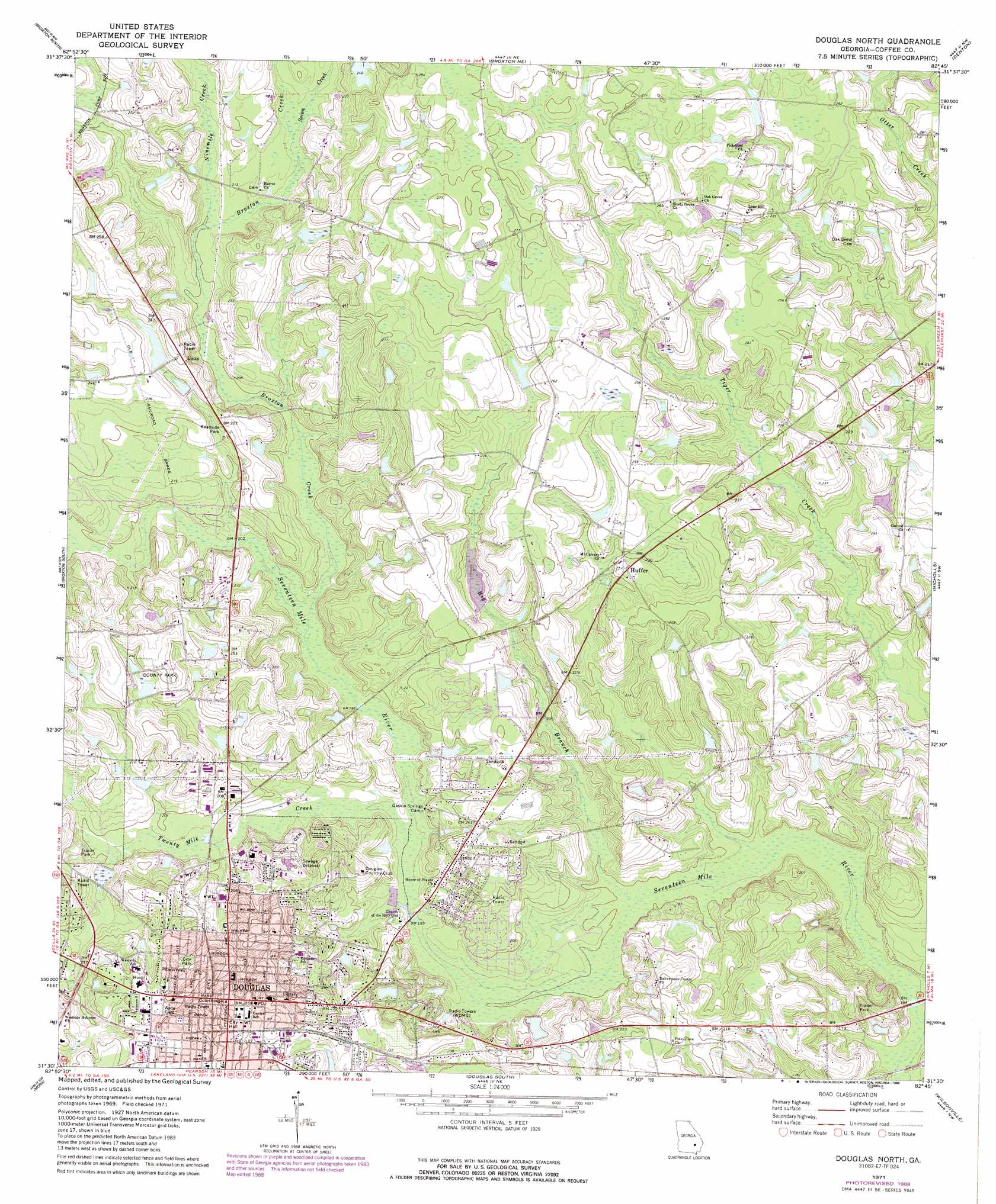
USGS Topo Quad 31082e7 - 1:24,000 scale
| Topo Map Name: | Douglas North |
| USGS Topo Quad ID: | 31082e7 |
| Print Size: | ca. 21 1/4" wide x 27" high |
| Southeast Coordinates: | 31.5° N latitude / 82.75° W longitude |
| Map Center Coordinates: | 31.5625° N latitude / 82.8125° W longitude |
| U.S. State: | GA |
| Filename: | o31082e7.jpg |
| Download Map JPG Image: | Douglas North topo map 1:24,000 scale |
| Map Type: | Topographic |
| Topo Series: | 7.5´ |
| Map Scale: | 1:24,000 |
| Source of Map Images: | United States Geological Survey (USGS) |
| Alternate Map Versions: |
Douglas North GA 1971, updated 1974 Download PDF Buy paper map Douglas North GA 1971, updated 1988 Download PDF Buy paper map Douglas North GA 2011 Download PDF Buy paper map Douglas North GA 2014 Download PDF Buy paper map |
1:24,000 Topo Quads surrounding Douglas North
China Hill |
Jacksonville |
Snipesville |
Roper |
Hazlehurst South |
Osierfield |
Broxton North |
Broxton Ne |
Denton |
Nicholls Ne |
Ambrose |
Broxton South |
Douglas North |
Nicholls |
Sessoms |
Lax |
Mora |
Douglas South |
Wilsonville |
Beach |
Willacoochee |
Kirkland |
Pearson |
Axson |
Talmo |
> Back to 31082e1 at 1:100,000 scale
> Back to 31082a1 at 1:250,000 scale
> Back to U.S. Topo Maps home
Douglas North topo map: Gazetteer
Douglas North: Dams
Hinson Lake Dam elevation 57m 187′Lott Lake Dam elevation 70m 229′
Douglas North: Parks
Eastside Park elevation 65m 213′Emma Wade Park elevation 75m 246′
Faircloth Field elevation 78m 255′
General Coffee State Park elevation 50m 164′
Jardine Stadium elevation 76m 249′
North Madison Park elevation 62m 203′
Unity Park elevation 78m 255′
Wade Field elevation 79m 259′
Wheeler Park elevation 68m 223′
Whispering Pines Park elevation 59m 193′
Douglas North: Populated Places
Blystonel elevation 64m 209′Cherokee Hills elevation 72m 236′
Douglas elevation 78m 255′
Huffer elevation 71m 232′
Lotts elevation 77m 252′
Oak Park elevation 66m 216′
Douglas North: Post Offices
Douglas Post Office elevation 77m 252′Douglas North: Reservoirs
Hinson Lake elevation 57m 187′Lott Lake elevation 70m 229′
Douglas North: Streams
Big Branch elevation 52m 170′Broxton Creek elevation 57m 187′
Ninemile Creek elevation 61m 200′
Seven Creek elevation 63m 206′
Twenty Mile Creek elevation 55m 180′
Douglas North digital topo map on disk
Buy this Douglas North topo map showing relief, roads, GPS coordinates and other geographical features, as a high-resolution digital map file on DVD: