Odum Topo Map Georgia
To zoom in, hover over the map of Odum
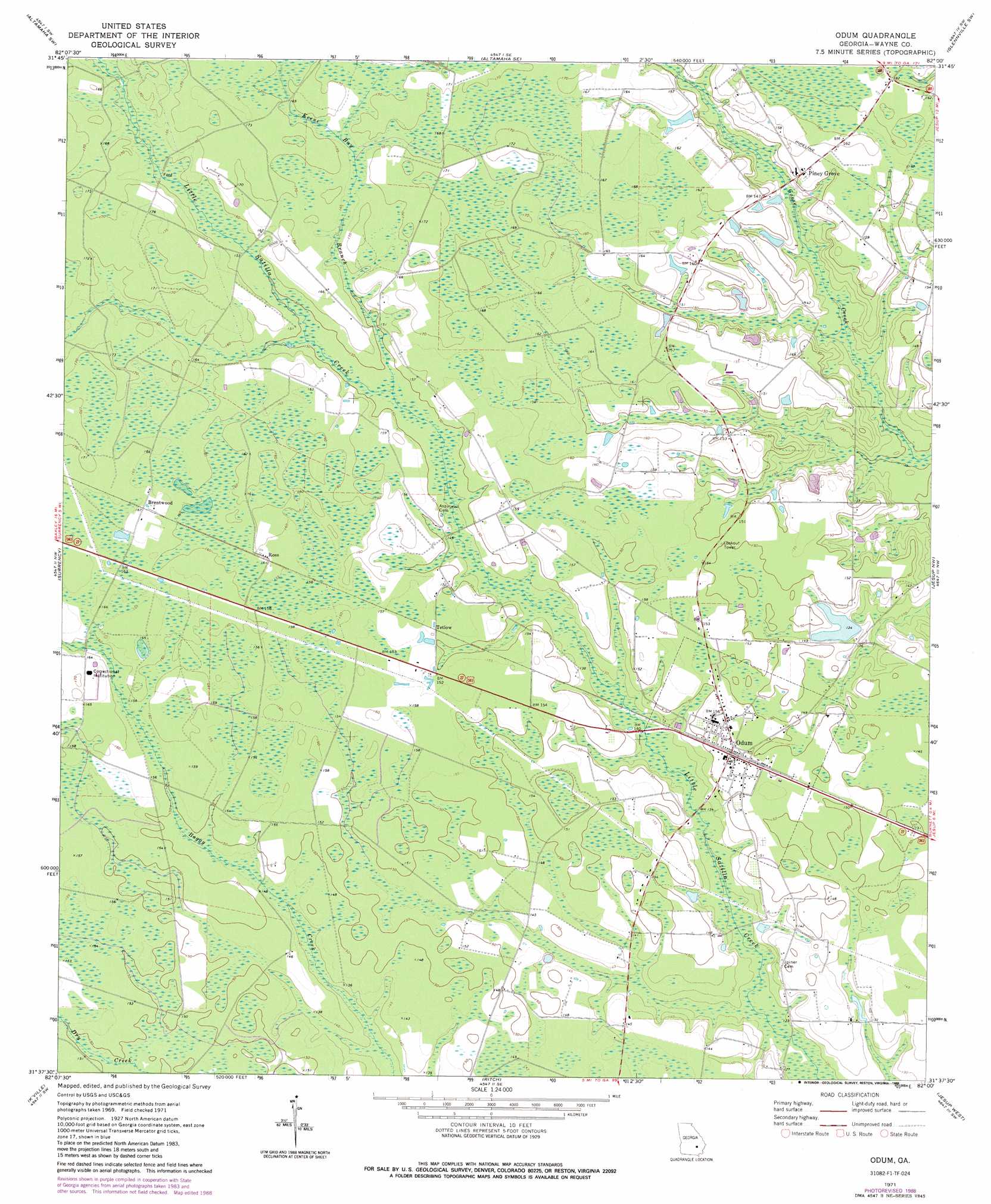
USGS Topo Quad 31082f1 - 1:24,000 scale
| Topo Map Name: | Odum |
| USGS Topo Quad ID: | 31082f1 |
| Print Size: | ca. 21 1/4" wide x 27" high |
| Southeast Coordinates: | 31.625° N latitude / 82° W longitude |
| Map Center Coordinates: | 31.6875° N latitude / 82.0625° W longitude |
| U.S. State: | GA |
| Filename: | o31082f1.jpg |
| Download Map JPG Image: | Odum topo map 1:24,000 scale |
| Map Type: | Topographic |
| Topo Series: | 7.5´ |
| Map Scale: | 1:24,000 |
| Source of Map Images: | United States Geological Survey (USGS) |
| Alternate Map Versions: |
Odum GA 1971, updated 1973 Download PDF Buy paper map Odum GA 1971, updated 1988 Download PDF Buy paper map Odum GA 2011 Download PDF Buy paper map Odum GA 2014 Download PDF Buy paper map |
1:24,000 Topo Quads surrounding Odum
Baxley Ne |
Altamaha |
Tison |
Glennville |
Glennville Ne |
Baxley |
Altamaha Sw |
Altamaha Se |
Glennville Sw |
Glennville Se |
Alma Ne |
Surrency |
Odum |
Jesup Nw |
Doctortown |
Coffee |
K'Ville |
Ritch |
Jesup West |
Jesup East |
Mershon |
Patterson |
Screven |
Mckinnon |
Manningtown |
> Back to 31082e1 at 1:100,000 scale
> Back to 31082a1 at 1:250,000 scale
> Back to U.S. Topo Maps home
Odum topo map: Gazetteer
Odum: Dams
Lake Lanell Dam elevation 41m 134′Odum: Populated Places
Brentwood elevation 50m 164′Odum elevation 47m 154′
Piney Grove elevation 47m 154′
Tetlow elevation 47m 154′
Odum: Post Offices
Odum Post Office elevation 47m 154′Odum: Reservoirs
Lake Lanell elevation 41m 134′Odum: Streams
Keene Bay Branch elevation 43m 141′Odum digital topo map on disk
Buy this Odum topo map showing relief, roads, GPS coordinates and other geographical features, as a high-resolution digital map file on DVD: