Alma Ne Topo Map Georgia
To zoom in, hover over the map of Alma Ne
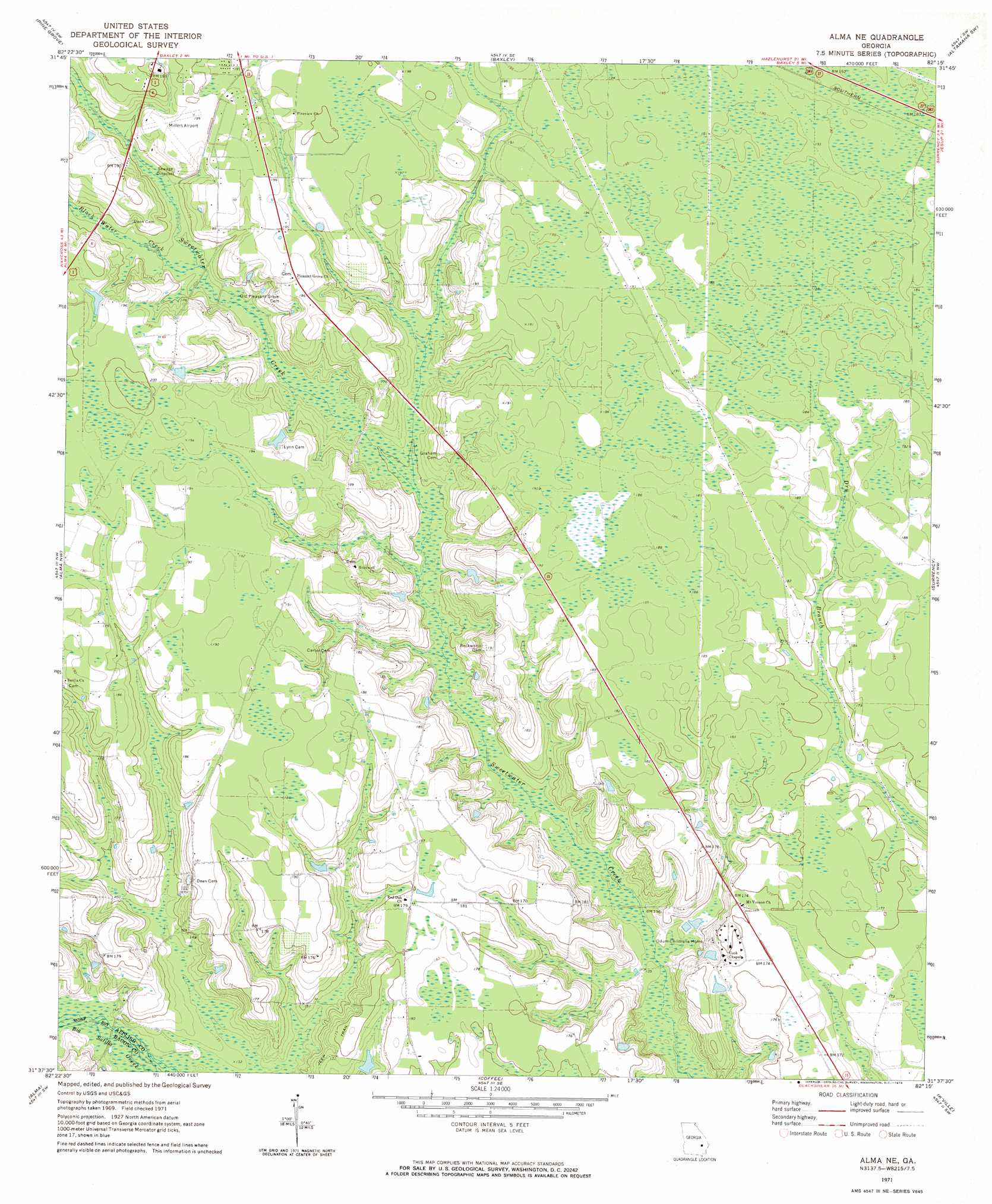
USGS Topo Quad 31082f3 - 1:24,000 scale
| Topo Map Name: | Alma Ne |
| USGS Topo Quad ID: | 31082f3 |
| Print Size: | ca. 21 1/4" wide x 27" high |
| Southeast Coordinates: | 31.625° N latitude / 82.25° W longitude |
| Map Center Coordinates: | 31.6875° N latitude / 82.3125° W longitude |
| U.S. State: | GA |
| Filename: | o31082f3.jpg |
| Download Map JPG Image: | Alma Ne topo map 1:24,000 scale |
| Map Type: | Topographic |
| Topo Series: | 7.5´ |
| Map Scale: | 1:24,000 |
| Source of Map Images: | United States Geological Survey (USGS) |
| Alternate Map Versions: |
Alma NE GA 1971, updated 1974 Download PDF Buy paper map Alma NE GA 2011 Download PDF Buy paper map Alma NE GA 2014 Download PDF Buy paper map |
1:24,000 Topo Quads surrounding Alma Ne
Hazlehurst North |
Grays Landing |
Baxley Ne |
Altamaha |
Tison |
Hazlehurst South |
Pine Grove |
Baxley |
Altamaha Sw |
Altamaha Se |
Nicholls Ne |
Alma Nw |
Alma Ne |
Surrency |
Odum |
Sessoms |
Alma |
Coffee |
K'Ville |
Ritch |
Beach |
Crawley |
Mershon |
Patterson |
Screven |
> Back to 31082e1 at 1:100,000 scale
> Back to 31082a1 at 1:250,000 scale
> Back to U.S. Topo Maps home
Alma Ne topo map: Gazetteer
Alma Ne: Populated Places
Holmesville elevation 54m 177′Pine Forest elevation 58m 190′
Alma Ne: Streams
Black Water Creek elevation 49m 160′Alma Ne digital topo map on disk
Buy this Alma Ne topo map showing relief, roads, GPS coordinates and other geographical features, as a high-resolution digital map file on DVD: