Nicholls Ne Topo Map Georgia
To zoom in, hover over the map of Nicholls Ne
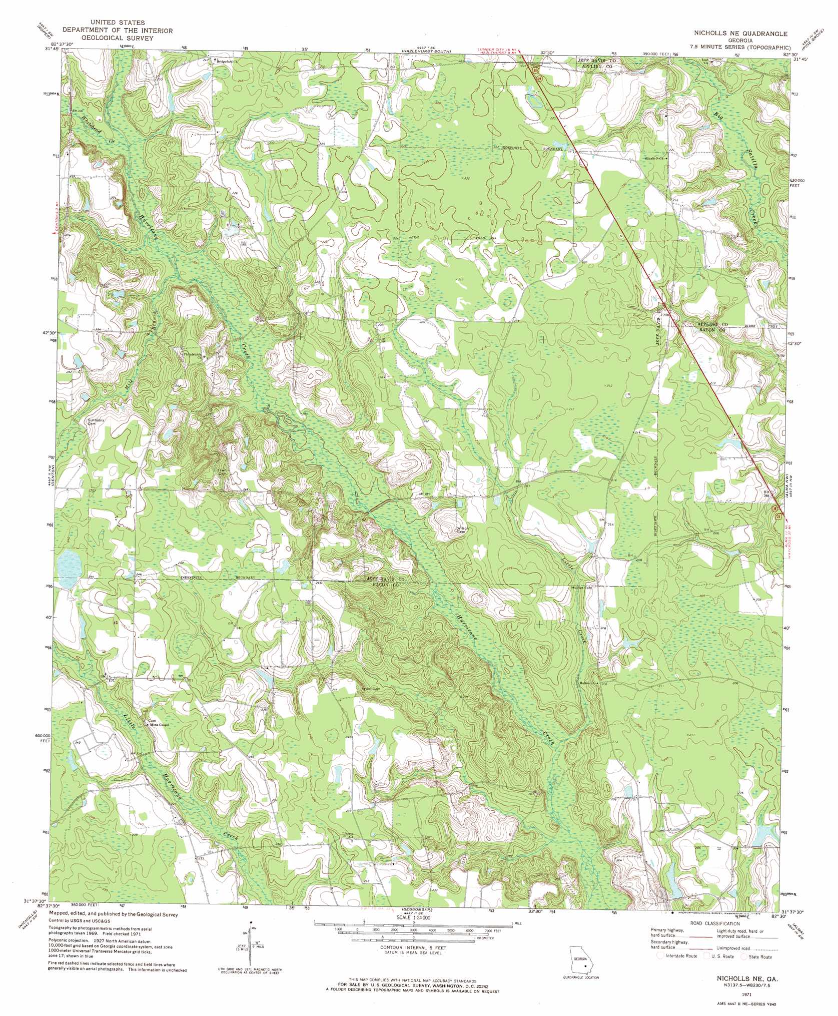
USGS Topo Quad 31082f5 - 1:24,000 scale
| Topo Map Name: | Nicholls Ne |
| USGS Topo Quad ID: | 31082f5 |
| Print Size: | ca. 21 1/4" wide x 27" high |
| Southeast Coordinates: | 31.625° N latitude / 82.5° W longitude |
| Map Center Coordinates: | 31.6875° N latitude / 82.5625° W longitude |
| U.S. State: | GA |
| Filename: | o31082f5.jpg |
| Download Map JPG Image: | Nicholls Ne topo map 1:24,000 scale |
| Map Type: | Topographic |
| Topo Series: | 7.5´ |
| Map Scale: | 1:24,000 |
| Source of Map Images: | United States Geological Survey (USGS) |
| Alternate Map Versions: |
Nicholls NE GA 1971, updated 1974 Download PDF Buy paper map Nicholls NE GA 2011 Download PDF Buy paper map Nicholls NE GA 2014 Download PDF Buy paper map |
1:24,000 Topo Quads surrounding Nicholls Ne
Jacksonville Ne |
Lumber City |
Hazlehurst North |
Grays Landing |
Baxley Ne |
Snipesville |
Roper |
Hazlehurst South |
Pine Grove |
Baxley |
Broxton Ne |
Denton |
Nicholls Ne |
Alma Nw |
Alma Ne |
Douglas North |
Nicholls |
Sessoms |
Alma |
Coffee |
Douglas South |
Wilsonville |
Beach |
Crawley |
Mershon |
> Back to 31082e1 at 1:100,000 scale
> Back to 31082a1 at 1:250,000 scale
> Back to U.S. Topo Maps home
Nicholls Ne topo map: Gazetteer
Nicholls Ne: Dams
Anderson Lake Dam elevation 59m 193′Mckinnon Lake Dam elevation 58m 190′
Nicholls Ne: Reservoirs
Anderson Lake elevation 59m 193′Mckinnon Lake elevation 58m 190′
Nicholls Ne: Streams
Little Creek elevation 49m 160′Mill Branch elevation 54m 177′
Whitehead Creek elevation 57m 187′
Nicholls Ne digital topo map on disk
Buy this Nicholls Ne topo map showing relief, roads, GPS coordinates and other geographical features, as a high-resolution digital map file on DVD: