Pine Grove Topo Map Georgia
To zoom in, hover over the map of Pine Grove
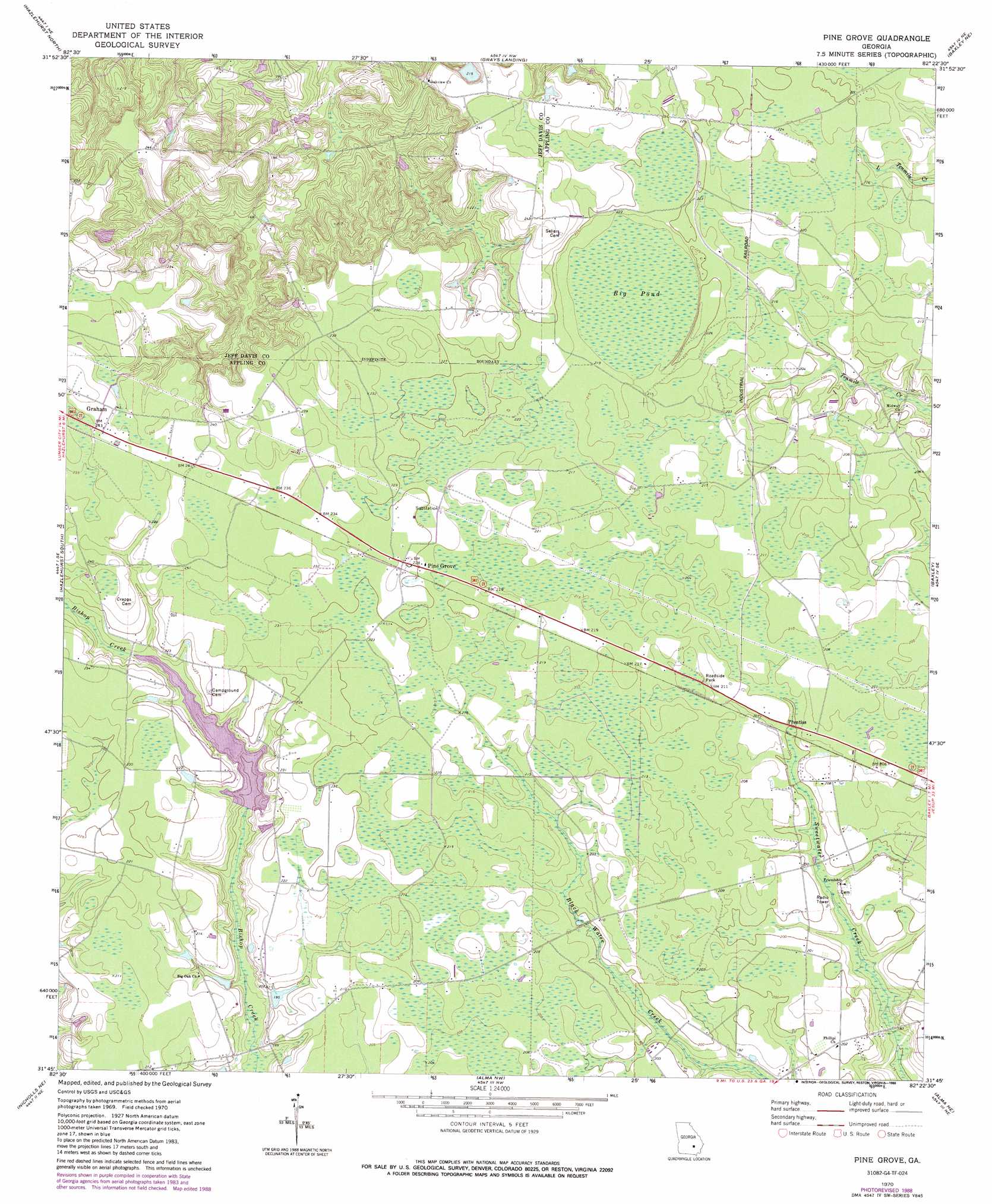
USGS Topo Quad 31082g4 - 1:24,000 scale
| Topo Map Name: | Pine Grove |
| USGS Topo Quad ID: | 31082g4 |
| Print Size: | ca. 21 1/4" wide x 27" high |
| Southeast Coordinates: | 31.75° N latitude / 82.375° W longitude |
| Map Center Coordinates: | 31.8125° N latitude / 82.4375° W longitude |
| U.S. State: | GA |
| Filename: | o31082g4.jpg |
| Download Map JPG Image: | Pine Grove topo map 1:24,000 scale |
| Map Type: | Topographic |
| Topo Series: | 7.5´ |
| Map Scale: | 1:24,000 |
| Source of Map Images: | United States Geological Survey (USGS) |
| Alternate Map Versions: |
Pine Grove GA 1970, updated 1974 Download PDF Buy paper map Pine Grove GA 1970, updated 1988 Download PDF Buy paper map Pine Grove GA 2011 Download PDF Buy paper map Pine Grove GA 2014 Download PDF Buy paper map |
1:24,000 Topo Quads surrounding Pine Grove
Jordan |
Uvalda |
Alston |
Johnson Corner |
Reidsville West |
Lumber City |
Hazlehurst North |
Grays Landing |
Baxley Ne |
Altamaha |
Roper |
Hazlehurst South |
Pine Grove |
Baxley |
Altamaha Sw |
Denton |
Nicholls Ne |
Alma Nw |
Alma Ne |
Surrency |
Nicholls |
Sessoms |
Alma |
Coffee |
K'Ville |
> Back to 31082e1 at 1:100,000 scale
> Back to 31082a1 at 1:250,000 scale
> Back to U.S. Topo Maps home
Pine Grove topo map: Gazetteer
Pine Grove: Dams
Bishop Creek Structure Number Seven Dam elevation 59m 193′Miller Lake Dam elevation 66m 216′
Pine Grove: Populated Places
Phillipi elevation 61m 200′Pine Grove elevation 67m 219′
Prentiss elevation 62m 203′
Pine Grove: Reservoirs
Bishop Creek Structure Number Seven Lake elevation 59m 193′Lake Mayers elevation 64m 209′
Miller Lake elevation 66m 216′
Pine Grove: Swamps
Big Pond elevation 65m 213′Pine Grove digital topo map on disk
Buy this Pine Grove topo map showing relief, roads, GPS coordinates and other geographical features, as a high-resolution digital map file on DVD: