Altamaha Topo Map Georgia
To zoom in, hover over the map of Altamaha
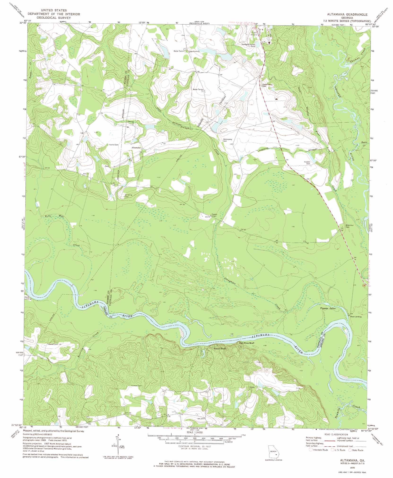
USGS Topo Quad 31082h2 - 1:24,000 scale
| Topo Map Name: | Altamaha |
| USGS Topo Quad ID: | 31082h2 |
| Print Size: | ca. 21 1/4" wide x 27" high |
| Southeast Coordinates: | 31.875° N latitude / 82.125° W longitude |
| Map Center Coordinates: | 31.9375° N latitude / 82.1875° W longitude |
| U.S. State: | GA |
| Filename: | o31082h2.jpg |
| Download Map JPG Image: | Altamaha topo map 1:24,000 scale |
| Map Type: | Topographic |
| Topo Series: | 7.5´ |
| Map Scale: | 1:24,000 |
| Source of Map Images: | United States Geological Survey (USGS) |
| Alternate Map Versions: |
Altamaha GA 1970, updated 1974 Download PDF Buy paper map Altamaha GA 2011 Download PDF Buy paper map Altamaha GA 2014 Download PDF Buy paper map |
1:24,000 Topo Quads surrounding Altamaha
Vidalia |
Lyons |
Ohoopee |
Collins |
Claxton |
Alston |
Johnson Corner |
Reidsville West |
Reidsville East |
Deans Crossing |
Grays Landing |
Baxley Ne |
Altamaha |
Tison |
Glennville |
Pine Grove |
Baxley |
Altamaha Sw |
Altamaha Se |
Glennville Sw |
Alma Nw |
Alma Ne |
Surrency |
Odum |
Jesup Nw |
> Back to 31082e1 at 1:100,000 scale
> Back to 31082a1 at 1:250,000 scale
> Back to U.S. Topo Maps home
Altamaha topo map: Gazetteer
Altamaha: Cliffs
Iron Mine Bluff elevation 34m 111′Moon Bluff elevation 29m 95′
Altamaha: Dams
Big Club House Pond Dam elevation 36m 118′Cotton Patch Pond Dam elevation 45m 147′
Downstream Twin Pond Dam elevation 44m 144′
Upstream Twin Pond Dam elevation 50m 164′
Wallace Pond Dam elevation 46m 150′
Altamaha: Populated Places
Altamaha elevation 51m 167′Eason Bluff elevation 30m 98′
Altamaha: Reservoirs
Big Club House Pond elevation 36m 118′Cotton Patch Pond elevation 45m 147′
Downstream Twin Pond elevation 44m 144′
Upstream Twin Pond elevation 50m 164′
Wallace Pond elevation 46m 150′
Altamaha: Streams
Battle Creek elevation 19m 62′Bells Mill Creek elevation 17m 55′
Roaring Creek elevation 19m 62′
Slaughter Creek elevation 18m 59′
Thomas Creek elevation 22m 72′
Altamaha digital topo map on disk
Buy this Altamaha topo map showing relief, roads, GPS coordinates and other geographical features, as a high-resolution digital map file on DVD: