Ray City Topo Map Georgia
To zoom in, hover over the map of Ray City
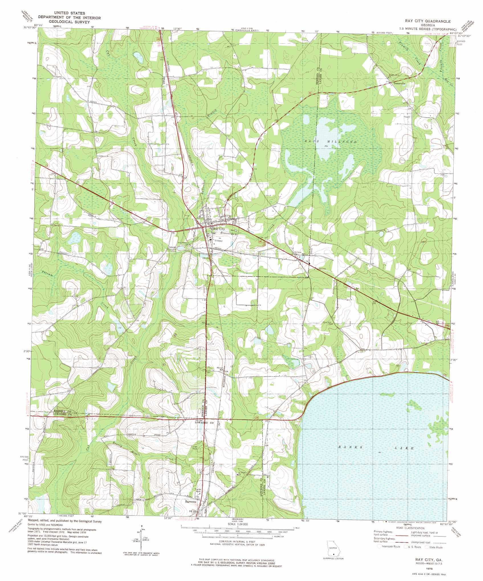
USGS Topo Quad 31083a2 - 1:24,000 scale
| Topo Map Name: | Ray City |
| USGS Topo Quad ID: | 31083a2 |
| Print Size: | ca. 21 1/4" wide x 27" high |
| Southeast Coordinates: | 31° N latitude / 83.125° W longitude |
| Map Center Coordinates: | 31.0625° N latitude / 83.1875° W longitude |
| U.S. State: | GA |
| Filename: | o31083a2.jpg |
| Download Map JPG Image: | Ray City topo map 1:24,000 scale |
| Map Type: | Topographic |
| Topo Series: | 7.5´ |
| Map Scale: | 1:24,000 |
| Source of Map Images: | United States Geological Survey (USGS) |
| Alternate Map Versions: |
Ray City GA 1978, updated 1978 Download PDF Buy paper map Ray City GA 2011 Download PDF Buy paper map Ray City GA 2014 Download PDF Buy paper map |
1:24,000 Topo Quads surrounding Ray City
Lenox |
Sapps Lake |
Tenmile Bay |
Willacoochee |
Kirkland |
Adel |
Nashville West |
Nashville East |
Hastings Fish Pond |
Henderson Still |
Cecil |
New Lois |
Ray City |
Lakeland |
Sirmans |
Hahira West |
Hahira East |
Bemiss |
Naylor |
Stockton |
Ousley |
Valdosta |
Indianola |
Howell |
Haylow |
> Back to 31083a1 at 1:100,000 scale
> Back to 31082a1 at 1:250,000 scale
> Back to U.S. Topo Maps home
Ray City topo map: Gazetteer
Ray City: Dams
Peters Lake Dam elevation 48m 157′Rays Mill Pond Dam elevation 61m 200′
Ray City: Lakes
Banks Lake elevation 58m 190′Ray City: Populated Places
Barretts elevation 76m 249′Ray City elevation 58m 190′
Teeterville elevation 64m 209′
Ray City: Reservoirs
Peters Lake elevation 48m 157′Rays Mill Pond elevation 61m 200′
Rays Millpond elevation 61m 200′
Ray City: Streams
Batterbee Branch elevation 52m 170′Beatty Mill Creek elevation 47m 154′
Beaverdam Creek elevation 52m 170′
Fivemile Creek elevation 55m 180′
Possum Creek elevation 49m 160′
Tenmile Creek elevation 55m 180′
Ray City digital topo map on disk
Buy this Ray City topo map showing relief, roads, GPS coordinates and other geographical features, as a high-resolution digital map file on DVD: