Berlin West Topo Map Georgia
To zoom in, hover over the map of Berlin West
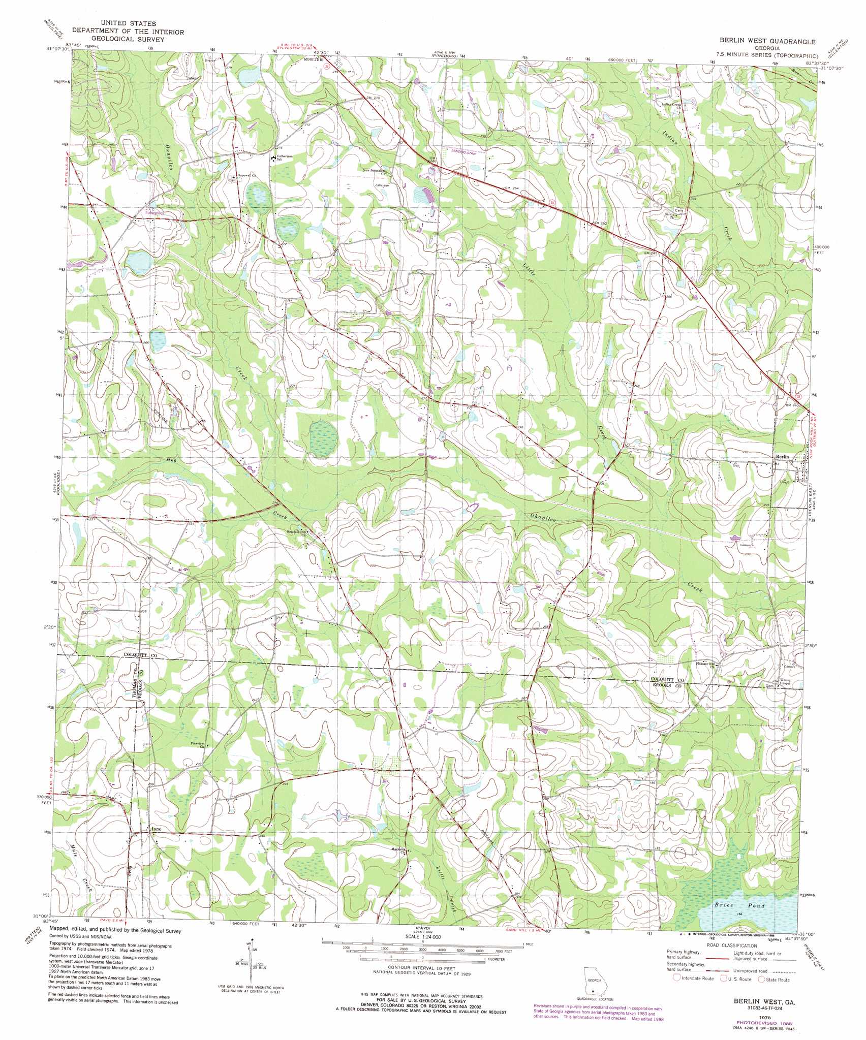
USGS Topo Quad 31083a6 - 1:24,000 scale
| Topo Map Name: | Berlin West |
| USGS Topo Quad ID: | 31083a6 |
| Print Size: | ca. 21 1/4" wide x 27" high |
| Southeast Coordinates: | 31° N latitude / 83.625° W longitude |
| Map Center Coordinates: | 31.0625° N latitude / 83.6875° W longitude |
| U.S. State: | GA |
| Filename: | o31083a6.jpg |
| Download Map JPG Image: | Berlin West topo map 1:24,000 scale |
| Map Type: | Topographic |
| Topo Series: | 7.5´ |
| Map Scale: | 1:24,000 |
| Source of Map Images: | United States Geological Survey (USGS) |
| Alternate Map Versions: |
Berlin West GA 1978, updated 1978 Download PDF Buy paper map Berlin West GA 1978, updated 1988 Download PDF Buy paper map Berlin West GA 2011 Download PDF Buy paper map Berlin West GA 2014 Download PDF Buy paper map |
1:24,000 Topo Quads surrounding Berlin West
Doerun |
Sigsbee |
Norman Park |
Omega |
Lenox |
Hartsfield |
Moultrie |
Pineboro |
Ellenton |
Adel |
Chastain |
Coolidge |
Berlin West |
Berlin East |
Cecil |
Merrillville |
Patten |
Pavo |
Pebble Hill |
Hahira West |
Thomasville |
Boston |
Dixie |
Quitman |
Ousley |
> Back to 31083a1 at 1:100,000 scale
> Back to 31082a1 at 1:250,000 scale
> Back to U.S. Topo Maps home
Berlin West topo map: Gazetteer
Berlin West: Airports
Sunbelt Strip elevation 79m 259′Berlin West: Lakes
Brice Pond elevation 50m 164′Berlin West: Populated Places
Ione elevation 82m 269′Weldon (historical) elevation 77m 252′
Berlin West: Streams
Hog Creek elevation 62m 203′Little Creek elevation 56m 183′
Berlin West digital topo map on disk
Buy this Berlin West topo map showing relief, roads, GPS coordinates and other geographical features, as a high-resolution digital map file on DVD: