Coolidge Topo Map Georgia
To zoom in, hover over the map of Coolidge
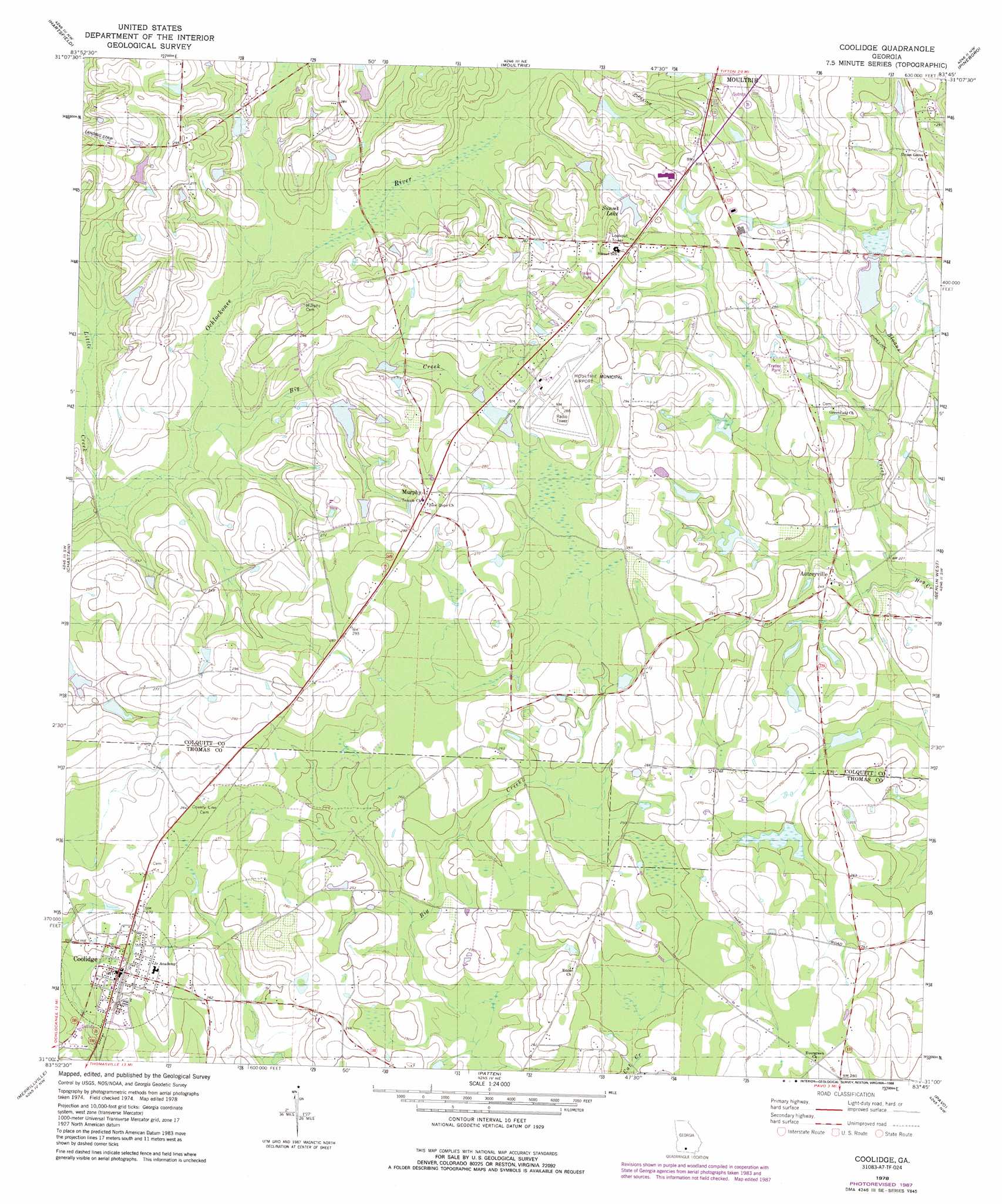
USGS Topo Quad 31083a7 - 1:24,000 scale
| Topo Map Name: | Coolidge |
| USGS Topo Quad ID: | 31083a7 |
| Print Size: | ca. 21 1/4" wide x 27" high |
| Southeast Coordinates: | 31° N latitude / 83.75° W longitude |
| Map Center Coordinates: | 31.0625° N latitude / 83.8125° W longitude |
| U.S. State: | GA |
| Filename: | o31083a7.jpg |
| Download Map JPG Image: | Coolidge topo map 1:24,000 scale |
| Map Type: | Topographic |
| Topo Series: | 7.5´ |
| Map Scale: | 1:24,000 |
| Source of Map Images: | United States Geological Survey (USGS) |
| Alternate Map Versions: |
Coolidge GA 1978, updated 1978 Download PDF Buy paper map Coolidge GA 1978, updated 1988 Download PDF Buy paper map Coolidge GA 2011 Download PDF Buy paper map Coolidge GA 2014 Download PDF Buy paper map |
1:24,000 Topo Quads surrounding Coolidge
Sale City |
Doerun |
Sigsbee |
Norman Park |
Omega |
Cotton |
Hartsfield |
Moultrie |
Pineboro |
Ellenton |
Meigs |
Chastain |
Coolidge |
Berlin West |
Berlin East |
Ochlocknee |
Merrillville |
Patten |
Pavo |
Pebble Hill |
Pine Park |
Thomasville |
Boston |
Dixie |
Quitman |
> Back to 31083a1 at 1:100,000 scale
> Back to 31082a1 at 1:250,000 scale
> Back to U.S. Topo Maps home
Coolidge topo map: Gazetteer
Coolidge: Airports
Moultrie Municipal Airport elevation 86m 282′Coolidge: Dams
Beatles Lake Dam elevation 83m 272′Beatles Lake North Dam elevation 82m 269′
Bridge Creek Structure Number Eight Dam elevation 71m 232′
Coolidge: Populated Places
Autreyville elevation 74m 242′Coolidge elevation 76m 249′
Enon elevation 80m 262′
Murphy elevation 89m 291′
Sunset elevation 90m 295′
Coolidge: Reservoirs
Beatles Lake elevation 83m 272′Beatles Lake North elevation 82m 269′
Bridge Creek Structure Number Eight Lake elevation 71m 232′
Sunset Lake elevation 84m 275′
Coolidge: Streams
Big Creek elevation 64m 209′Little Creek elevation 62m 203′
Sloans Creek elevation 67m 219′
Coolidge digital topo map on disk
Buy this Coolidge topo map showing relief, roads, GPS coordinates and other geographical features, as a high-resolution digital map file on DVD: