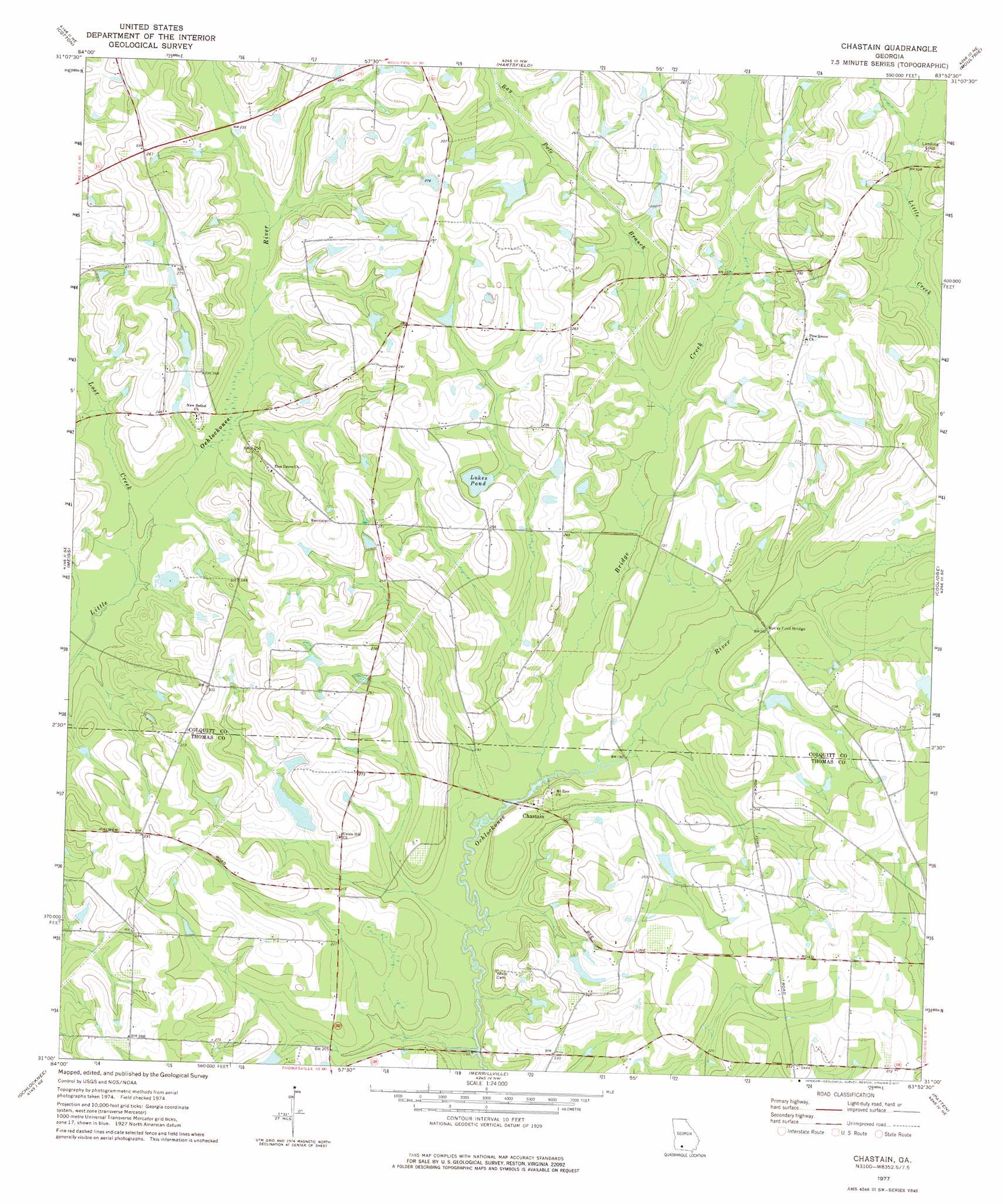
Chastain Topo Map Georgia
To zoom in, hover over the map of Chastain
USGS Topo Quad 31083a8 - 1:24,000 scale
| Topo Map Name: | Chastain |
| USGS Topo Quad ID: | 31083a8 |
| Print Size: | ca. 21 1/4" wide x 27" high |
| Southeast Coordinates: | 31° N latitude / 83.875° W longitude |
| Map Center Coordinates: | 31.0625° N latitude / 83.9375° W longitude |
| U.S. State: | GA |
| Filename: | o31083a8.jpg |
| Download Map JPG Image: | Chastain topo map 1:24,000 scale |
| Map Type: | Topographic |
| Topo Series: | 7.5´ |
| Map Scale: | 1:24,000 |
| Source of Map Images: | United States Geological Survey (USGS) |
| Alternate Map Versions: |
Chastain GA 1977, updated 1977 Download PDF Buy paper map Chastain GA 2011 Download PDF Buy paper map Chastain GA 2014 Download PDF Buy paper map |
1:24,000 Topo Quads surrounding Chastain
Baconton South |
Sale City |
Doerun |
Sigsbee |
Norman Park |
Camilla |
Cotton |
Hartsfield |
Moultrie |
Pineboro |
Pelham |
Meigs |
Chastain |
Coolidge |
Berlin West |
Cairo North |
Ochlocknee |
Merrillville |
Patten |
Pavo |
Cairo South |
Pine Park |
Thomasville |
Boston |
Dixie |
> Back to 31083a1 at 1:100,000 scale
> Back to 31082a1 at 1:250,000 scale
> Back to U.S. Topo Maps home
Chastain topo map: Gazetteer
Chastain: Airports
Lost Creek Farms Airport elevation 85m 278′Chastain: Bridges
Rocky Ford Bridge elevation 59m 193′Watson Bridge elevation 60m 196′
Chastain: Dams
Bannister Lake Dam elevation 67m 219′Griffin Lake Dam elevation 68m 223′
Chastain: Lakes
Lukes Pond elevation 75m 246′Chastain: Populated Places
Chastain elevation 67m 219′Chastain: Reservoirs
Bannister Lake elevation 67m 219′Griffin Lake elevation 68m 223′
Chastain: Streams
Bay Pole Branch elevation 63m 206′Bridge Creek elevation 55m 180′
Lost Creek elevation 60m 196′
Chastain digital topo map on disk
Buy this Chastain topo map showing relief, roads, GPS coordinates and other geographical features, as a high-resolution digital map file on DVD: