Hastings Fish Pond Topo Map Georgia
To zoom in, hover over the map of Hastings Fish Pond
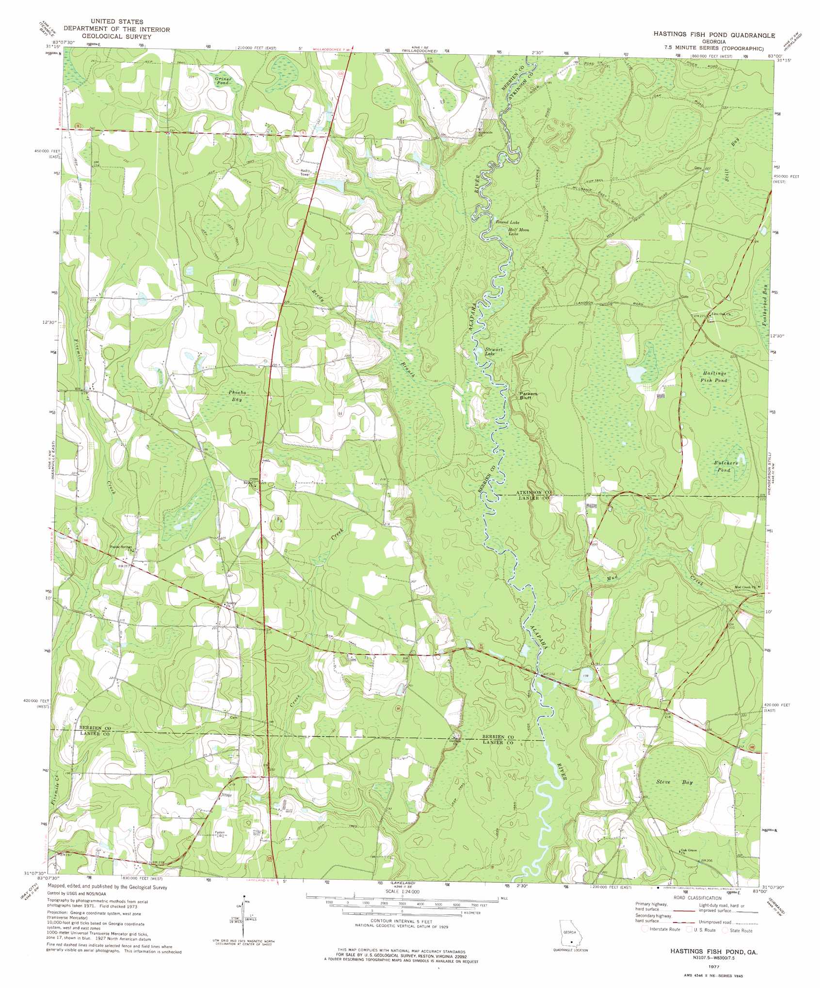
USGS Topo Quad 31083b1 - 1:24,000 scale
| Topo Map Name: | Hastings Fish Pond |
| USGS Topo Quad ID: | 31083b1 |
| Print Size: | ca. 21 1/4" wide x 27" high |
| Southeast Coordinates: | 31.125° N latitude / 83° W longitude |
| Map Center Coordinates: | 31.1875° N latitude / 83.0625° W longitude |
| U.S. State: | GA |
| Filename: | o31083b1.jpg |
| Download Map JPG Image: | Hastings Fish Pond topo map 1:24,000 scale |
| Map Type: | Topographic |
| Topo Series: | 7.5´ |
| Map Scale: | 1:24,000 |
| Source of Map Images: | United States Geological Survey (USGS) |
| Alternate Map Versions: |
Hastings Fish Pond GA 1977, updated 1977 Download PDF Buy paper map Hastings Fish Pond GA 2011 Download PDF Buy paper map Hastings Fish Pond GA 2014 Download PDF Buy paper map |
1:24,000 Topo Quads surrounding Hastings Fish Pond
Enigma |
Alapaha |
Lax |
Mora |
Douglas South |
Sapps Lake |
Tenmile Bay |
Willacoochee |
Kirkland |
Pearson |
Nashville West |
Nashville East |
Hastings Fish Pond |
Henderson Still |
Sandy Bottom |
New Lois |
Ray City |
Lakeland |
Sirmans |
Homerville West |
Hahira East |
Bemiss |
Naylor |
Stockton |
Du Pont |
> Back to 31083a1 at 1:100,000 scale
> Back to 31082a1 at 1:250,000 scale
> Back to U.S. Topo Maps home
Hastings Fish Pond topo map: Gazetteer
Hastings Fish Pond: Cliffs
Parkers Bluff elevation 60m 196′Hastings Fish Pond: Dams
Gaskins Lake Dam elevation 66m 216′Hastings Fish Pond: Lakes
Butchers Pond elevation 66m 216′Griner Pond elevation 67m 219′
Half Moon Lake elevation 54m 177′
Hastings Fish Pond elevation 66m 216′
Round Lake elevation 53m 173′
Stewart Lake elevation 53m 173′
Hastings Fish Pond: Reservoirs
Gaskins Lake elevation 66m 216′Hastings Fish Pond: Streams
Mud Creek elevation 52m 170′Reedy Branch elevation 53m 173′
Hastings Fish Pond: Swamps
Phoeba Bay elevation 67m 219′Steve Bay elevation 58m 190′
Still Bay elevation 65m 213′
Hastings Fish Pond digital topo map on disk
Buy this Hastings Fish Pond topo map showing relief, roads, GPS coordinates and other geographical features, as a high-resolution digital map file on DVD: