Nashville East Topo Map Georgia
To zoom in, hover over the map of Nashville East
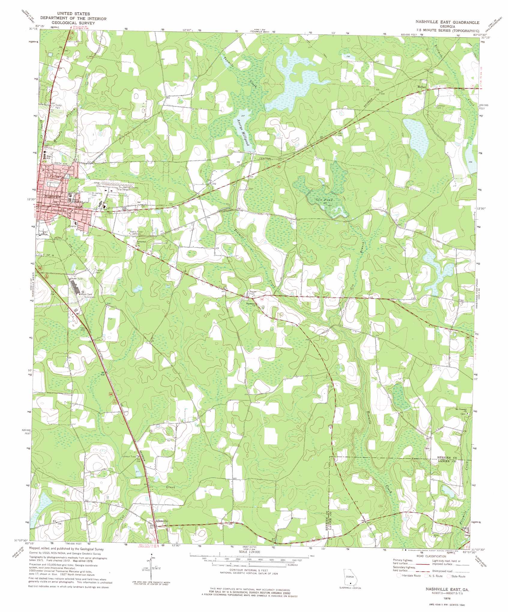
USGS Topo Quad 31083b2 - 1:24,000 scale
| Topo Map Name: | Nashville East |
| USGS Topo Quad ID: | 31083b2 |
| Print Size: | ca. 21 1/4" wide x 27" high |
| Southeast Coordinates: | 31.125° N latitude / 83.125° W longitude |
| Map Center Coordinates: | 31.1875° N latitude / 83.1875° W longitude |
| U.S. State: | GA |
| Filename: | o31083b2.jpg |
| Download Map JPG Image: | Nashville East topo map 1:24,000 scale |
| Map Type: | Topographic |
| Topo Series: | 7.5´ |
| Map Scale: | 1:24,000 |
| Source of Map Images: | United States Geological Survey (USGS) |
| Alternate Map Versions: |
Nashville East GA 1978, updated 1978 Download PDF Buy paper map Nashville East GA 2011 Download PDF Buy paper map Nashville East GA 2014 Download PDF Buy paper map |
1:24,000 Topo Quads surrounding Nashville East
Tifton East |
Enigma |
Alapaha |
Lax |
Mora |
Lenox |
Sapps Lake |
Tenmile Bay |
Willacoochee |
Kirkland |
Adel |
Nashville West |
Nashville East |
Hastings Fish Pond |
Henderson Still |
Cecil |
New Lois |
Ray City |
Lakeland |
Sirmans |
Hahira West |
Hahira East |
Bemiss |
Naylor |
Stockton |
> Back to 31083a1 at 1:100,000 scale
> Back to 31082a1 at 1:250,000 scale
> Back to U.S. Topo Maps home
Nashville East topo map: Gazetteer
Nashville East: Airports
Berrien County Airport elevation 71m 232′South One Ten Airport elevation 69m 226′
Nashville East: Lakes
Averys Millpond elevation 72m 236′Gin Pond elevation 69m 226′
Nashville East: Parks
Beetree Recreation Area elevation 71m 232′Carter Park elevation 69m 226′
Heritage Park elevation 69m 226′
Northside Park elevation 75m 246′
Nashville East: Populated Places
Allenville elevation 70m 229′Weber elevation 75m 246′
Nashville East: Streams
Gin Branch elevation 63m 206′Wolfpen Branch elevation 66m 216′
Nashville East digital topo map on disk
Buy this Nashville East topo map showing relief, roads, GPS coordinates and other geographical features, as a high-resolution digital map file on DVD: