Norman Park Topo Map Georgia
To zoom in, hover over the map of Norman Park
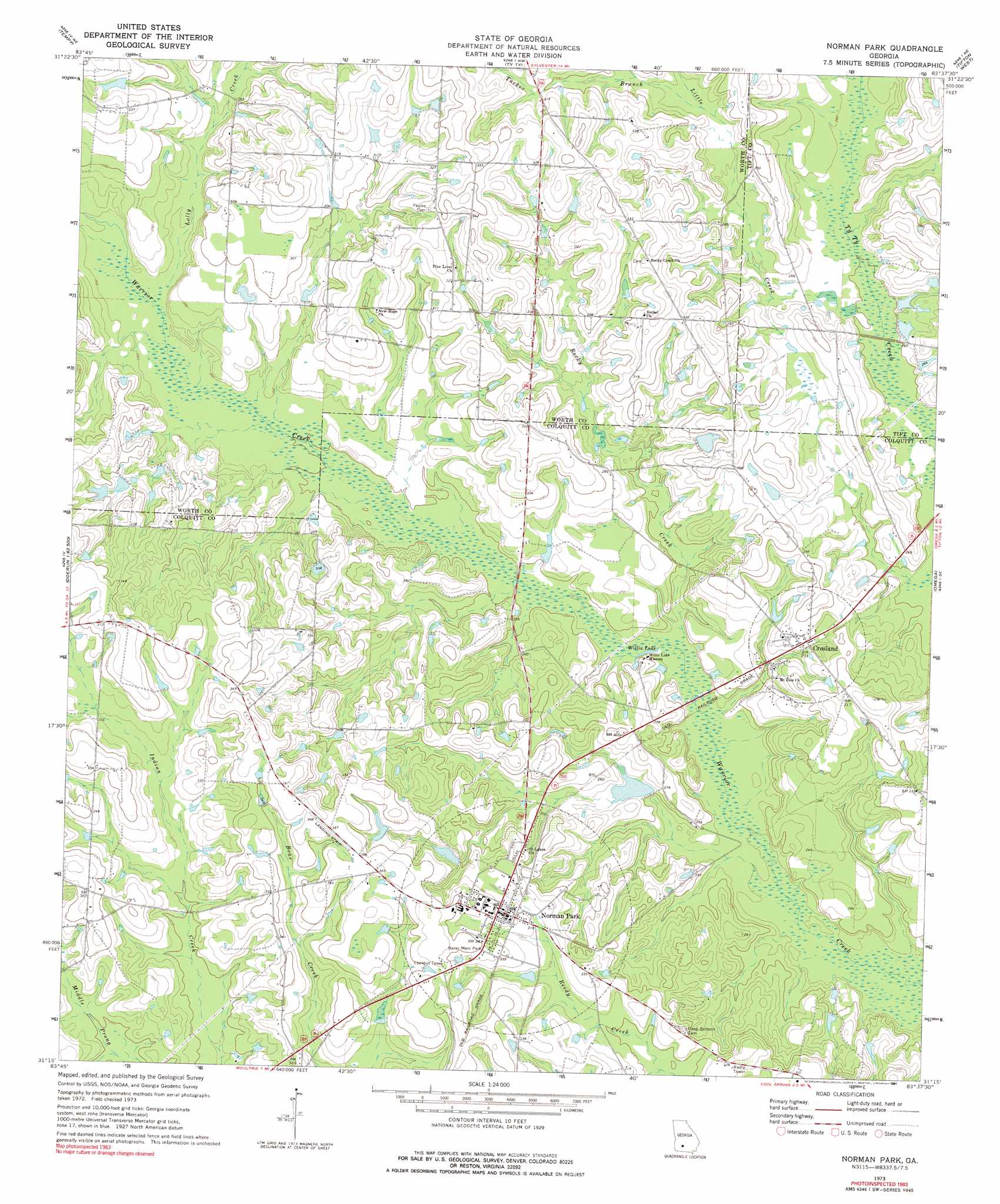
USGS Topo Quad 31083c6 - 1:24,000 scale
| Topo Map Name: | Norman Park |
| USGS Topo Quad ID: | 31083c6 |
| Print Size: | ca. 21 1/4" wide x 27" high |
| Southeast Coordinates: | 31.25° N latitude / 83.625° W longitude |
| Map Center Coordinates: | 31.3125° N latitude / 83.6875° W longitude |
| U.S. State: | GA |
| Filename: | o31083c6.jpg |
| Download Map JPG Image: | Norman Park topo map 1:24,000 scale |
| Map Type: | Topographic |
| Topo Series: | 7.5´ |
| Map Scale: | 1:24,000 |
| Source of Map Images: | United States Geological Survey (USGS) |
| Alternate Map Versions: |
Norman Park GA 1973, updated 1975 Download PDF Buy paper map Norman Park GA 1973, updated 1991 Download PDF Buy paper map Norman Park GA 2011 Download PDF Buy paper map Norman Park GA 2014 Download PDF Buy paper map |
1:24,000 Topo Quads surrounding Norman Park
Acree |
Sylvester |
Sumner |
Chula |
Waterloo |
Bridgeboro |
Tempy |
Ty Ty |
Tifton West |
Tifton East |
Doerun |
Sigsbee |
Norman Park |
Omega |
Lenox |
Hartsfield |
Moultrie |
Pineboro |
Ellenton |
Adel |
Chastain |
Coolidge |
Berlin West |
Berlin East |
Cecil |
> Back to 31083a1 at 1:100,000 scale
> Back to 31082a1 at 1:250,000 scale
> Back to U.S. Topo Maps home
Norman Park topo map: Gazetteer
Norman Park: Dams
Gray Lake Dam elevation 86m 282′Hall Lake Dam elevation 89m 291′
Norman Park: Lakes
Willis Lake elevation 73m 239′Norman Park: Populated Places
Crosland elevation 84m 275′Norman Park elevation 102m 334′
Norman Park: Reservoirs
Gray Lake elevation 86m 282′Hall Lake elevation 89m 291′
Norman Park: Streams
Little Branch elevation 79m 259′Little Creek elevation 76m 249′
Lolly Creek elevation 79m 259′
Rocky Creek elevation 73m 239′
Tucker Branch elevation 84m 275′
Norman Park digital topo map on disk
Buy this Norman Park topo map showing relief, roads, GPS coordinates and other geographical features, as a high-resolution digital map file on DVD: