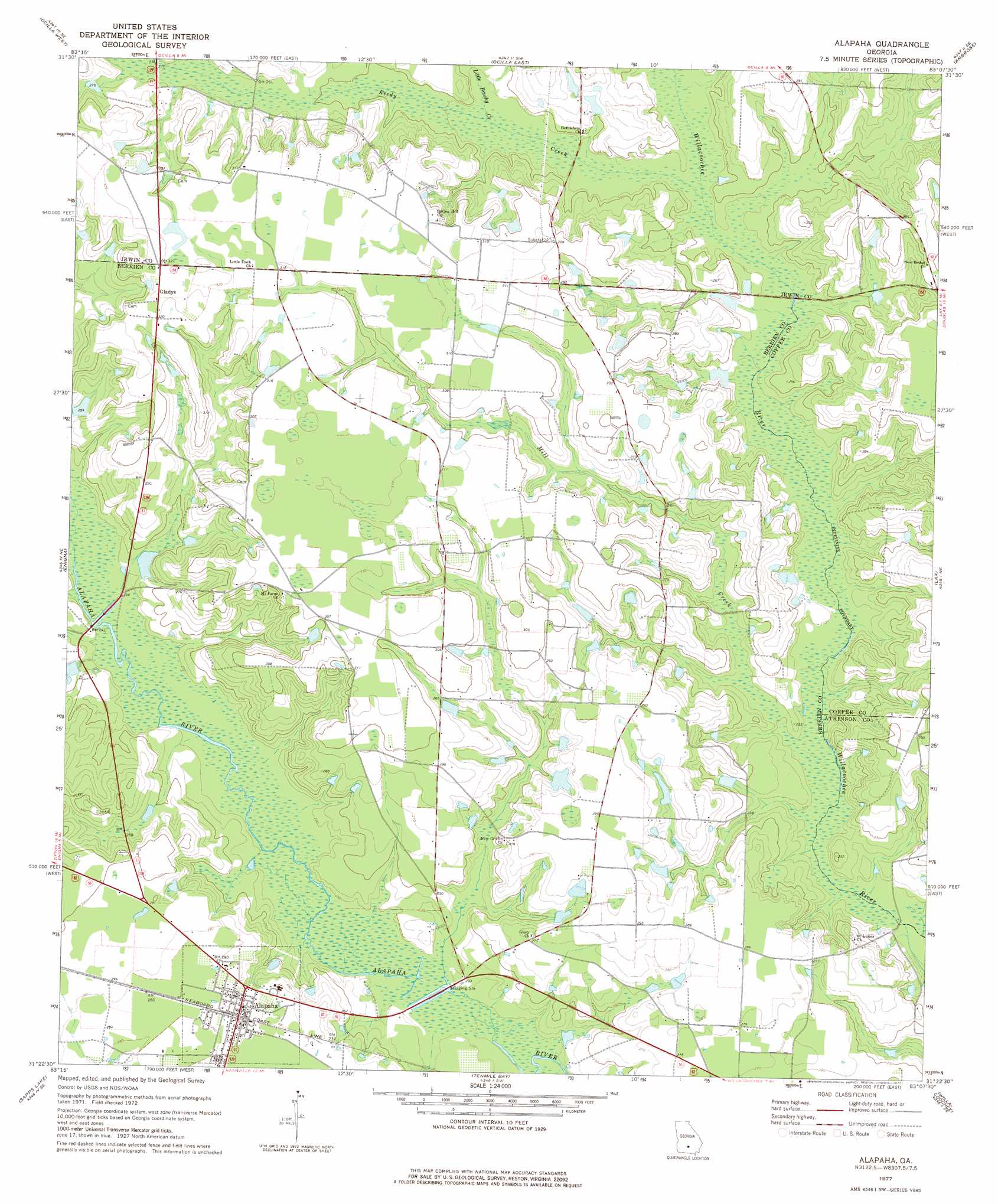
Alapaha Topo Map Georgia
To zoom in, hover over the map of Alapaha
USGS Topo Quad 31083d2 - 1:24,000 scale
| Topo Map Name: | Alapaha |
| USGS Topo Quad ID: | 31083d2 |
| Print Size: | ca. 21 1/4" wide x 27" high |
| Southeast Coordinates: | 31.375° N latitude / 83.125° W longitude |
| Map Center Coordinates: | 31.4375° N latitude / 83.1875° W longitude |
| U.S. State: | GA |
| Filename: | o31083d2.jpg |
| Download Map JPG Image: | Alapaha topo map 1:24,000 scale |
| Map Type: | Topographic |
| Topo Series: | 7.5´ |
| Map Scale: | 1:24,000 |
| Source of Map Images: | United States Geological Survey (USGS) |
| Alternate Map Versions: |
Alapaha GA 1977, updated 1977 Download PDF Buy paper map Alapaha GA 2011 Download PDF Buy paper map Alapaha GA 2014 Download PDF Buy paper map |
1:24,000 Topo Quads surrounding Alapaha
Irwinville |
Fitzgerald West |
Fitzgerald East |
Osierfield |
Broxton North |
Waterloo |
Ocilla West |
Ocilla East |
Ambrose |
Broxton South |
Tifton East |
Enigma |
Alapaha |
Lax |
Mora |
Lenox |
Sapps Lake |
Tenmile Bay |
Willacoochee |
Kirkland |
Adel |
Nashville West |
Nashville East |
Hastings Fish Pond |
Henderson Still |
> Back to 31083a1 at 1:100,000 scale
> Back to 31082a1 at 1:250,000 scale
> Back to U.S. Topo Maps home
Alapaha topo map: Gazetteer
Alapaha: Dams
Tucker Lake Dam elevation 88m 288′Alapaha: Populated Places
Alapaha elevation 87m 285′Gladys elevation 97m 318′
Alapaha: Reservoirs
Tucker Lake elevation 88m 288′Alapaha: Streams
Little Brushy Creek elevation 71m 232′Mill Creek elevation 66m 216′
Reedy Creek elevation 71m 232′
Alapaha digital topo map on disk
Buy this Alapaha topo map showing relief, roads, GPS coordinates and other geographical features, as a high-resolution digital map file on DVD: