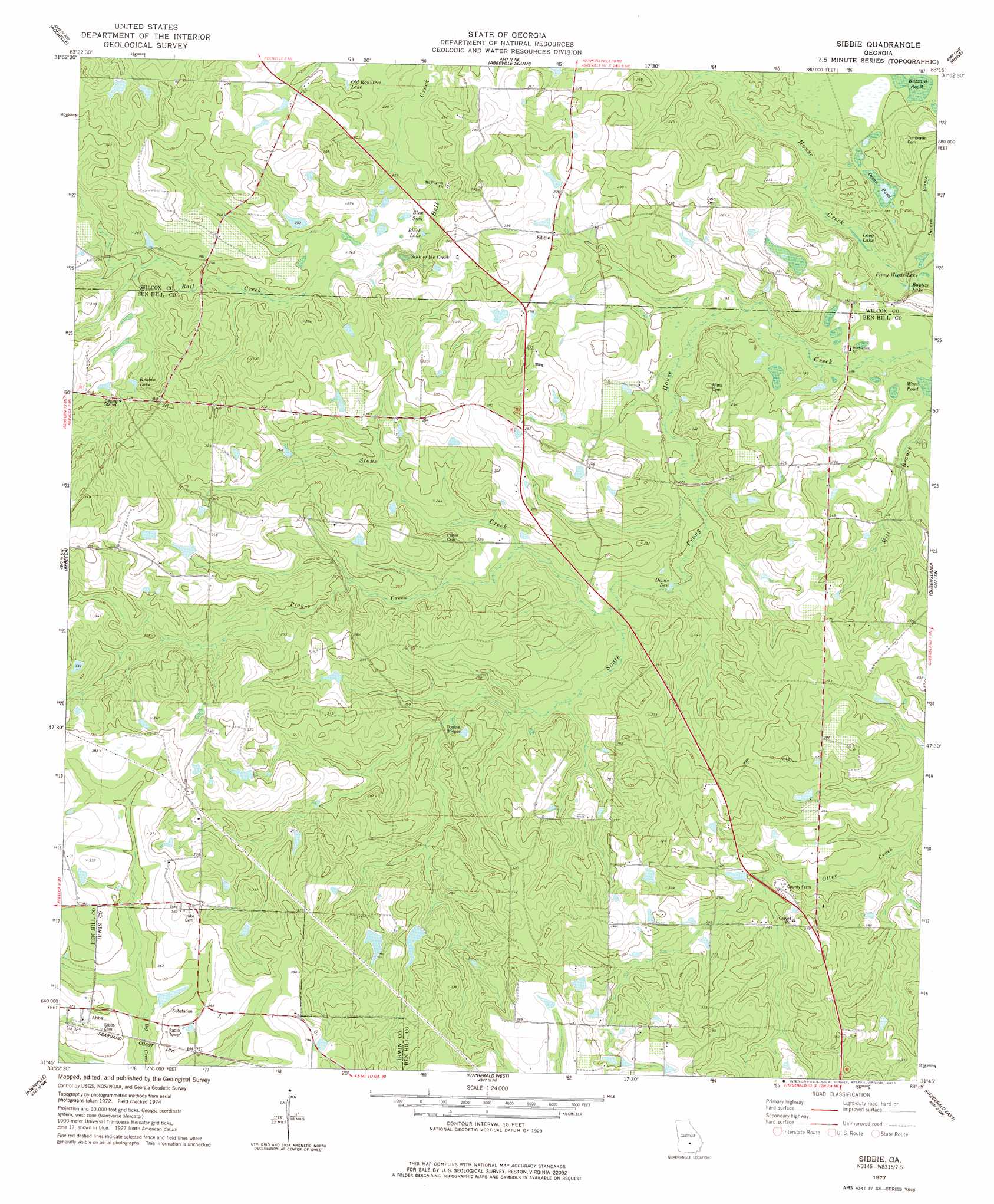
Sibbie Topo Map Georgia
To zoom in, hover over the map of Sibbie
USGS Topo Quad 31083g3 - 1:24,000 scale
| Topo Map Name: | Sibbie |
| USGS Topo Quad ID: | 31083g3 |
| Print Size: | ca. 21 1/4" wide x 27" high |
| Southeast Coordinates: | 31.75° N latitude / 83.25° W longitude |
| Map Center Coordinates: | 31.8125° N latitude / 83.3125° W longitude |
| U.S. State: | GA |
| Filename: | o31083g3.jpg |
| Download Map JPG Image: | Sibbie topo map 1:24,000 scale |
| Map Type: | Topographic |
| Topo Series: | 7.5´ |
| Map Scale: | 1:24,000 |
| Source of Map Images: | United States Geological Survey (USGS) |
| Alternate Map Versions: |
Sibbie GA 1977, updated 1977 Download PDF Buy paper map Sibbie GA 2011 Download PDF Buy paper map Sibbie GA 2014 Download PDF Buy paper map |
1:24,000 Topo Quads surrounding Sibbie
Pineview West |
Pineview East |
Abbeville North |
Lake Cypress |
Milan |
Pitts |
Rochelle |
Abbeville South |
Rhine |
Cooks Still |
Amboy |
Rebecca |
Sibbie |
Queensland |
China Hill |
Bethel |
Irwinville |
Fitzgerald West |
Fitzgerald East |
Osierfield |
Chula |
Waterloo |
Ocilla West |
Ocilla East |
Ambrose |
> Back to 31083e1 at 1:100,000 scale
> Back to 31082a1 at 1:250,000 scale
> Back to U.S. Topo Maps home
Sibbie topo map: Gazetteer
Sibbie: Bridges
Double Bridges elevation 69m 226′Sibbie: Dams
Snowden Dam One elevation 85m 278′Snowden Dam Two elevation 85m 278′
Snowden Lake East Dam elevation 83m 272′
Snowden Lake West Dam elevation 93m 305′
Sibbie: Lakes
Baptize Lake elevation 54m 177′Black Lake elevation 69m 226′
Blue Sink elevation 72m 236′
Devils Den elevation 61m 200′
Long Lake elevation 54m 177′
Ocean Pond elevation 56m 183′
Old Rountree Lake elevation 73m 239′
Piney Woods Lake elevation 54m 177′
Reubin Lake elevation 80m 262′
Sink of the Creek elevation 69m 226′
Ware Pond elevation 56m 183′
Sibbie: Populated Places
Abba elevation 110m 360′Sibbie elevation 69m 226′
Sibbie: Reservoirs
Snowden Lake East elevation 83m 272′Snowden Lake West elevation 93m 305′
Sibbie: Streams
Player Creek elevation 65m 213′Stone Creek elevation 63m 206′
Sibbie digital topo map on disk
Buy this Sibbie topo map showing relief, roads, GPS coordinates and other geographical features, as a high-resolution digital map file on DVD: