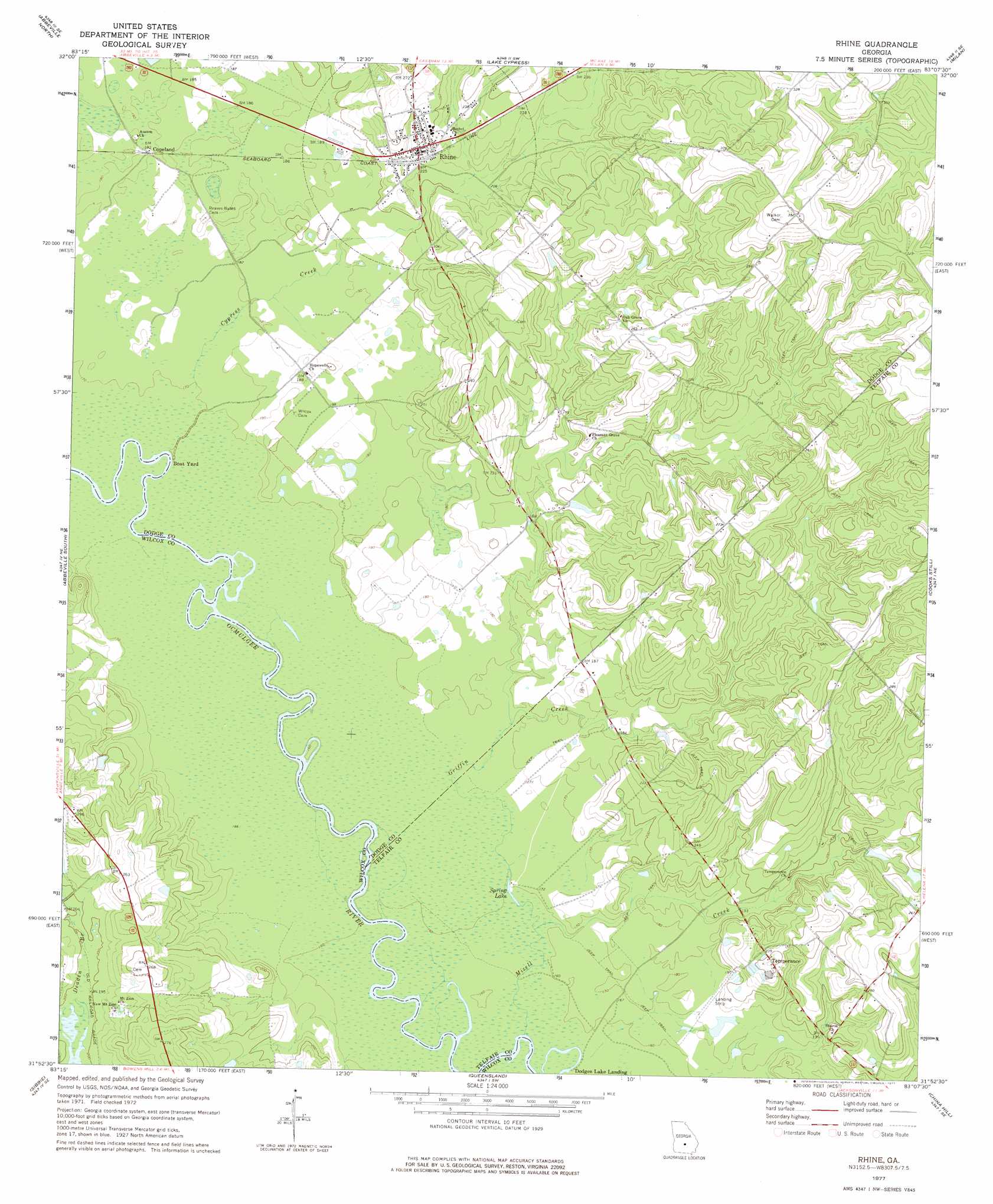
Rhine Topo Map Georgia
To zoom in, hover over the map of Rhine
USGS Topo Quad 31083h2 - 1:24,000 scale
| Topo Map Name: | Rhine |
| USGS Topo Quad ID: | 31083h2 |
| Print Size: | ca. 21 1/4" wide x 27" high |
| Southeast Coordinates: | 31.875° N latitude / 83.125° W longitude |
| Map Center Coordinates: | 31.9375° N latitude / 83.1875° W longitude |
| U.S. State: | GA |
| Filename: | o31083h2.jpg |
| Download Map JPG Image: | Rhine topo map 1:24,000 scale |
| Map Type: | Topographic |
| Topo Series: | 7.5´ |
| Map Scale: | 1:24,000 |
| Source of Map Images: | United States Geological Survey (USGS) |
| Alternate Map Versions: |
Rhine GA 1977, updated 1977 Download PDF Buy paper map Rhine GA 2011 Download PDF Buy paper map Rhine GA 2014 Download PDF Buy paper map |
1:24,000 Topo Quads surrounding Rhine
Finleyson East |
West Of Eastman |
Eastman |
Jay Bird Springs |
Mcrae Nw |
Pineview East |
Abbeville North |
Lake Cypress |
Milan |
Mcrae |
Rochelle |
Abbeville South |
Rhine |
Cooks Still |
Workmore |
Rebecca |
Sibbie |
Queensland |
China Hill |
Jacksonville |
Irwinville |
Fitzgerald West |
Fitzgerald East |
Osierfield |
Broxton North |
> Back to 31083e1 at 1:100,000 scale
> Back to 31082a1 at 1:250,000 scale
> Back to U.S. Topo Maps home
Rhine topo map: Gazetteer
Rhine: Airports
Fussell Airport elevation 53m 173′Rhine: Dams
Matthews Lake Dam elevation 75m 246′Rhine: Populated Places
Copeland elevation 55m 180′Rhine elevation 74m 242′
Sharon elevation 61m 200′
Temperance elevation 79m 259′
Rhine: Reservoirs
Matthews Lake elevation 75m 246′Spring Lake elevation 49m 160′
Rhine: Streams
Cypress Creek elevation 51m 167′Griffin Creek elevation 48m 157′
Mizell Creek elevation 47m 154′
Rhine digital topo map on disk
Buy this Rhine topo map showing relief, roads, GPS coordinates and other geographical features, as a high-resolution digital map file on DVD: