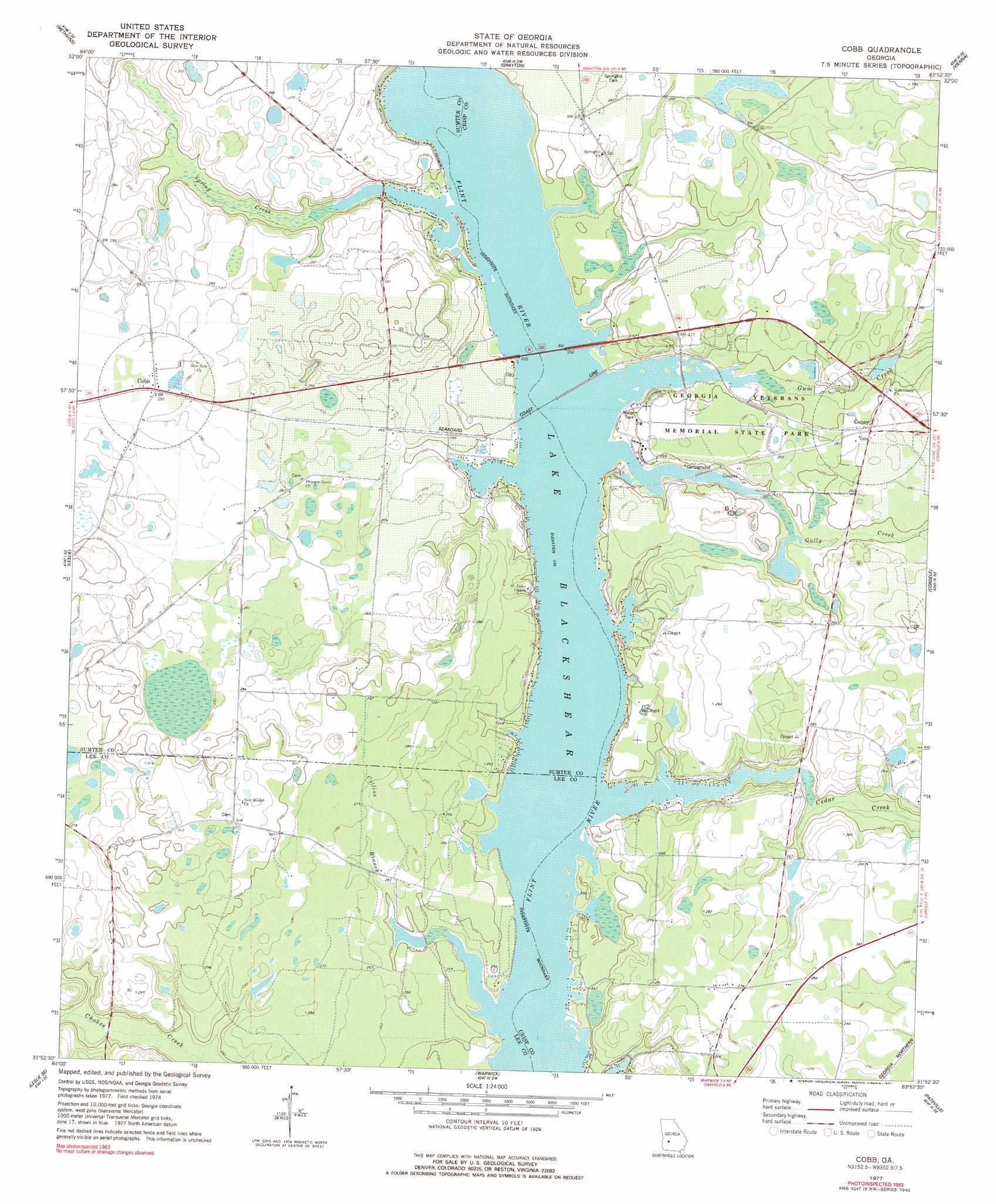
Cobb Topo Map Georgia
To zoom in, hover over the map of Cobb
USGS Topo Quad 31083h8 - 1:24,000 scale
| Topo Map Name: | Cobb |
| USGS Topo Quad ID: | 31083h8 |
| Print Size: | ca. 21 1/4" wide x 27" high |
| Southeast Coordinates: | 31.875° N latitude / 83.875° W longitude |
| Map Center Coordinates: | 31.9375° N latitude / 83.9375° W longitude |
| U.S. State: | GA |
| Filename: | o31083h8.jpg |
| Download Map JPG Image: | Cobb topo map 1:24,000 scale |
| Map Type: | Topographic |
| Topo Series: | 7.5´ |
| Map Scale: | 1:24,000 |
| Source of Map Images: | United States Geological Survey (USGS) |
| Alternate Map Versions: |
Cobb GA 1977, updated 1977 Download PDF Buy paper map Cobb GA 1977, updated 1977 Download PDF Buy paper map Cobb GA 2011 Download PDF Buy paper map Cobb GA 2014 Download PDF Buy paper map |
1:24,000 Topo Quads surrounding Cobb
Andersonville |
Pennington |
Byromville |
Pinehurst |
Pineview Nw |
Americus |
Methvins |
Drayton |
Vienna |
Pineview Sw |
Smithville East |
Leslie |
Cobb |
Cordele |
Penia |
Neyami |
Leslie Se |
Warwick |
Pateville |
Arabi |
Leesburg |
Albany Ne |
Doles |
Cuffietown |
Ashburn |
> Back to 31083e1 at 1:100,000 scale
> Back to 31082a1 at 1:250,000 scale
> Back to U.S. Topo Maps home
Cobb topo map: Gazetteer
Cobb: Crossings
Coxs Ferry (historical) elevation 72m 236′Hugenia Ferry (historical) elevation 72m 236′
Cobb: Dams
Gill Pace Lake Dam elevation 81m 265′Lower Wheatley Lake Dam elevation 73m 239′
Wheatley Lake North Dam elevation 78m 255′
Womack Lake Dam elevation 85m 278′
Cobb: Parks
Georgia Veterans Memorial State Park elevation 78m 255′Cobb: Populated Places
Cobb elevation 89m 291′Coney elevation 80m 262′
Daphne (historical) elevation 74m 242′
Flintside elevation 80m 262′
Cobb: Reservoirs
Gill Pace Lake elevation 81m 265′Lower Wheatley Lake elevation 73m 239′
Wheatley Lake North elevation 78m 255′
Womack Lake elevation 85m 278′
Cobb: Streams
Cedar Creek elevation 72m 236′Collins Branch elevation 75m 246′
Gully Creek elevation 72m 236′
Gum Creek elevation 72m 236′
Spring Creek elevation 73m 239′
Cobb digital topo map on disk
Buy this Cobb topo map showing relief, roads, GPS coordinates and other geographical features, as a high-resolution digital map file on DVD: