Pelham Topo Map Georgia
To zoom in, hover over the map of Pelham
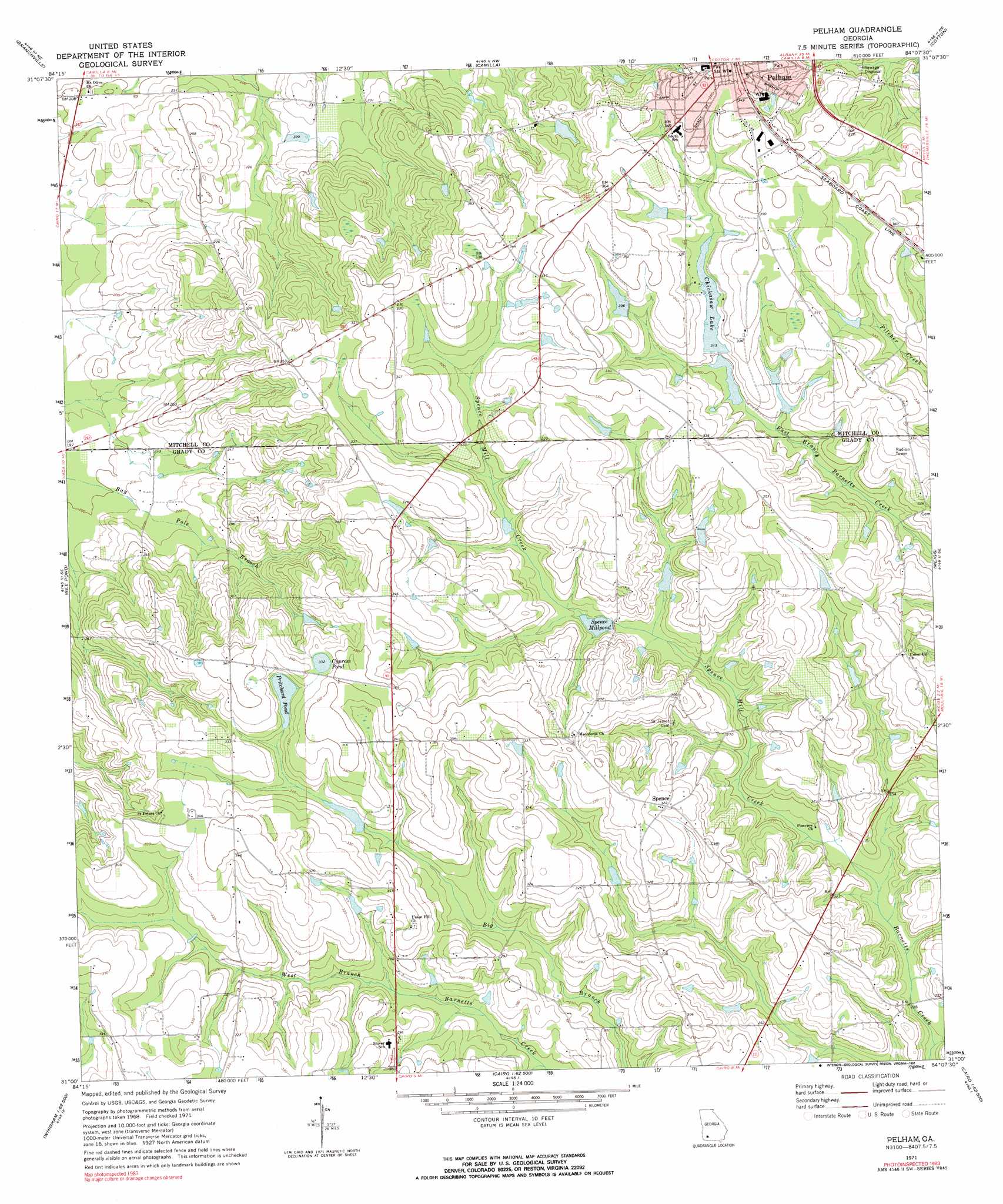
USGS Topo Quad 31084a2 - 1:24,000 scale
| Topo Map Name: | Pelham |
| USGS Topo Quad ID: | 31084a2 |
| Print Size: | ca. 21 1/4" wide x 27" high |
| Southeast Coordinates: | 31° N latitude / 84.125° W longitude |
| Map Center Coordinates: | 31.0625° N latitude / 84.1875° W longitude |
| U.S. State: | GA |
| Filename: | o31084a2.jpg |
| Download Map JPG Image: | Pelham topo map 1:24,000 scale |
| Map Type: | Topographic |
| Topo Series: | 7.5´ |
| Map Scale: | 1:24,000 |
| Source of Map Images: | United States Geological Survey (USGS) |
| Alternate Map Versions: |
Pelham GA 1971, updated 1974 Download PDF Buy paper map Pelham GA 1971, updated 1991 Download PDF Buy paper map Pelham GA 2011 Download PDF Buy paper map Pelham GA 2014 Download PDF Buy paper map |
1:24,000 Topo Quads surrounding Pelham
Elmodel |
Newton |
Baconton South |
Sale City |
Doerun |
Hopeful |
Branchville |
Camilla |
Cotton |
Hartsfield |
Vada |
Gee Pond |
Pelham |
Meigs |
Chastain |
Climax North |
Whigham |
Cairo North |
Ochlocknee |
Merrillville |
Climax South |
Reno |
Cairo South |
Pine Park |
Thomasville |
> Back to 31084a1 at 1:100,000 scale
> Back to 31084a1 at 1:250,000 scale
> Back to U.S. Topo Maps home
Pelham topo map: Gazetteer
Pelham: Basins
Rich Sink elevation 74m 242′Pelham: Dams
Bentley Lake Dam elevation 91m 298′Chickasaw Lake Dam elevation 92m 301′
McClendon Lake Dam elevation 94m 308′
Spence Millpond Dam elevation 81m 265′
Walton Lake Dam elevation 102m 334′
Pelham: Lakes
Cypress Pond elevation 101m 331′Pritchard Pond elevation 96m 314′
Pelham: Populated Places
Oak Grove (historical) elevation 99m 324′Spence elevation 98m 321′
Union Hill elevation 96m 314′
Pelham: Reservoirs
Bentley Lake elevation 91m 298′Chickasaw Lake elevation 92m 301′
None None Reservoir elevation 94m 308′
Spence Millpond elevation 81m 265′
Walton Lake elevation 102m 334′
Pelham: Streams
Spence Mill Creek elevation 70m 229′Pelham digital topo map on disk
Buy this Pelham topo map showing relief, roads, GPS coordinates and other geographical features, as a high-resolution digital map file on DVD:
Gulf Coast (LA, MS, AL, FL) & Southwestern Georgia
Buy digital topo maps: Gulf Coast (LA, MS, AL, FL) & Southwestern Georgia
 & Southwestern Georgia map DVD")