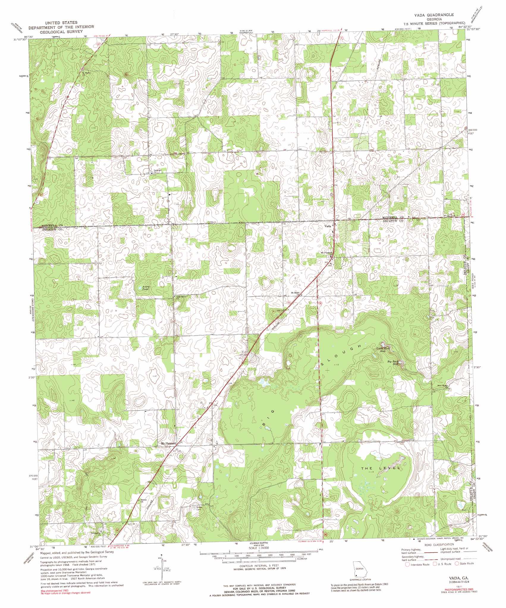
Vada Topo Map Georgia
To zoom in, hover over the map of Vada
USGS Topo Quad 31084a4 - 1:24,000 scale
| Topo Map Name: | Vada |
| USGS Topo Quad ID: | 31084a4 |
| Print Size: | ca. 21 1/4" wide x 27" high |
| Southeast Coordinates: | 31° N latitude / 84.375° W longitude |
| Map Center Coordinates: | 31.0625° N latitude / 84.4375° W longitude |
| U.S. State: | GA |
| Filename: | o31084a4.jpg |
| Download Map JPG Image: | Vada topo map 1:24,000 scale |
| Map Type: | Topographic |
| Topo Series: | 7.5´ |
| Map Scale: | 1:24,000 |
| Source of Map Images: | United States Geological Survey (USGS) |
| Alternate Map Versions: |
Vada GA 1971, updated 1974 Download PDF Buy paper map Vada GA 2011 Download PDF Buy paper map Vada GA 2014 Download PDF Buy paper map |
1:24,000 Topo Quads surrounding Vada
Damascus |
Bethany |
Elmodel |
Newton |
Baconton South |
Colquitt |
Cooktown |
Hopeful |
Branchville |
Camilla |
Boykin |
Steadhams Store |
Vada |
Gee Pond |
Pelham |
Brinson |
Bainbridge |
Climax North |
Whigham |
Cairo North |
Faceville |
Fowlstown |
Climax South |
Reno |
Cairo South |
> Back to 31084a1 at 1:100,000 scale
> Back to 31084a1 at 1:250,000 scale
> Back to U.S. Topo Maps home
Vada topo map: Gazetteer
Vada: Basins
Big Rock Sink elevation 28m 91′Little Rock Sink elevation 28m 91′
Vada: Flats
The Level elevation 38m 124′Vada: Guts
Big Slough elevation 31m 101′Vada: Lakes
Avery Pond elevation 43m 141′Vada: Populated Places
Mount Pleasant elevation 41m 134′Vada elevation 45m 147′
Vada digital topo map on disk
Buy this Vada topo map showing relief, roads, GPS coordinates and other geographical features, as a high-resolution digital map file on DVD:
Gulf Coast (LA, MS, AL, FL) & Southwestern Georgia
Buy digital topo maps: Gulf Coast (LA, MS, AL, FL) & Southwestern Georgia
 & Southwestern Georgia map DVD")