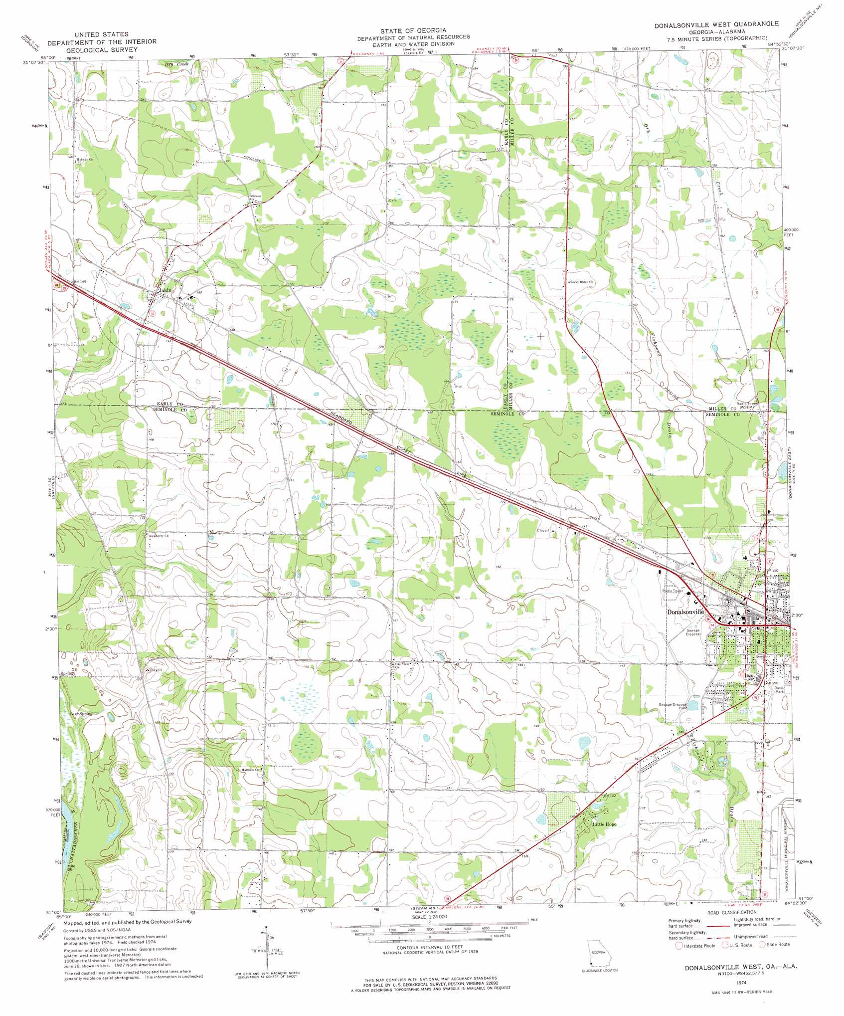
Donalsonville West Topo Map Georgia
To zoom in, hover over the map of Donalsonville West
USGS Topo Quad 31084a8 - 1:24,000 scale
| Topo Map Name: | Donalsonville West |
| USGS Topo Quad ID: | 31084a8 |
| Print Size: | ca. 21 1/4" wide x 27" high |
| Southeast Coordinates: | 31° N latitude / 84.875° W longitude |
| Map Center Coordinates: | 31.0625° N latitude / 84.9375° W longitude |
| U.S. States: | GA, AL |
| Filename: | o31084a8.jpg |
| Download Map JPG Image: | Donalsonville West topo map 1:24,000 scale |
| Map Type: | Topographic |
| Topo Series: | 7.5´ |
| Map Scale: | 1:24,000 |
| Source of Map Images: | United States Geological Survey (USGS) |
| Alternate Map Versions: |
Donalsonville West GA 1974, updated 1976 Download PDF Buy paper map Donalsonville West GA 2011 Download PDF Buy paper map Donalsonville West GA 2014 Download PDF Buy paper map |
1:24,000 Topo Quads surrounding Donalsonville West
Sigma |
Columbia |
Blakely South |
Hentown |
Damascus |
Ashford |
Gordon |
Lucile |
Donalsonville Ne |
Colquitt |
Grangeburg |
Saffold |
Donalsonville West |
Donalsonville East |
Boykin |
Malone |
Bascom |
Steam Mill |
Desser |
Brinson |
Marianna |
Dellwood |
Fairchild |
Reynoldsville |
Faceville |
> Back to 31084a1 at 1:100,000 scale
> Back to 31084a1 at 1:250,000 scale
> Back to U.S. Topo Maps home
Donalsonville West topo map: Gazetteer
Donalsonville West: Airports
Donalsonville Municipal Airport elevation 43m 141′Hicks Landing Strip elevation 55m 180′
Donalsonville West: Lakes
Byrd Pond elevation 48m 157′Donalsonville West: Parks
Davis Park elevation 45m 147′Donalsonville West: Populated Places
Donalsonville elevation 45m 147′Jakin elevation 44m 144′
Little Hope elevation 43m 141′
Town and Country Estates elevation 40m 131′
Town and Country Subdivision Number 2 elevation 42m 137′
Donalsonville West: Post Offices
Donalsonville Post Office elevation 44m 144′Donalsonville West: Springs
Carr Spring elevation 27m 88′Donalsonville West digital topo map on disk
Buy this Donalsonville West topo map showing relief, roads, GPS coordinates and other geographical features, as a high-resolution digital map file on DVD:
Gulf Coast (LA, MS, AL, FL) & Southwestern Georgia
Buy digital topo maps: Gulf Coast (LA, MS, AL, FL) & Southwestern Georgia
 & Southwestern Georgia map DVD")