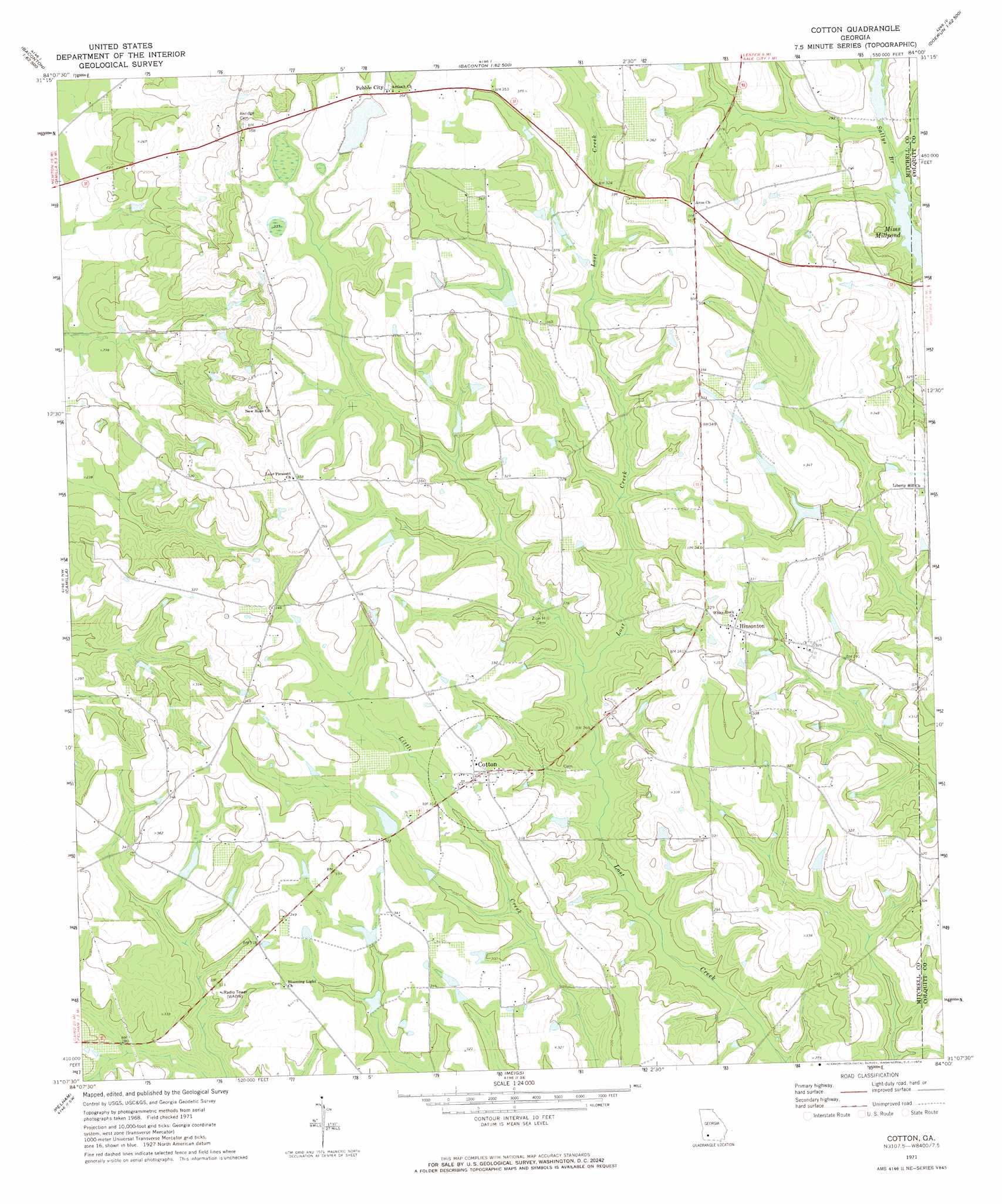
Cotton Topo Map Georgia
To zoom in, hover over the map of Cotton
USGS Topo Quad 31084b1 - 1:24,000 scale
| Topo Map Name: | Cotton |
| USGS Topo Quad ID: | 31084b1 |
| Print Size: | ca. 21 1/4" wide x 27" high |
| Southeast Coordinates: | 31.125° N latitude / 84° W longitude |
| Map Center Coordinates: | 31.1875° N latitude / 84.0625° W longitude |
| U.S. State: | GA |
| Filename: | o31084b1.jpg |
| Download Map JPG Image: | Cotton topo map 1:24,000 scale |
| Map Type: | Topographic |
| Topo Series: | 7.5´ |
| Map Scale: | 1:24,000 |
| Source of Map Images: | United States Geological Survey (USGS) |
| Alternate Map Versions: |
Cotton GA 1971, updated 1974 Download PDF Buy paper map Cotton GA 2011 Download PDF Buy paper map Cotton GA 2014 Download PDF Buy paper map |
1:24,000 Topo Quads surrounding Cotton
Red Store Crossroads |
Baconton North |
Putney |
Bridgeboro |
Tempy |
Newton |
Baconton South |
Sale City |
Doerun |
Sigsbee |
Branchville |
Camilla |
Cotton |
Hartsfield |
Moultrie |
Gee Pond |
Pelham |
Meigs |
Chastain |
Coolidge |
Whigham |
Cairo North |
Ochlocknee |
Merrillville |
Patten |
> Back to 31084a1 at 1:100,000 scale
> Back to 31084a1 at 1:250,000 scale
> Back to U.S. Topo Maps home
Cotton topo map: Gazetteer
Cotton: Dams
Connell Lake Dam elevation 87m 285′Hand Lake Dam elevation 88m 288′
Rigsby Lake Dam elevation 83m 272′
Rigsby Lake Dam elevation 106m 347′
Sonny Glenn Estate Lake Dam elevation 88m 288′
Willingham Lake Dam elevation 78m 255′
Cotton: Populated Places
Akridge (historical) elevation 108m 354′Cotton elevation 99m 324′
Hinsonton elevation 103m 337′
Laney elevation 107m 351′
Pebble City elevation 111m 364′
Rogerville elevation 105m 344′
Saco (historical) elevation 109m 357′
Cotton: Reservoirs
Connell Lake elevation 87m 285′Hand Lake elevation 88m 288′
Rigsby Lake elevation 106m 347′
Rigsby Lake elevation 83m 272′
Sonny Glenn Estate Lake elevation 88m 288′
Willingham Lake elevation 78m 255′
Cotton: Streams
Sallys Branch elevation 88m 288′Cotton digital topo map on disk
Buy this Cotton topo map showing relief, roads, GPS coordinates and other geographical features, as a high-resolution digital map file on DVD:
Gulf Coast (LA, MS, AL, FL) & Southwestern Georgia
Buy digital topo maps: Gulf Coast (LA, MS, AL, FL) & Southwestern Georgia
 & Southwestern Georgia map DVD")