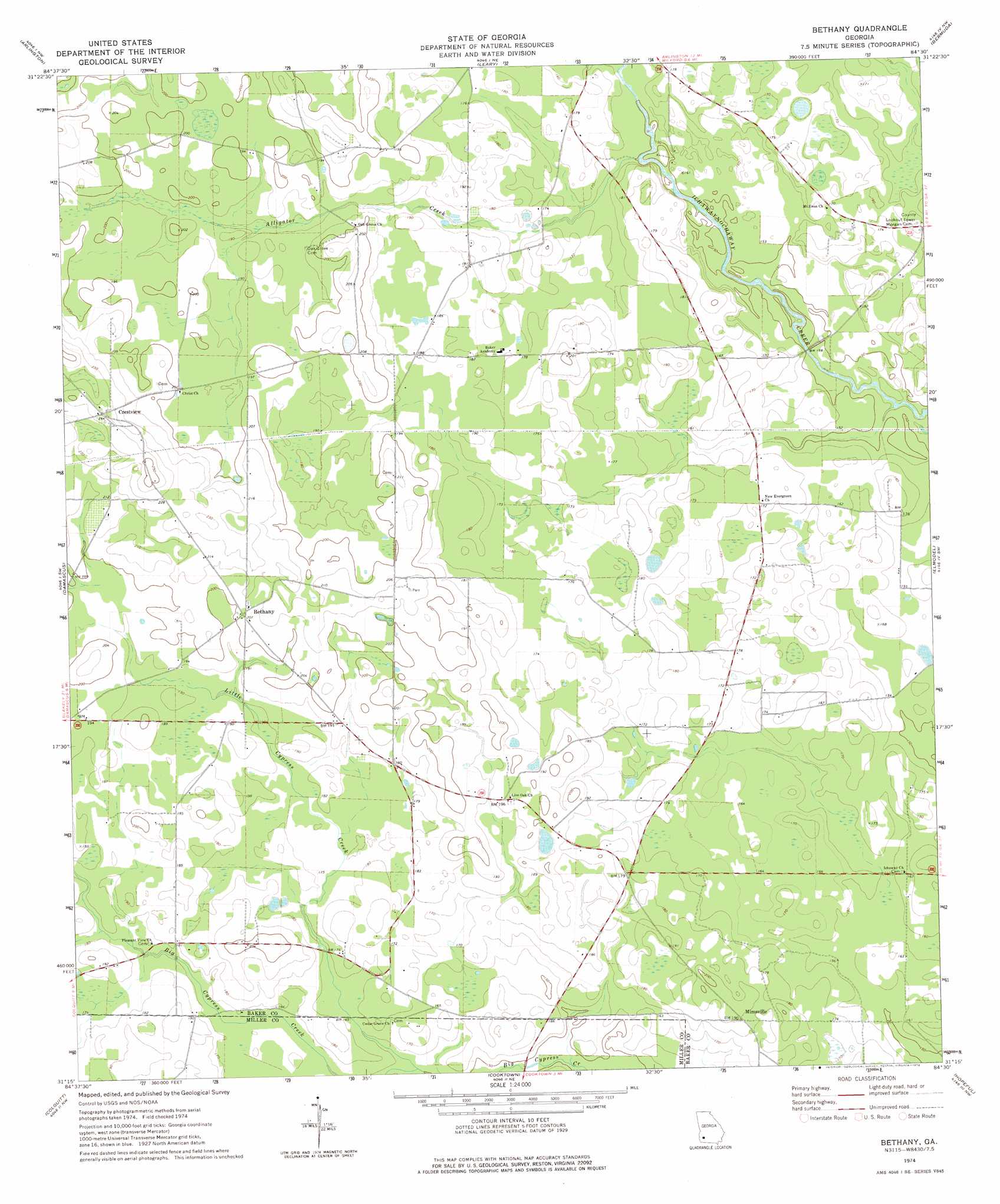
Bethany Topo Map Georgia
To zoom in, hover over the map of Bethany
USGS Topo Quad 31084c5 - 1:24,000 scale
| Topo Map Name: | Bethany |
| USGS Topo Quad ID: | 31084c5 |
| Print Size: | ca. 21 1/4" wide x 27" high |
| Southeast Coordinates: | 31.25° N latitude / 84.5° W longitude |
| Map Center Coordinates: | 31.3125° N latitude / 84.5625° W longitude |
| U.S. State: | GA |
| Filename: | o31084c5.jpg |
| Download Map JPG Image: | Bethany topo map 1:24,000 scale |
| Map Type: | Topographic |
| Topo Series: | 7.5´ |
| Map Scale: | 1:24,000 |
| Source of Map Images: | United States Geological Survey (USGS) |
| Alternate Map Versions: |
Bethany GA 1974, updated 1976 Download PDF Buy paper map Bethany GA 2011 Download PDF Buy paper map Bethany GA 2014 Download PDF Buy paper map |
1:24,000 Topo Quads surrounding Bethany
Bluffton |
Edison |
Morgan |
Holt |
Pretoria |
Bancroft |
Arlington |
Leary |
Bermuda |
Red Store Crossroads |
Hentown |
Damascus |
Bethany |
Elmodel |
Newton |
Donalsonville Ne |
Colquitt |
Cooktown |
Hopeful |
Branchville |
Donalsonville East |
Boykin |
Steadhams Store |
Vada |
Gee Pond |
> Back to 31084a1 at 1:100,000 scale
> Back to 31084a1 at 1:250,000 scale
> Back to U.S. Topo Maps home
Bethany topo map: Gazetteer
Bethany: Populated Places
Bethany elevation 62m 203′Crestview elevation 74m 242′
Mimsville elevation 57m 187′
Bethany: Streams
Alligator Creek elevation 45m 147′Little Cypress Creek elevation 46m 150′
Bethany digital topo map on disk
Buy this Bethany topo map showing relief, roads, GPS coordinates and other geographical features, as a high-resolution digital map file on DVD:
Gulf Coast (LA, MS, AL, FL) & Southwestern Georgia
Buy digital topo maps: Gulf Coast (LA, MS, AL, FL) & Southwestern Georgia
 & Southwestern Georgia map DVD")