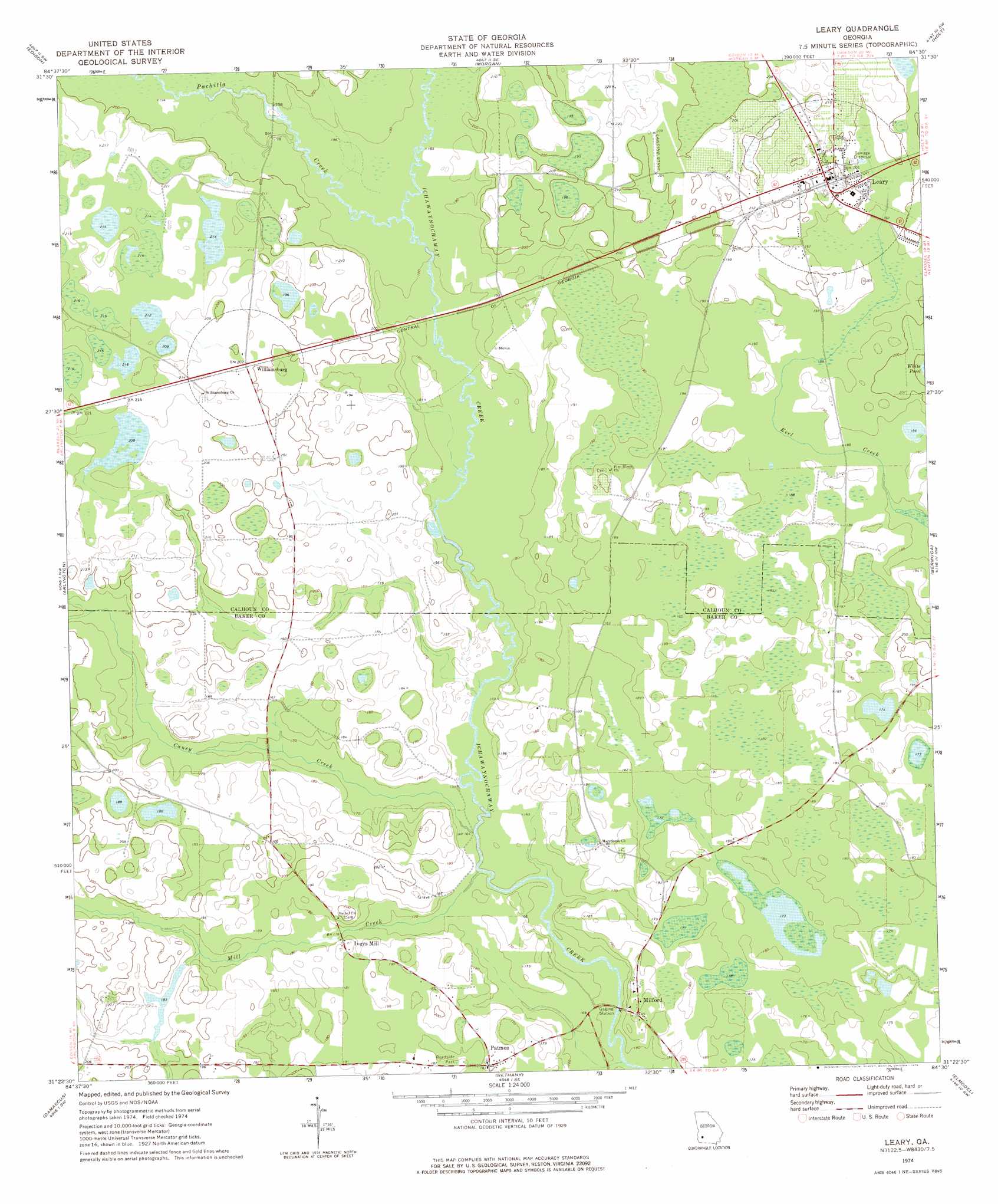
Leary Topo Map Georgia
To zoom in, hover over the map of Leary
USGS Topo Quad 31084d5 - 1:24,000 scale
| Topo Map Name: | Leary |
| USGS Topo Quad ID: | 31084d5 |
| Print Size: | ca. 21 1/4" wide x 27" high |
| Southeast Coordinates: | 31.375° N latitude / 84.5° W longitude |
| Map Center Coordinates: | 31.4375° N latitude / 84.5625° W longitude |
| U.S. State: | GA |
| Filename: | o31084d5.jpg |
| Download Map JPG Image: | Leary topo map 1:24,000 scale |
| Map Type: | Topographic |
| Topo Series: | 7.5´ |
| Map Scale: | 1:24,000 |
| Source of Map Images: | United States Geological Survey (USGS) |
| Alternate Map Versions: |
Leary GA 1974, updated 1976 Download PDF Buy paper map Leary GA 2011 Download PDF Buy paper map Leary GA 2014 Download PDF Buy paper map |
1:24,000 Topo Quads surrounding Leary
Carnegie |
Martins Crossroads |
Doverel |
Chickasawhatchee |
Sasser |
Bluffton |
Edison |
Morgan |
Holt |
Pretoria |
Bancroft |
Arlington |
Leary |
Bermuda |
Red Store Crossroads |
Hentown |
Damascus |
Bethany |
Elmodel |
Newton |
Donalsonville Ne |
Colquitt |
Cooktown |
Hopeful |
Branchville |
> Back to 31084a1 at 1:100,000 scale
> Back to 31084a1 at 1:250,000 scale
> Back to U.S. Topo Maps home
Leary topo map: Gazetteer
Leary: Dams
Thompson Lake Dam elevation 55m 180′Leary: Populated Places
Iveys Mill elevation 58m 190′Leary elevation 63m 206′
Milford elevation 55m 180′
Patmos elevation 55m 180′
Williamsburg elevation 61m 200′
Leary: Reservoirs
Thompson Lake elevation 55m 180′Leary: Streams
Caney Creek elevation 49m 160′Mill Creek elevation 49m 160′
Pachitla Creek elevation 56m 183′
Leary digital topo map on disk
Buy this Leary topo map showing relief, roads, GPS coordinates and other geographical features, as a high-resolution digital map file on DVD:
Gulf Coast (LA, MS, AL, FL) & Southwestern Georgia
Buy digital topo maps: Gulf Coast (LA, MS, AL, FL) & Southwestern Georgia
 & Southwestern Georgia map DVD")