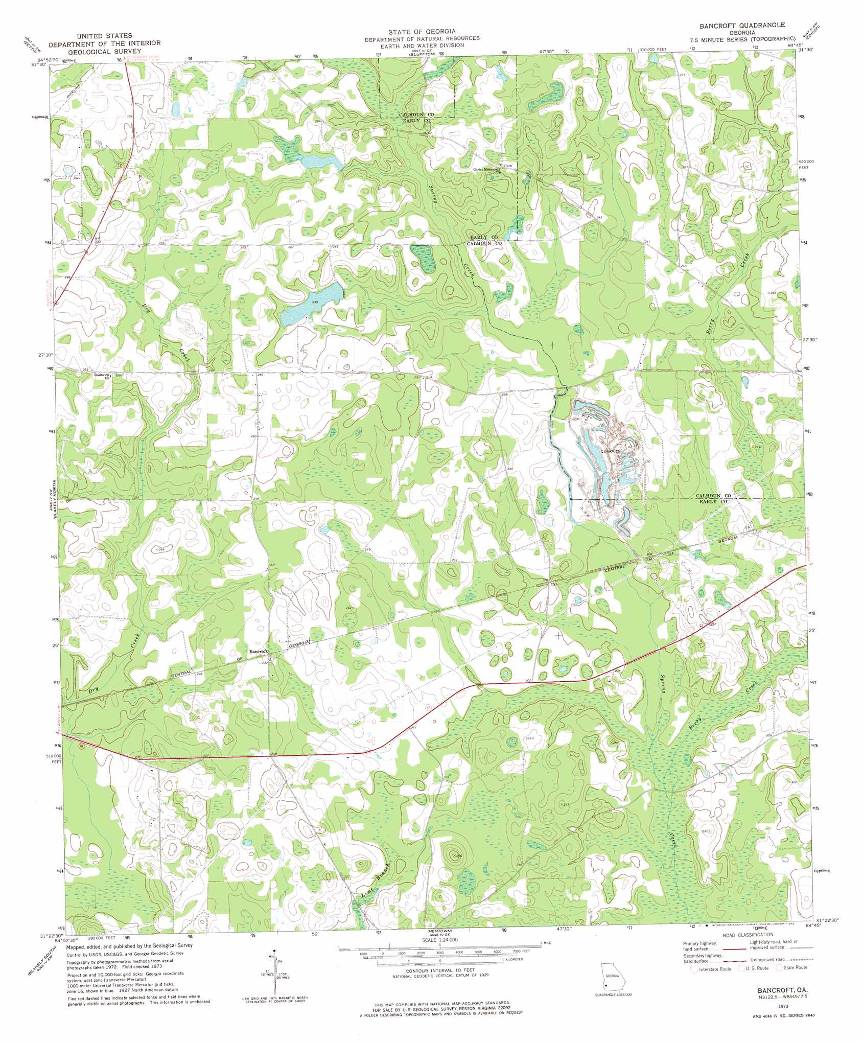
Bancroft Topo Map Georgia
To zoom in, hover over the map of Bancroft
USGS Topo Quad 31084d7 - 1:24,000 scale
| Topo Map Name: | Bancroft |
| USGS Topo Quad ID: | 31084d7 |
| Print Size: | ca. 21 1/4" wide x 27" high |
| Southeast Coordinates: | 31.375° N latitude / 84.75° W longitude |
| Map Center Coordinates: | 31.4375° N latitude / 84.8125° W longitude |
| U.S. State: | GA |
| Filename: | o31084d7.jpg |
| Download Map JPG Image: | Bancroft topo map 1:24,000 scale |
| Map Type: | Topographic |
| Topo Series: | 7.5´ |
| Map Scale: | 1:24,000 |
| Source of Map Images: | United States Geological Survey (USGS) |
| Alternate Map Versions: |
Bancroft GA 1973, updated 1975 Download PDF Buy paper map Bancroft GA 2011 Download PDF Buy paper map Bancroft GA 2014 Download PDF Buy paper map |
1:24,000 Topo Quads surrounding Bancroft
Fort Gaines Ne |
Coleman |
Carnegie |
Martins Crossroads |
Doverel |
Fort Gaines |
Zetto |
Bluffton |
Edison |
Morgan |
Columbia Ne |
Blakely North |
Bancroft |
Arlington |
Leary |
Columbia |
Blakely South |
Hentown |
Damascus |
Bethany |
Gordon |
Lucile |
Donalsonville Ne |
Colquitt |
Cooktown |
> Back to 31084a1 at 1:100,000 scale
> Back to 31084a1 at 1:250,000 scale
> Back to U.S. Topo Maps home
Bancroft topo map: Gazetteer
Bancroft: Dams
Kolomoki Plantation Lake Dam elevation 80m 262′Ralph Balkcom Dam elevation 73m 239′
Bancroft: Populated Places
Bancroft elevation 70m 229′Bancroft: Reservoirs
Kolomoki Plantation Lake elevation 80m 262′Bancroft: Streams
Lee Branch elevation 70m 229′Mulligan Branch elevation 61m 200′
Number Five Branch elevation 63m 206′
Number Seven Branch elevation 63m 206′
Perry Creek elevation 56m 183′
Bancroft digital topo map on disk
Buy this Bancroft topo map showing relief, roads, GPS coordinates and other geographical features, as a high-resolution digital map file on DVD:
Gulf Coast (LA, MS, AL, FL) & Southwestern Georgia
Buy digital topo maps: Gulf Coast (LA, MS, AL, FL) & Southwestern Georgia
 & Southwestern Georgia map DVD")