Holt Topo Map Georgia
To zoom in, hover over the map of Holt
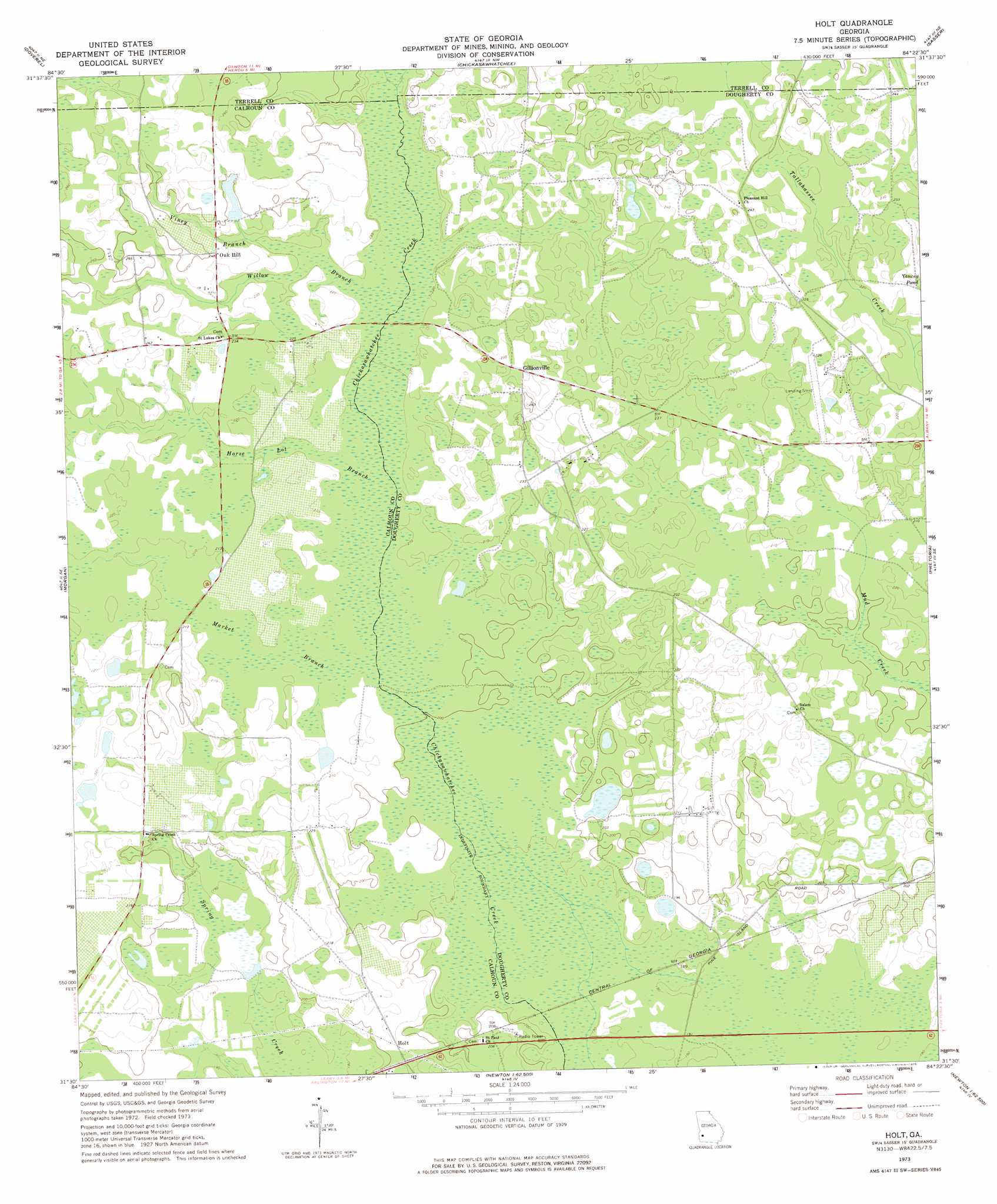
USGS Topo Quad 31084e4 - 1:24,000 scale
| Topo Map Name: | Holt |
| USGS Topo Quad ID: | 31084e4 |
| Print Size: | ca. 21 1/4" wide x 27" high |
| Southeast Coordinates: | 31.5° N latitude / 84.375° W longitude |
| Map Center Coordinates: | 31.5625° N latitude / 84.4375° W longitude |
| U.S. State: | GA |
| Filename: | o31084e4.jpg |
| Download Map JPG Image: | Holt topo map 1:24,000 scale |
| Map Type: | Topographic |
| Topo Series: | 7.5´ |
| Map Scale: | 1:24,000 |
| Source of Map Images: | United States Geological Survey (USGS) |
| Alternate Map Versions: |
Holt GA 1973, updated 1975 Download PDF Buy paper map Holt GA 2011 Download PDF Buy paper map Holt GA 2014 Download PDF Buy paper map |
1:24,000 Topo Quads surrounding Holt
Brooksville |
Shellman |
Dawson |
Bronwood |
Neyami |
Martins Crossroads |
Doverel |
Chickasawhatchee |
Sasser |
Leesburg |
Edison |
Morgan |
Holt |
Pretoria |
Albany West |
Arlington |
Leary |
Bermuda |
Red Store Crossroads |
Baconton North |
Damascus |
Bethany |
Elmodel |
Newton |
Baconton South |
> Back to 31084e1 at 1:100,000 scale
> Back to 31084a1 at 1:250,000 scale
> Back to U.S. Topo Maps home
Holt topo map: Gazetteer
Holt: Airports
Tallassee Plantation Airport elevation 65m 213′Holt: Dams
Suddeth Lake Dam elevation 73m 239′Holt: Populated Places
Gillionville elevation 73m 239′Holt elevation 64m 209′
Oak Hill elevation 75m 246′
Holt: Reservoirs
Suddeth Lake elevation 73m 239′Holt: Streams
Horse Lot Branch elevation 63m 206′Market Branch elevation 61m 200′
Vincey Branch elevation 67m 219′
Willow Branch elevation 66m 216′
Holt: Swamps
Silver Lake elevation 64m 209′Holt digital topo map on disk
Buy this Holt topo map showing relief, roads, GPS coordinates and other geographical features, as a high-resolution digital map file on DVD:
Gulf Coast (LA, MS, AL, FL) & Southwestern Georgia
Buy digital topo maps: Gulf Coast (LA, MS, AL, FL) & Southwestern Georgia
 & Southwestern Georgia map DVD")