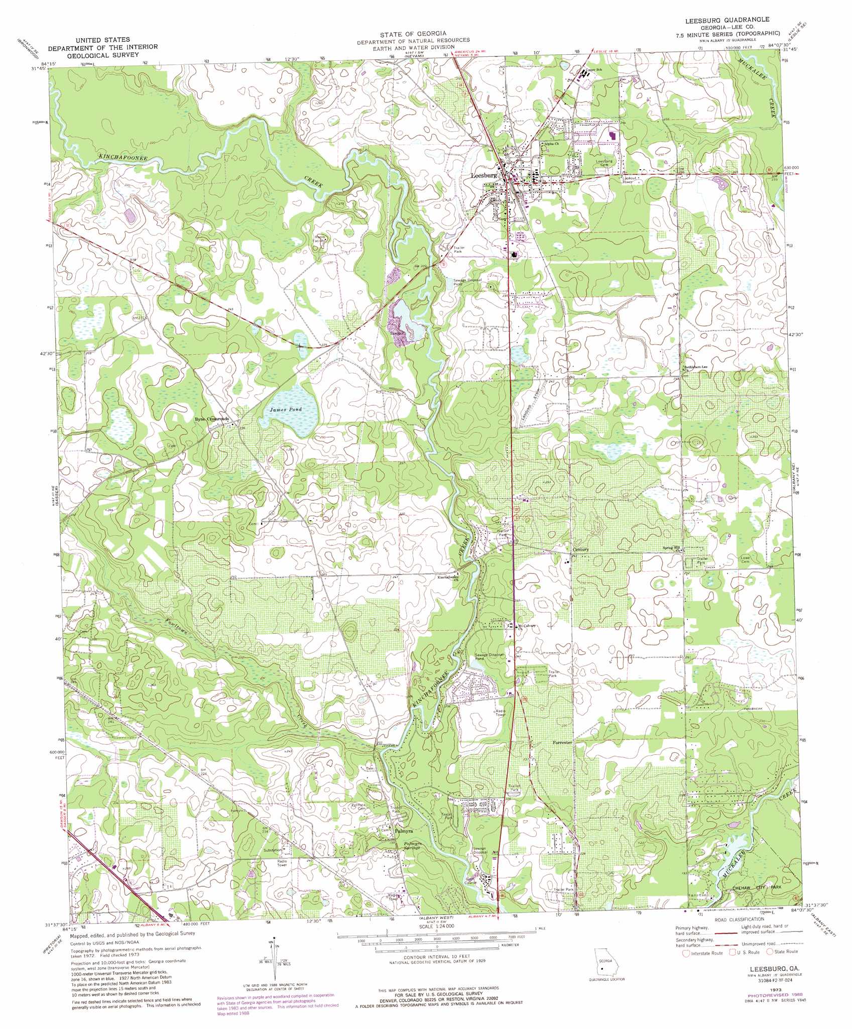
Leesburg Topo Map Georgia
To zoom in, hover over the map of Leesburg
USGS Topo Quad 31084f2 - 1:24,000 scale
| Topo Map Name: | Leesburg |
| USGS Topo Quad ID: | 31084f2 |
| Print Size: | ca. 21 1/4" wide x 27" high |
| Southeast Coordinates: | 31.625° N latitude / 84.125° W longitude |
| Map Center Coordinates: | 31.6875° N latitude / 84.1875° W longitude |
| U.S. State: | GA |
| Filename: | o31084f2.jpg |
| Download Map JPG Image: | Leesburg topo map 1:24,000 scale |
| Map Type: | Topographic |
| Topo Series: | 7.5´ |
| Map Scale: | 1:24,000 |
| Source of Map Images: | United States Geological Survey (USGS) |
| Alternate Map Versions: |
Leesburg GA 1973, updated 1976 Download PDF Buy paper map Leesburg GA 1973, updated 1988 Download PDF Buy paper map Leesburg GA 2011 Download PDF Buy paper map Leesburg GA 2014 Download PDF Buy paper map |
1:24,000 Topo Quads surrounding Leesburg
Bottsford |
Smithville West |
Smithville East |
Leslie |
Cobb |
Dawson |
Bronwood |
Neyami |
Leslie Se |
Warwick |
Chickasawhatchee |
Sasser |
Leesburg |
Albany Ne |
Doles |
Holt |
Pretoria |
Albany West |
Albany East |
Acree |
Bermuda |
Red Store Crossroads |
Baconton North |
Putney |
Bridgeboro |
> Back to 31084e1 at 1:100,000 scale
> Back to 31084a1 at 1:250,000 scale
> Back to U.S. Topo Maps home
Leesburg topo map: Gazetteer
Leesburg: Bridges
Jackson Bridge elevation 61m 200′Leesburg: Lakes
James Pond elevation 62m 203′Leesburg: Populated Places
Byne Crossroads elevation 73m 239′Century elevation 74m 242′
Forrester elevation 70m 229′
Leesburg elevation 77m 252′
Palmyra elevation 63m 206′
Leesburg: Springs
Palmyra Springs elevation 60m 196′Leesburg: Streams
Fowltown Creek elevation 58m 190′Reedy Creek elevation 67m 219′
Rock Hole Creek elevation 59m 193′
Leesburg digital topo map on disk
Buy this Leesburg topo map showing relief, roads, GPS coordinates and other geographical features, as a high-resolution digital map file on DVD:
Gulf Coast (LA, MS, AL, FL) & Southwestern Georgia
Buy digital topo maps: Gulf Coast (LA, MS, AL, FL) & Southwestern Georgia
 & Southwestern Georgia map DVD")