Chickasawhatchee Topo Map Georgia
To zoom in, hover over the map of Chickasawhatchee
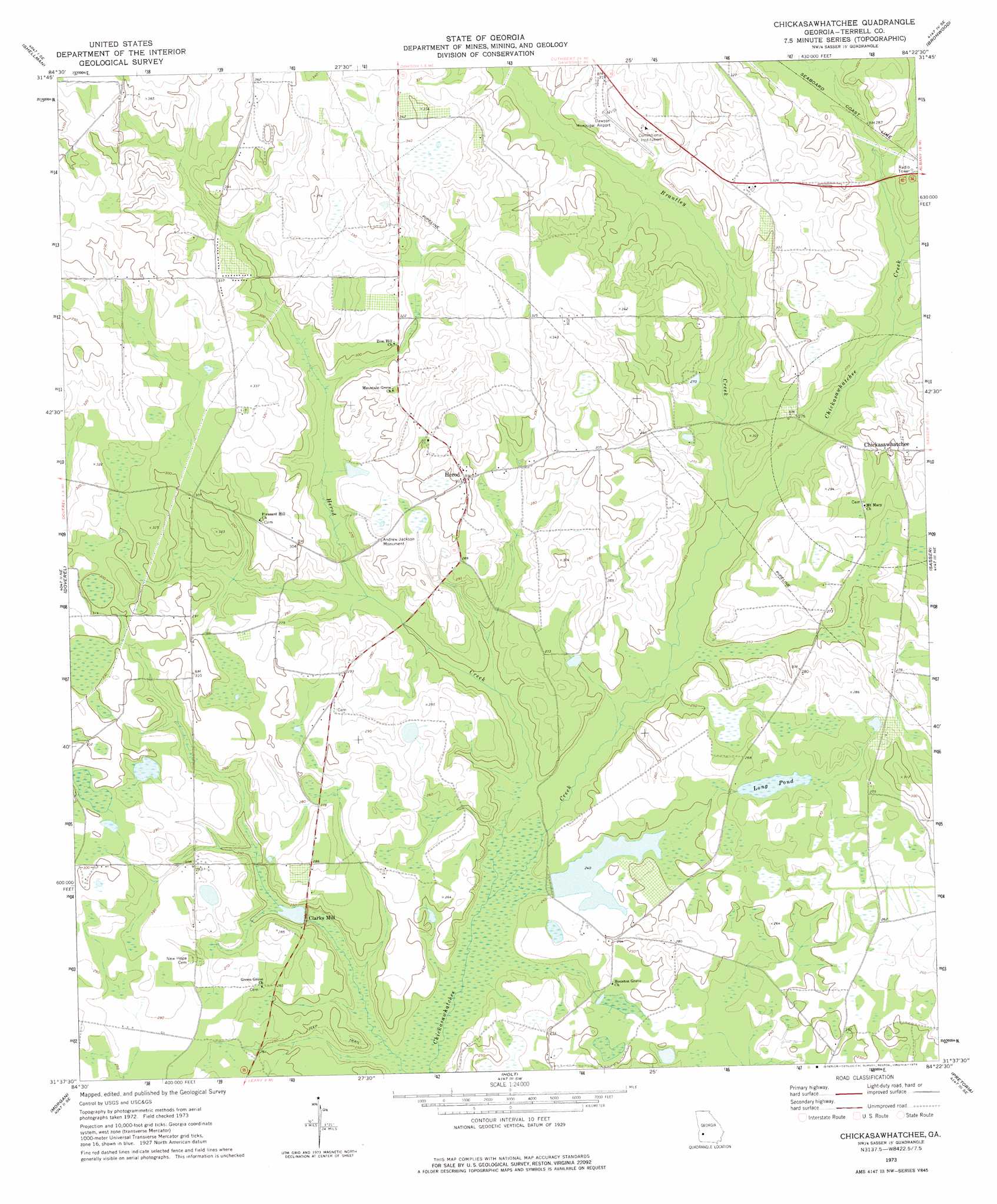
USGS Topo Quad 31084f4 - 1:24,000 scale
| Topo Map Name: | Chickasawhatchee |
| USGS Topo Quad ID: | 31084f4 |
| Print Size: | ca. 21 1/4" wide x 27" high |
| Southeast Coordinates: | 31.625° N latitude / 84.375° W longitude |
| Map Center Coordinates: | 31.6875° N latitude / 84.4375° W longitude |
| U.S. State: | GA |
| Filename: | o31084f4.jpg |
| Download Map JPG Image: | Chickasawhatchee topo map 1:24,000 scale |
| Map Type: | Topographic |
| Topo Series: | 7.5´ |
| Map Scale: | 1:24,000 |
| Source of Map Images: | United States Geological Survey (USGS) |
| Alternate Map Versions: |
Chickasawhatchee GA 1973, updated 1974 Download PDF Buy paper map Chickasawhatchee GA 2011 Download PDF Buy paper map Chickasawhatchee GA 2014 Download PDF Buy paper map |
1:24,000 Topo Quads surrounding Chickasawhatchee
Benevolence |
Parrott |
Bottsford |
Smithville West |
Smithville East |
Brooksville |
Shellman |
Dawson |
Bronwood |
Neyami |
Martins Crossroads |
Doverel |
Chickasawhatchee |
Sasser |
Leesburg |
Edison |
Morgan |
Holt |
Pretoria |
Albany West |
Arlington |
Leary |
Bermuda |
Red Store Crossroads |
Baconton North |
> Back to 31084e1 at 1:100,000 scale
> Back to 31084a1 at 1:250,000 scale
> Back to U.S. Topo Maps home
Chickasawhatchee topo map: Gazetteer
Chickasawhatchee: Airports
Dawson Municipal Airport elevation 93m 305′Chickasawhatchee: Dams
Clarks Millpond Dam elevation 75m 246′Freatherfield Lake Dam elevation 75m 246′
Laing Lake Dam elevation 78m 255′
Chickasawhatchee: Lakes
Long Pond elevation 81m 265′Chickasawhatchee: Parks
Andrew Jackson Monument elevation 89m 291′Chickasawhatchee: Populated Places
Clarks Mill elevation 72m 236′Herod elevation 91m 298′
Chickasawhatchee: Reservoirs
Clarks Millpond Dam elevation 75m 246′Featherfield Lake elevation 75m 246′
Laing Lake elevation 78m 255′
Chickasawhatchee: Streams
Brantley Creek elevation 74m 242′Herod Creek elevation 68m 223′
Chickasawhatchee digital topo map on disk
Buy this Chickasawhatchee topo map showing relief, roads, GPS coordinates and other geographical features, as a high-resolution digital map file on DVD:
Gulf Coast (LA, MS, AL, FL) & Southwestern Georgia
Buy digital topo maps: Gulf Coast (LA, MS, AL, FL) & Southwestern Georgia
 & Southwestern Georgia map DVD")