Doverel Topo Map Georgia
To zoom in, hover over the map of Doverel
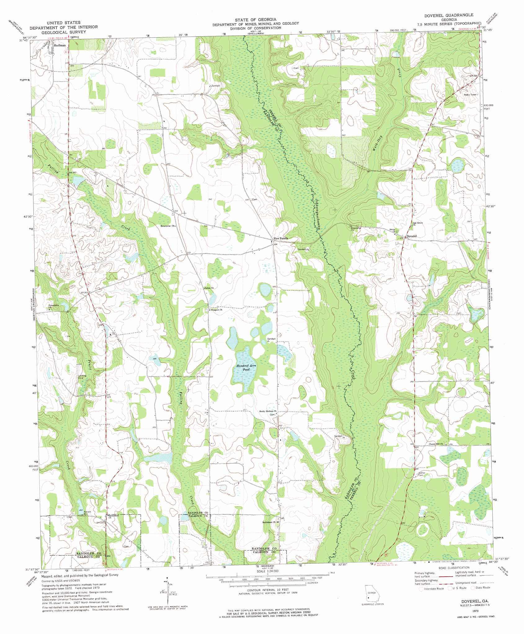
USGS Topo Quad 31084f5 - 1:24,000 scale
| Topo Map Name: | Doverel |
| USGS Topo Quad ID: | 31084f5 |
| Print Size: | ca. 21 1/4" wide x 27" high |
| Southeast Coordinates: | 31.625° N latitude / 84.5° W longitude |
| Map Center Coordinates: | 31.6875° N latitude / 84.5625° W longitude |
| U.S. State: | GA |
| Filename: | o31084f5.jpg |
| Download Map JPG Image: | Doverel topo map 1:24,000 scale |
| Map Type: | Topographic |
| Topo Series: | 7.5´ |
| Map Scale: | 1:24,000 |
| Source of Map Images: | United States Geological Survey (USGS) |
| Alternate Map Versions: |
Doverel GA 1973, updated 1975 Download PDF Buy paper map Doverel GA 2011 Download PDF Buy paper map Doverel GA 2014 Download PDF Buy paper map |
1:24,000 Topo Quads surrounding Doverel
County Line |
Benevolence |
Parrott |
Bottsford |
Smithville West |
Cuthbert |
Brooksville |
Shellman |
Dawson |
Bronwood |
Carnegie |
Martins Crossroads |
Doverel |
Chickasawhatchee |
Sasser |
Bluffton |
Edison |
Morgan |
Holt |
Pretoria |
Bancroft |
Arlington |
Leary |
Bermuda |
Red Store Crossroads |
> Back to 31084e1 at 1:100,000 scale
> Back to 31084a1 at 1:250,000 scale
> Back to U.S. Topo Maps home
Doverel topo map: Gazetteer
Doverel: Dams
Bentley Lake Dam elevation 102m 334′Bynum Lake Dam elevation 98m 321′
Rice Lake Dam elevation 79m 259′
Rice Lake Dam North elevation 92m 301′
Wall Lake Dam elevation 90m 295′
Doverel: Lakes
Hundred Acre Pond elevation 93m 305′Doverel: Populated Places
Aycock Mill elevation 79m 259′Doverel elevation 101m 331′
Five Points elevation 97m 318′
Doverel: Reservoirs
Bentley Lake elevation 102m 334′Bynum Lake elevation 98m 321′
Rice Lake elevation 79m 259′
Rice Lake North elevation 92m 301′
Wall Lake elevation 90m 295′
Doverel: Streams
Walk-Ikey Creek elevation 79m 259′Doverel digital topo map on disk
Buy this Doverel topo map showing relief, roads, GPS coordinates and other geographical features, as a high-resolution digital map file on DVD:
Gulf Coast (LA, MS, AL, FL) & Southwestern Georgia
Buy digital topo maps: Gulf Coast (LA, MS, AL, FL) & Southwestern Georgia
 & Southwestern Georgia map DVD")