Coleman Topo Map Georgia
To zoom in, hover over the map of Coleman
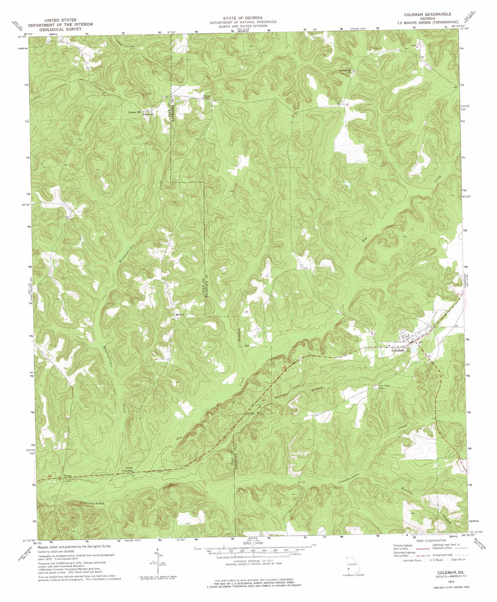
USGS Topo Quad 31084f8 - 1:24,000 scale
| Topo Map Name: | Coleman |
| USGS Topo Quad ID: | 31084f8 |
| Print Size: | ca. 21 1/4" wide x 27" high |
| Southeast Coordinates: | 31.625° N latitude / 84.875° W longitude |
| Map Center Coordinates: | 31.6875° N latitude / 84.9375° W longitude |
| U.S. State: | GA |
| Filename: | o31084f8.jpg |
| Download Map JPG Image: | Coleman topo map 1:24,000 scale |
| Map Type: | Topographic |
| Topo Series: | 7.5´ |
| Map Scale: | 1:24,000 |
| Source of Map Images: | United States Geological Survey (USGS) |
| Alternate Map Versions: |
Coleman GA 1973, updated 1975 Download PDF Buy paper map Coleman GA 2011 Download PDF Buy paper map Coleman GA 2014 Download PDF Buy paper map |
1:24,000 Topo Quads surrounding Coleman
Eufaula North |
Georgetown |
Sanford |
County Line |
Benevolence |
Eufaula South |
Hatcher |
Morris |
Cuthbert |
Brooksville |
Fort Gaines Nw |
Fort Gaines Ne |
Coleman |
Carnegie |
Martins Crossroads |
Abbeville East |
Fort Gaines |
Zetto |
Bluffton |
Edison |
Haleburg |
Columbia Ne |
Blakely North |
Bancroft |
Arlington |
> Back to 31084e1 at 1:100,000 scale
> Back to 31084a1 at 1:250,000 scale
> Back to U.S. Topo Maps home
Coleman topo map: Gazetteer
Coleman: Populated Places
Bethel elevation 132m 433′Coleman elevation 122m 400′
Cotton Hill elevation 137m 449′
Jones Crossing elevation 65m 213′
Pecan elevation 62m 203′
Coleman: Streams
Caney Branch elevation 57m 187′Hog Creek elevation 57m 187′
Knowles Branch elevation 73m 239′
Little Creek elevation 72m 236′
Waukeefriskee Creek elevation 53m 173′
Wolf Branch elevation 72m 236′
Coleman digital topo map on disk
Buy this Coleman topo map showing relief, roads, GPS coordinates and other geographical features, as a high-resolution digital map file on DVD:
Gulf Coast (LA, MS, AL, FL) & Southwestern Georgia
Buy digital topo maps: Gulf Coast (LA, MS, AL, FL) & Southwestern Georgia
 & Southwestern Georgia map DVD")