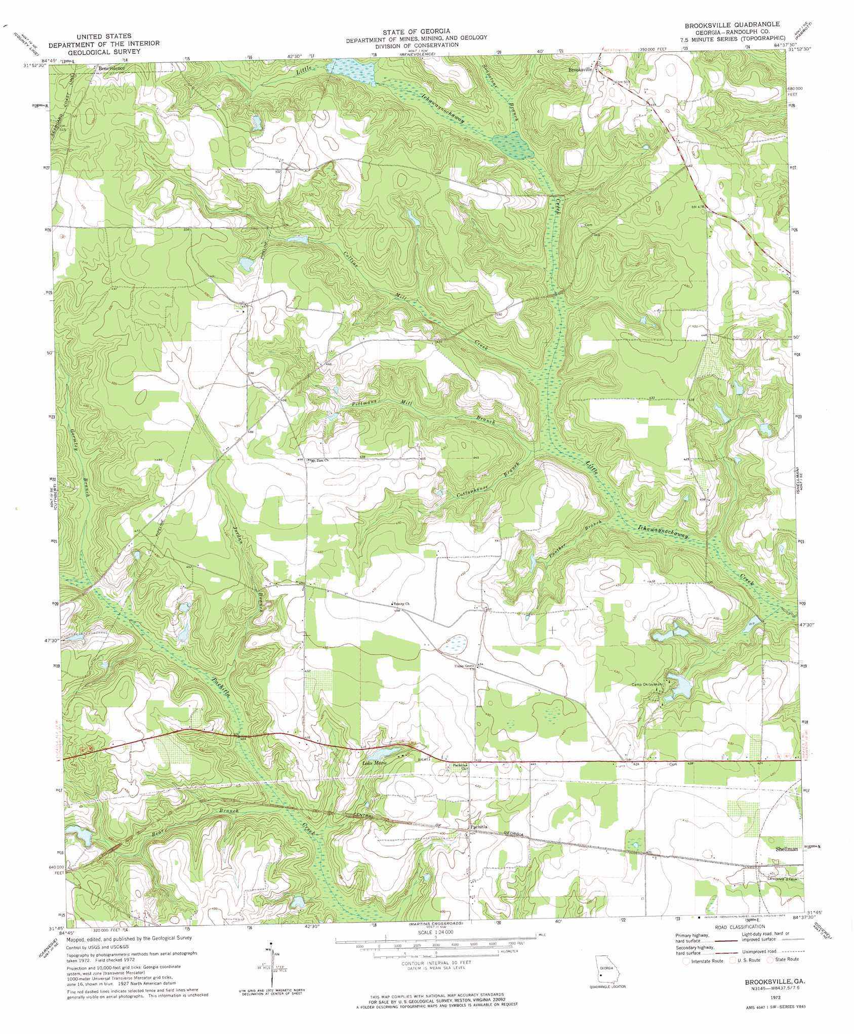
Brooksville Topo Map Georgia
To zoom in, hover over the map of Brooksville
USGS Topo Quad 31084g6 - 1:24,000 scale
| Topo Map Name: | Brooksville |
| USGS Topo Quad ID: | 31084g6 |
| Print Size: | ca. 21 1/4" wide x 27" high |
| Southeast Coordinates: | 31.75° N latitude / 84.625° W longitude |
| Map Center Coordinates: | 31.8125° N latitude / 84.6875° W longitude |
| U.S. State: | GA |
| Filename: | o31084g6.jpg |
| Download Map JPG Image: | Brooksville topo map 1:24,000 scale |
| Map Type: | Topographic |
| Topo Series: | 7.5´ |
| Map Scale: | 1:24,000 |
| Source of Map Images: | United States Geological Survey (USGS) |
| Alternate Map Versions: |
Brooksville GA 1972, updated 1974 Download PDF Buy paper map Brooksville GA 2011 Download PDF Buy paper map Brooksville GA 2014 Download PDF Buy paper map |
1:24,000 Topo Quads surrounding Brooksville
Lumpkin Sw |
Lumpkin |
Richland |
Preston |
Plains |
Sanford |
County Line |
Benevolence |
Parrott |
Bottsford |
Morris |
Cuthbert |
Brooksville |
Shellman |
Dawson |
Coleman |
Carnegie |
Martins Crossroads |
Doverel |
Chickasawhatchee |
Zetto |
Bluffton |
Edison |
Morgan |
Holt |
> Back to 31084e1 at 1:100,000 scale
> Back to 31084a1 at 1:250,000 scale
> Back to U.S. Topo Maps home
Brooksville topo map: Gazetteer
Brooksville: Airports
Bynum Airport elevation 129m 423′Sammons Airport elevation 122m 400′
Brooksville: Dams
Flint River Girl Scout Lake Dam elevation 105m 344′Jackson Lake Dam elevation 116m 380′
Lake Marie Dam elevation 114m 374′
Merritt Lake Dam elevation 135m 442′
Merritt Lake Dam elevation 95m 311′
Shellhouse Lake Dam elevation 119m 390′
Wheely Lake Dam elevation 104m 341′
Brooksville: Populated Places
Brooksville elevation 152m 498′Pachitla elevation 123m 403′
Water Pipe elevation 148m 485′
Brooksville: Reservoirs
Flint River Girl Scout Lake elevation 105m 344′Jackson Lake elevation 116m 380′
Lake Marie elevation 114m 374′
Marie Lake elevation 114m 374′
Merritt Lake elevation 95m 311′
Merritt Lake elevation 135m 442′
Shellhouse Lake elevation 119m 390′
Wheely Lake elevation 104m 341′
Brooksville: Streams
Bear Branch elevation 99m 324′Collins Mill Creek elevation 102m 334′
Cottonhouse Branch elevation 102m 334′
Gormley Branch elevation 108m 354′
Jordan Branch elevation 103m 337′
Panther Branch elevation 97m 318′
Pittmans Mill Branch elevation 100m 328′
Soapstone Branch elevation 113m 370′
Brooksville digital topo map on disk
Buy this Brooksville topo map showing relief, roads, GPS coordinates and other geographical features, as a high-resolution digital map file on DVD:
Gulf Coast (LA, MS, AL, FL) & Southwestern Georgia
Buy digital topo maps: Gulf Coast (LA, MS, AL, FL) & Southwestern Georgia
 & Southwestern Georgia map DVD")