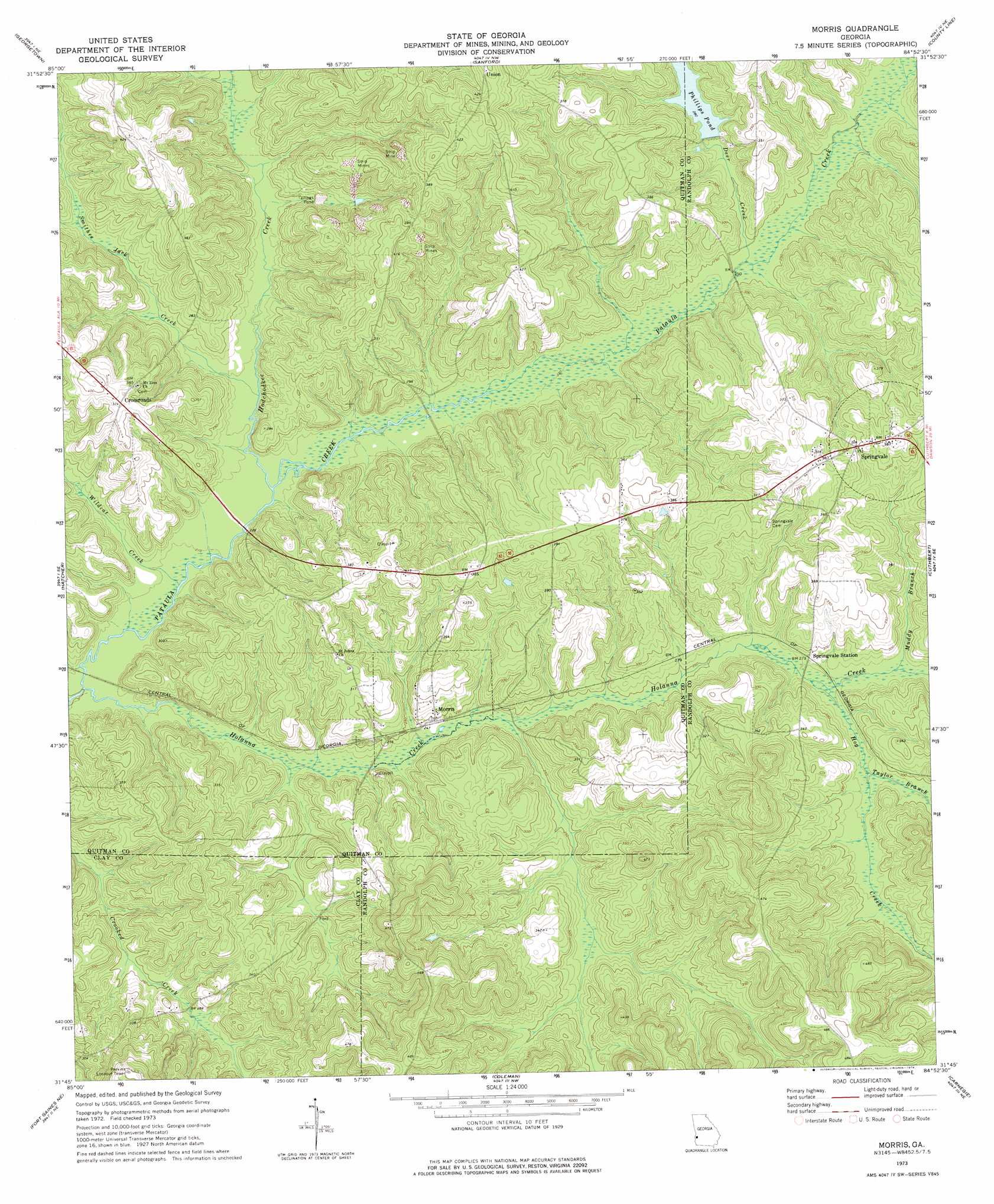
Morris Topo Map Georgia
To zoom in, hover over the map of Morris
USGS Topo Quad 31084g8 - 1:24,000 scale
| Topo Map Name: | Morris |
| USGS Topo Quad ID: | 31084g8 |
| Print Size: | ca. 21 1/4" wide x 27" high |
| Southeast Coordinates: | 31.75° N latitude / 84.875° W longitude |
| Map Center Coordinates: | 31.8125° N latitude / 84.9375° W longitude |
| U.S. State: | GA |
| Filename: | o31084g8.jpg |
| Download Map JPG Image: | Morris topo map 1:24,000 scale |
| Map Type: | Topographic |
| Topo Series: | 7.5´ |
| Map Scale: | 1:24,000 |
| Source of Map Images: | United States Geological Survey (USGS) |
| Alternate Map Versions: |
Morris GA 1973, updated 1974 Download PDF Buy paper map Morris GA 2011 Download PDF Buy paper map Morris GA 2014 Download PDF Buy paper map |
1:24,000 Topo Quads surrounding Morris
Howe |
Twin Springs |
Lumpkin Sw |
Lumpkin |
Richland |
Eufaula North |
Georgetown |
Sanford |
County Line |
Benevolence |
Eufaula South |
Hatcher |
Morris |
Cuthbert |
Brooksville |
Fort Gaines Nw |
Fort Gaines Ne |
Coleman |
Carnegie |
Martins Crossroads |
Abbeville East |
Fort Gaines |
Zetto |
Bluffton |
Edison |
> Back to 31084e1 at 1:100,000 scale
> Back to 31084a1 at 1:250,000 scale
> Back to U.S. Topo Maps home
Morris topo map: Gazetteer
Morris: Dams
Phillips Pond Dam elevation 87m 285′Morris: Populated Places
Crossroads elevation 113m 370′Morris elevation 75m 246′
Springvale elevation 117m 383′
Morris: Reservoirs
Phillips Pond elevation 87m 285′Phillps Pond elevation 79m 259′
Morris: Streams
Deer Creek elevation 73m 239′Hodchodkee Creek elevation 66m 216′
Hog Creek elevation 79m 259′
Holanna Creek elevation 63m 206′
Hunt Branch elevation 83m 272′
Kitchen Branch elevation 80m 262′
Mill Branch elevation 77m 252′
Muddy Branch elevation 82m 269′
Owon Branch elevation 78m 255′
Parker Branch elevation 75m 246′
Short Creek elevation 72m 236′
Smithee Jack Creek elevation 66m 216′
Taylor Branch elevation 82m 269′
Wildcat Creek elevation 64m 209′
Morris digital topo map on disk
Buy this Morris topo map showing relief, roads, GPS coordinates and other geographical features, as a high-resolution digital map file on DVD:
Gulf Coast (LA, MS, AL, FL) & Southwestern Georgia
Buy digital topo maps: Gulf Coast (LA, MS, AL, FL) & Southwestern Georgia
 & Southwestern Georgia map DVD")