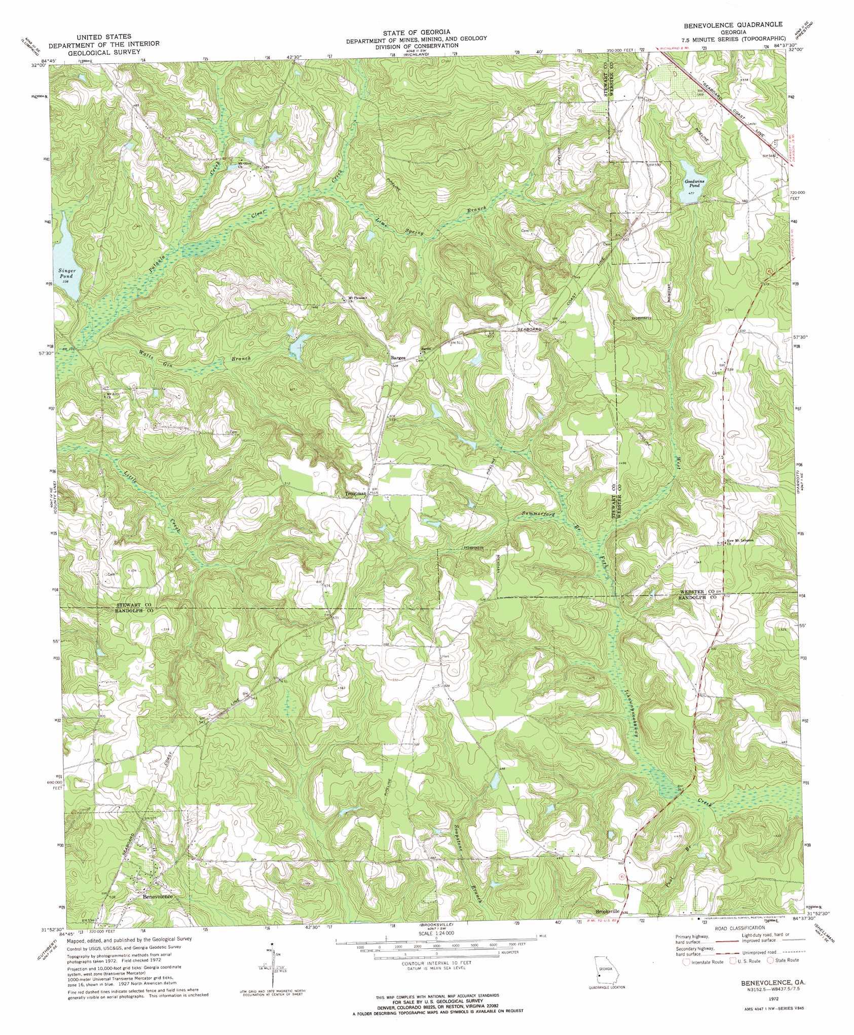
Benevolence Topo Map Georgia
To zoom in, hover over the map of Benevolence
USGS Topo Quad 31084h6 - 1:24,000 scale
| Topo Map Name: | Benevolence |
| USGS Topo Quad ID: | 31084h6 |
| Print Size: | ca. 21 1/4" wide x 27" high |
| Southeast Coordinates: | 31.875° N latitude / 84.625° W longitude |
| Map Center Coordinates: | 31.9375° N latitude / 84.6875° W longitude |
| U.S. State: | GA |
| Filename: | o31084h6.jpg |
| Download Map JPG Image: | Benevolence topo map 1:24,000 scale |
| Map Type: | Topographic |
| Topo Series: | 7.5´ |
| Map Scale: | 1:24,000 |
| Source of Map Images: | United States Geological Survey (USGS) |
| Alternate Map Versions: |
Benevolence GA 1972, updated 1974 Download PDF Buy paper map Benevolence GA 2011 Download PDF Buy paper map Benevolence GA 2014 Download PDF Buy paper map |
1:24,000 Topo Quads surrounding Benevolence
Union |
Louvale |
Brooklyn |
Church Hill |
Draneville |
Lumpkin Sw |
Lumpkin |
Richland |
Preston |
Plains |
Sanford |
County Line |
Benevolence |
Parrott |
Bottsford |
Morris |
Cuthbert |
Brooksville |
Shellman |
Dawson |
Coleman |
Carnegie |
Martins Crossroads |
Doverel |
Chickasawhatchee |
> Back to 31084e1 at 1:100,000 scale
> Back to 31084a1 at 1:250,000 scale
> Back to U.S. Topo Maps home
Benevolence topo map: Gazetteer
Benevolence: Bridges
Singer Bridge elevation 97m 318′Benevolence: Dams
Goodwins Pond Dam elevation 144m 472′Singers Pond Dam elevation 103m 337′
Benevolence: Lakes
Singer Pond elevation 103m 337′Benevolence: Populated Places
Benevolence elevation 157m 515′Gore elevation 169m 554′
Troutman elevation 156m 511′
Benevolence: Reservoirs
Goodwins Pond elevation 144m 472′Singers Pond elevation 105m 344′
Benevolence: Streams
Clear Creek elevation 100m 328′Lime Spring Branch elevation 106m 347′
Pool Branch elevation 108m 354′
Summerford Branch elevation 116m 380′
Watts Gin Branch elevation 97m 318′
Benevolence digital topo map on disk
Buy this Benevolence topo map showing relief, roads, GPS coordinates and other geographical features, as a high-resolution digital map file on DVD:
Gulf Coast (LA, MS, AL, FL) & Southwestern Georgia
Buy digital topo maps: Gulf Coast (LA, MS, AL, FL) & Southwestern Georgia
 & Southwestern Georgia map DVD")