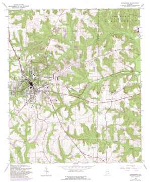
Enterprise Topo Map Alabama
To zoom in, hover over the map of Enterprise
USGS Topo Quad 31085c7 - 1:24,000 scale
| Topo Map Name: | Enterprise |
| USGS Topo Quad ID: | 31085c7 |
| Print Size: | ca. 21 1/4" wide x 27" high |
| Southeast Coordinates: | 31.25° N latitude / 85.75° W longitude |
| Map Center Coordinates: | 31.3125° N latitude / 85.8125° W longitude |
| U.S. State: | AL |
| Filename: | o31085c7.jpg |
| Download Map JPG Image: | Enterprise topo map 1:24,000 scale |
| Map Type: | Topographic |
| Topo Series: | 7.5´ |
| Map Scale: | 1:24,000 |
| Source of Map Images: | United States Geological Survey (USGS) |
| Alternate Map Versions: |
Enterprise AL 1960, updated 1964 Download PDF Buy paper map Enterprise AL 1960, updated 1984 Download PDF Buy paper map Enterprise AL 2011 Download PDF Buy paper map Enterprise AL 2014 Download PDF Buy paper map |
1:24,000 Topo Quads surrounding Enterprise
> Back to 31085a1 at 1:100,000 scale
> Back to 31084a1 at 1:250,000 scale
> Back to U.S. Topo Maps home
Enterprise topo map: Gazetteer
Enterprise: Airports
County Line Landing Strip elevation 98m 321′Enterprise: Dams
Enterprise Country Club Lake Dam elevation 87m 285′Lake Charles Dam elevation 87m 285′
Lunsford Pond Dam elevation 95m 311′
Paschal Pond Dam elevation 78m 255′
Phillip Martin Pond Dam elevation 82m 269′
Smith Brothers Pond Dam elevation 75m 246′
Enterprise: Parks
Boll Weevil Monument elevation 108m 354′Dixie Boys Baseball Park elevation 122m 400′
G C Donaldson Park elevation 116m 380′
Enterprise: Populated Places
Alpha Heights elevation 97m 318′Boland Acres elevation 116m 380′
Briarhill Acres elevation 88m 288′
Brown Subdivision elevation 103m 337′
Byrd Subdivision elevation 119m 390′
Chateau Court elevation 110m 360′
Clubview Estates elevation 115m 377′
College Heights elevation 110m 360′
Coppinville elevation 105m 344′
Country Club Estates elevation 95m 311′
Country Club Meadows elevation 111m 364′
Country Estates elevation 112m 367′
Deerfield Park elevation 106m 347′
Dobbs Subdivision elevation 109m 357′
Enterprise elevation 108m 354′
Forest Park elevation 93m 305′
Foxhill elevation 106m 347′
Gerald elevation 55m 180′
Green Acres elevation 110m 360′
Griffin Heights elevation 104m 341′
Harrand Creek Estates elevation 78m 255′
Heritage Heights elevation 105m 344′
Hillcrest elevation 106m 347′
Holiday Village elevation 106m 347′
Honeysuckle Hills elevation 92m 301′
Idlewood elevation 110m 360′
Indian Lakes elevation 101m 331′
Indian Springs elevation 104m 341′
Indigo elevation 103m 337′
Jamestown Colony elevation 108m 354′
Johnson Subdivision elevation 102m 334′
Keyton elevation 106m 347′
Level Plains elevation 96m 314′
Martin Heights elevation 110m 360′
Morgan Subdivision elevation 108m 354′
North Heights elevation 118m 387′
Oak Ridge elevation 106m 347′
Olivers Lake elevation 94m 308′
Omni elevation 102m 334′
Pinedale Estates elevation 107m 351′
Regency Heights elevation 106m 347′
Rolling Acres elevation 91m 298′
Scottsdale Heights elevation 99m 324′
Shell Heights elevation 119m 390′
Singing Brook elevation 102m 334′
Valley Hills elevation 98m 321′
Williams Subdivision elevation 109m 357′
Willow Bend elevation 106m 347′
Wooddale elevation 110m 360′
Wooded Acres elevation 96m 314′
Enterprise: Post Offices
Enterprise Post Office elevation 104m 341′Enterprise: Reservoirs
Enterprise Country Club Lake elevation 87m 285′Griffith Lake elevation 83m 272′
Lake Charles elevation 90m 295′
Paschal Pond elevation 78m 255′
Phillip Martin Pond elevation 82m 269′
Porters Lake elevation 100m 328′
Smith Brothers Pond elevation 75m 246′
Enterprise: Streams
Indian Camp Creek elevation 66m 216′Little Cowpen Creek elevation 75m 246′
Rodney Branch elevation 67m 219′
Enterprise digital topo map on disk
Buy this Enterprise topo map showing relief, roads, GPS coordinates and other geographical features, as a high-resolution digital map file on DVD:
Gulf Coast (LA, MS, AL, FL) & Southwestern Georgia
Buy digital topo maps: Gulf Coast (LA, MS, AL, FL) & Southwestern Georgia


