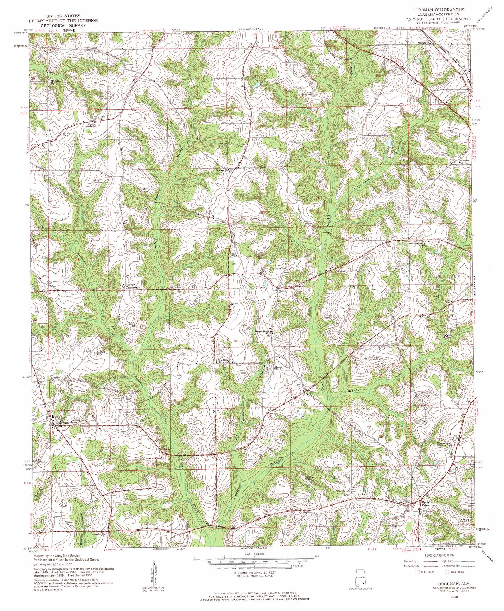
Goodman Topo Map Alabama
To zoom in, hover over the map of Goodman
USGS Topo Quad 31085c8 - 1:24,000 scale
| Topo Map Name: | Goodman |
| USGS Topo Quad ID: | 31085c8 |
| Print Size: | ca. 21 1/4" wide x 27" high |
| Southeast Coordinates: | 31.25° N latitude / 85.875° W longitude |
| Map Center Coordinates: | 31.3125° N latitude / 85.9375° W longitude |
| U.S. State: | AL |
| Filename: | o31085c8.jpg |
| Download Map JPG Image: | Goodman topo map 1:24,000 scale |
| Map Type: | Topographic |
| Topo Series: | 7.5´ |
| Map Scale: | 1:24,000 |
| Source of Map Images: | United States Geological Survey (USGS) |
| Alternate Map Versions: |
Goodman AL 1960, updated 1963 Download PDF Buy paper map Goodman AL 1960, updated 1963 Download PDF Buy paper map Goodman AL 2011 Download PDF Buy paper map Goodman AL 2014 Download PDF Buy paper map |
1:24,000 Topo Quads surrounding Goodman
Bullock |
Bluff Springs |
Victoria |
Brundidge Se |
Ariton |
Danleys Crossroads |
Elba |
New Brockton |
Enterprise Ne |
Ozark |
Opp East |
Ino |
Goodman |
Enterprise |
Daleville |
Kinston |
Sellersville |
Coffee Springs |
Bellwood |
Clayhatchee |
Hacoda |
Samson |
Geneva West |
Geneva East |
Hartford |
> Back to 31085a1 at 1:100,000 scale
> Back to 31084a1 at 1:250,000 scale
> Back to U.S. Topo Maps home
Goodman topo map: Gazetteer
Goodman: Airports
Enterprise Municipal Airport elevation 107m 351′Goodman: Dams
John Moates Lake Dam elevation 108m 354′Monroe Mynard Pond Dam elevation 91m 298′
Goodman: Parks
Meadow Lawn Memorial Park elevation 108m 354′Goodman: Populated Places
Battens Crossroads elevation 105m 344′Fairfield Estates elevation 109m 357′
Goodman elevation 107m 351′
Pine Forest elevation 102m 334′
Turner Crossroads elevation 104m 341′
Goodman: Reservoirs
Moates Lake elevation 108m 354′Monroe Mynard Pond elevation 91m 298′
Goodman: Streams
Bear Branch elevation 60m 196′Blanket Creek elevation 65m 213′
Boggy Branch elevation 70m 229′
Kelly Branch elevation 101m 331′
Little Double Bridges Creek elevation 59m 193′
Long Branch elevation 63m 206′
Longbranch Creek elevation 78m 255′
Martin Spring Branch elevation 82m 269′
New Home Branch elevation 61m 200′
Peacock Mill Branch elevation 65m 213′
Roberts Branch elevation 70m 229′
Rocky Branch elevation 58m 190′
Spring Branch elevation 67m 219′
Wilbers Creek elevation 67m 219′
Goodman digital topo map on disk
Buy this Goodman topo map showing relief, roads, GPS coordinates and other geographical features, as a high-resolution digital map file on DVD:
Gulf Coast (LA, MS, AL, FL) & Southwestern Georgia
Buy digital topo maps: Gulf Coast (LA, MS, AL, FL) & Southwestern Georgia
 & Southwestern Georgia map DVD")