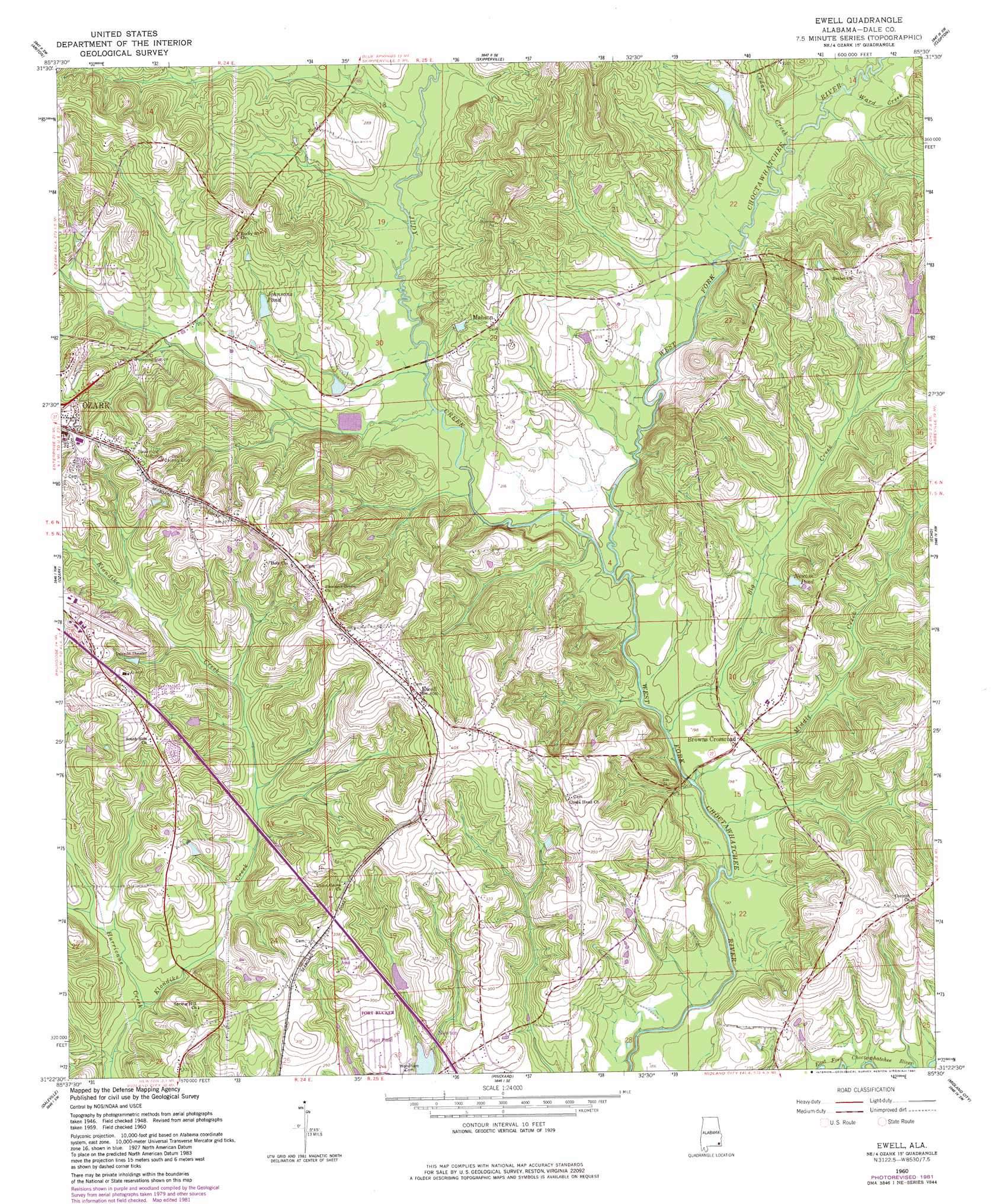
Ewell Topo Map Alabama
To zoom in, hover over the map of Ewell
USGS Topo Quad 31085d5 - 1:24,000 scale
| Topo Map Name: | Ewell |
| USGS Topo Quad ID: | 31085d5 |
| Print Size: | ca. 21 1/4" wide x 27" high |
| Southeast Coordinates: | 31.375° N latitude / 85.5° W longitude |
| Map Center Coordinates: | 31.4375° N latitude / 85.5625° W longitude |
| U.S. State: | AL |
| Filename: | o31085d5.jpg |
| Download Map JPG Image: | Ewell topo map 1:24,000 scale |
| Map Type: | Topographic |
| Topo Series: | 7.5´ |
| Map Scale: | 1:24,000 |
| Source of Map Images: | United States Geological Survey (USGS) |
| Alternate Map Versions: |
Ewell AL 1960, updated 1963 Download PDF Buy paper map Ewell AL 1960, updated 1981 Download PDF Buy paper map Ewell AL 2011 Download PDF Buy paper map Ewell AL 2014 Download PDF Buy paper map |
1:24,000 Topo Quads surrounding Ewell
Brundidge |
Elamville |
Clio |
Texasville |
Lawrenceville |
Brundidge Se |
Ariton |
Skipperville |
Clopton |
Abbeville West |
Enterprise Ne |
Ozark |
Ewell |
Echo |
Newville |
Enterprise |
Daleville |
Pinckard |
Midland City |
Headland |
Bellwood |
Clayhatchee |
Malvern |
Dothan West |
Dothan East |
> Back to 31085a1 at 1:100,000 scale
> Back to 31084a1 at 1:250,000 scale
> Back to U.S. Topo Maps home
Ewell topo map: Gazetteer
Ewell: Airports
Blackwell Field elevation 105m 344′Hunt AHP Airport elevation 89m 291′
Ewell: Bridges
Chitty Bridge elevation 63m 206′Ewell: Dams
Carver Johnson Lake Dam elevation 79m 259′James Crooks Lake Dam elevation 64m 209′
Ewell: Populated Places
Browns Crossroad elevation 65m 213′Ewell elevation 122m 400′
Mabson elevation 84m 275′
Ewell: Reservoirs
James Crooks Lake elevation 64m 209′Johnsons Pond elevation 79m 259′
Newton Pond elevation 80m 262′
Ewell: Springs
Klondyke Springs elevation 60m 196′Ewell: Streams
Big Creek elevation 57m 187′Cedar Creek elevation 64m 209′
Judy Creek elevation 57m 187′
Klondike Creek elevation 57m 187′
Middle Creek elevation 55m 180′
Panther Creek elevation 62m 203′
Sevenmile Creek elevation 68m 223′
Spear Branch elevation 55m 180′
Telico Branch elevation 63m 206′
Ewell digital topo map on disk
Buy this Ewell topo map showing relief, roads, GPS coordinates and other geographical features, as a high-resolution digital map file on DVD:
Gulf Coast (LA, MS, AL, FL) & Southwestern Georgia
Buy digital topo maps: Gulf Coast (LA, MS, AL, FL) & Southwestern Georgia
 & Southwestern Georgia map DVD")