New Brockton Topo Map Alabama
To zoom in, hover over the map of New Brockton
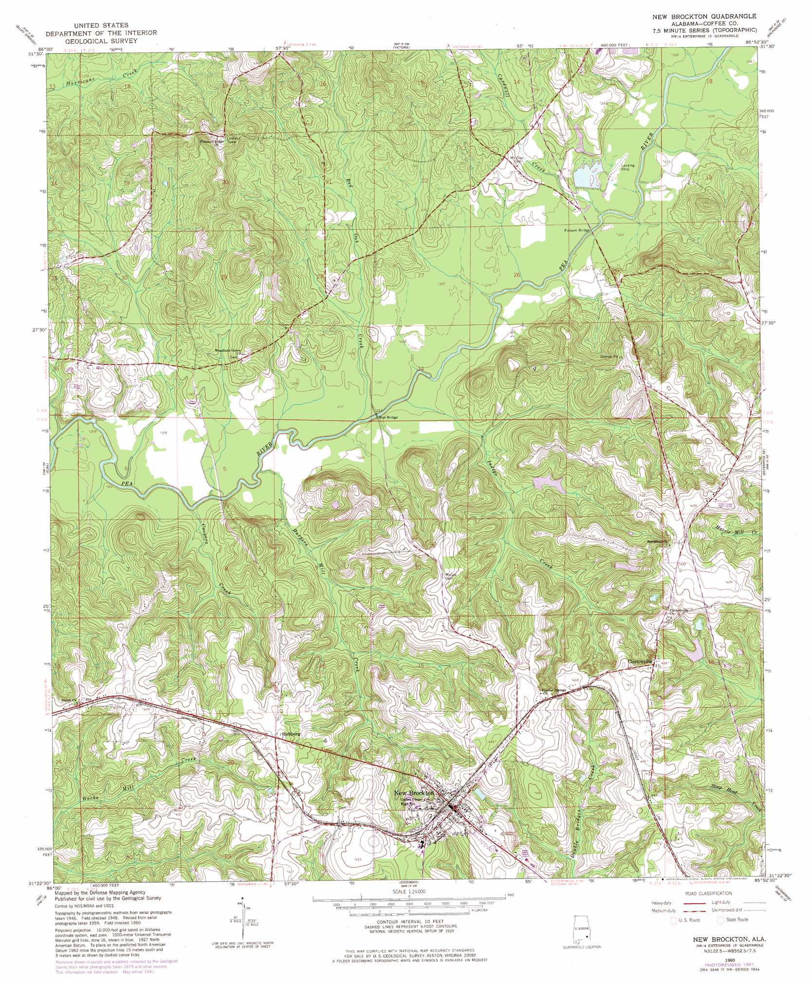
USGS Topo Quad 31085d8 - 1:24,000 scale
| Topo Map Name: | New Brockton |
| USGS Topo Quad ID: | 31085d8 |
| Print Size: | ca. 21 1/4" wide x 27" high |
| Southeast Coordinates: | 31.375° N latitude / 85.875° W longitude |
| Map Center Coordinates: | 31.4375° N latitude / 85.9375° W longitude |
| U.S. State: | AL |
| Filename: | o31085d8.jpg |
| Download Map JPG Image: | New Brockton topo map 1:24,000 scale |
| Map Type: | Topographic |
| Topo Series: | 7.5´ |
| Map Scale: | 1:24,000 |
| Source of Map Images: | United States Geological Survey (USGS) |
| Alternate Map Versions: |
New Brockton AL 1960, updated 1963 Download PDF Buy paper map New Brockton AL 1960, updated 1981 Download PDF Buy paper map New Brockton AL 2011 Download PDF Buy paper map New Brockton AL 2014 Download PDF Buy paper map |
1:24,000 Topo Quads surrounding New Brockton
Glenwood |
Goshen |
Brundidge Nw |
Brundidge |
Elamville |
Bullock |
Bluff Springs |
Victoria |
Brundidge Se |
Ariton |
Danleys Crossroads |
Elba |
New Brockton |
Enterprise Ne |
Ozark |
Opp East |
Ino |
Goodman |
Enterprise |
Daleville |
Kinston |
Sellersville |
Coffee Springs |
Bellwood |
Clayhatchee |
> Back to 31085a1 at 1:100,000 scale
> Back to 31084a1 at 1:250,000 scale
> Back to U.S. Topo Maps home
New Brockton topo map: Gazetteer
New Brockton: Bridges
Folsom Bridge elevation 67m 219′Roe Bridge elevation 65m 213′
Weeks Bridge elevation 61m 200′
New Brockton: Dams
Hollis Pond Dam elevation 105m 344′Lake Nolin Dam elevation 70m 229′
Sawyer Lake Dam elevation 89m 291′
New Brockton: Populated Places
Clintonville elevation 133m 436′Mixson elevation 83m 272′
New Brockton elevation 140m 459′
Richburg elevation 127m 416′
New Brockton: Post Offices
New Brockton Post Office elevation 138m 452′New Brockton: Reservoirs
Hollis Pond elevation 105m 344′Nolin Lake elevation 69m 226′
Sawyer Lake elevation 89m 291′
New Brockton: Streams
Cardwell Creek elevation 67m 219′Coopers Creek elevation 61m 200′
Ellis Mill Creek elevation 57m 187′
Folsome Mill Creek elevation 64m 209′
Harpers Mill Creek elevation 64m 209′
Indigo Creek elevation 63m 206′
Johnson Creek elevation 62m 203′
Marsh Branch elevation 76m 249′
McGees Branch elevation 70m 229′
Meadow Branch elevation 73m 239′
Red Oak Creek elevation 64m 209′
School House Branch elevation 81m 265′
Tindle Creek elevation 67m 219′
New Brockton digital topo map on disk
Buy this New Brockton topo map showing relief, roads, GPS coordinates and other geographical features, as a high-resolution digital map file on DVD:
Gulf Coast (LA, MS, AL, FL) & Southwestern Georgia
Buy digital topo maps: Gulf Coast (LA, MS, AL, FL) & Southwestern Georgia
 & Southwestern Georgia map DVD")