Abbeville East Topo Map Alabama
To zoom in, hover over the map of Abbeville East
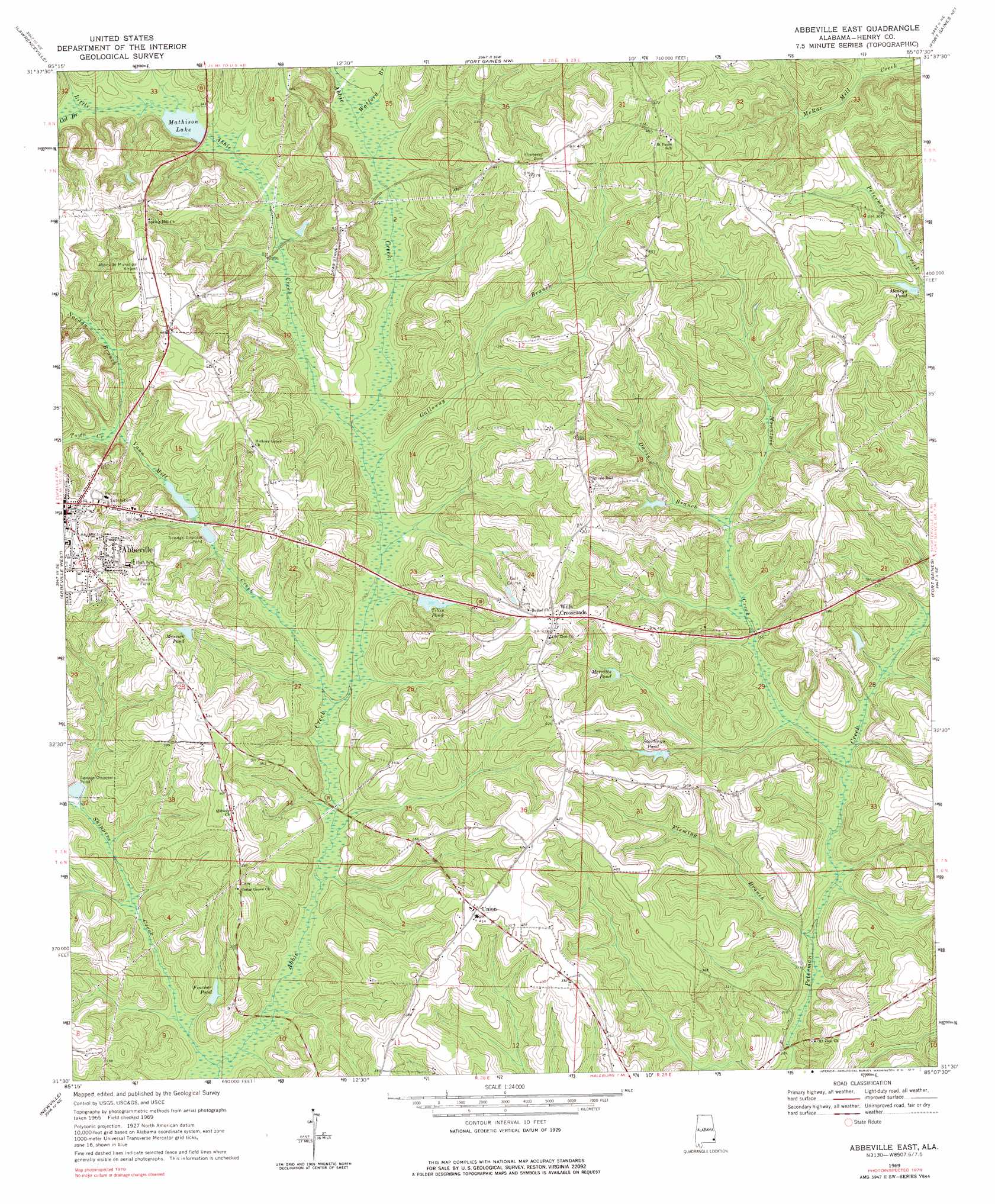
USGS Topo Quad 31085e2 - 1:24,000 scale
| Topo Map Name: | Abbeville East |
| USGS Topo Quad ID: | 31085e2 |
| Print Size: | ca. 21 1/4" wide x 27" high |
| Southeast Coordinates: | 31.5° N latitude / 85.125° W longitude |
| Map Center Coordinates: | 31.5625° N latitude / 85.1875° W longitude |
| U.S. State: | AL |
| Filename: | o31085e2.jpg |
| Download Map JPG Image: | Abbeville East topo map 1:24,000 scale |
| Map Type: | Topographic |
| Topo Series: | 7.5´ |
| Map Scale: | 1:24,000 |
| Source of Map Images: | United States Geological Survey (USGS) |
| Alternate Map Versions: |
Abbeville East AL 1969, updated 1971 Download PDF Buy paper map Abbeville East AL 1969, updated 1971 Download PDF Buy paper map Abbeville East AL 2011 Download PDF Buy paper map Abbeville East AL 2014 Download PDF Buy paper map |
1:24,000 Topo Quads surrounding Abbeville East
Clayton South |
Baker Hill |
Eufaula South |
Hatcher |
Morris |
Texasville |
Lawrenceville |
Fort Gaines Nw |
Fort Gaines Ne |
Coleman |
Clopton |
Abbeville West |
Abbeville East |
Fort Gaines |
Zetto |
Echo |
Newville |
Haleburg |
Columbia Ne |
Blakely North |
Midland City |
Headland |
Sigma |
Columbia |
Blakely South |
> Back to 31085e1 at 1:100,000 scale
> Back to 31084a1 at 1:250,000 scale
> Back to U.S. Topo Maps home
Abbeville East topo map: Gazetteer
Abbeville East: Airports
Abbeville Municipal Airport elevation 140m 459′Abbeville East: Dams
Edsel Adams Dam elevation 94m 308′G B Mathison Dam elevation 97m 318′
M L Tillis Pond Dam elevation 90m 295′
Abbeville East: Populated Places
Union elevation 125m 410′Wills Crossroads elevation 132m 433′
Abbeville East: Reservoirs
Fincher Pond elevation 76m 249′Mathison Lake elevation 99m 324′
Merritts Pond elevation 92m 301′
Messick Pond elevation 106m 347′
Moneys Pond elevation 99m 324′
Starlings Pond elevation 88m 288′
Tillis Pond elevation 90m 295′
Abbeville East: Streams
Cat Branch elevation 101m 331′Davis Branch elevation 81m 265′
Fleming Branch elevation 60m 196′
Galloway Branch elevation 80m 262′
Little Abbie Creek elevation 82m 269′
Mountain Creek elevation 69m 226′
Nordan Branch elevation 95m 311′
Skippers Creek elevation 68m 223′
Town Creek elevation 94m 308′
Vann Mill Creek elevation 76m 249′
Watford Branch elevation 89m 291′
Abbeville East digital topo map on disk
Buy this Abbeville East topo map showing relief, roads, GPS coordinates and other geographical features, as a high-resolution digital map file on DVD:
Gulf Coast (LA, MS, AL, FL) & Southwestern Georgia
Buy digital topo maps: Gulf Coast (LA, MS, AL, FL) & Southwestern Georgia
 & Southwestern Georgia map DVD")