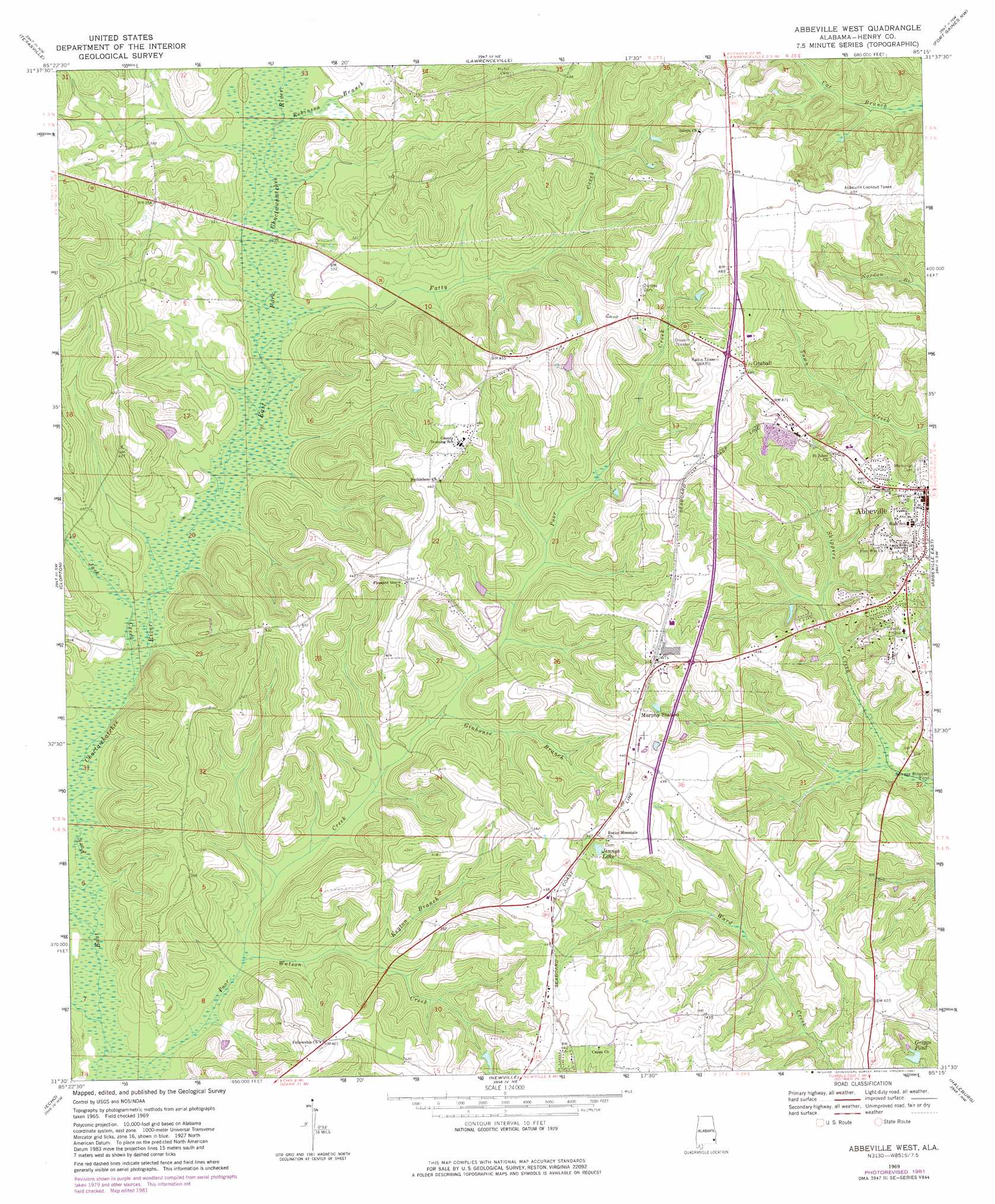
Abbeville West Topo Map Alabama
To zoom in, hover over the map of Abbeville West
USGS Topo Quad 31085e3 - 1:24,000 scale
| Topo Map Name: | Abbeville West |
| USGS Topo Quad ID: | 31085e3 |
| Print Size: | ca. 21 1/4" wide x 27" high |
| Southeast Coordinates: | 31.5° N latitude / 85.25° W longitude |
| Map Center Coordinates: | 31.5625° N latitude / 85.3125° W longitude |
| U.S. State: | AL |
| Filename: | o31085e3.jpg |
| Download Map JPG Image: | Abbeville West topo map 1:24,000 scale |
| Map Type: | Topographic |
| Topo Series: | 7.5´ |
| Map Scale: | 1:24,000 |
| Source of Map Images: | United States Geological Survey (USGS) |
| Alternate Map Versions: |
Abbeville West AL 1969 Download PDF Buy paper map Abbeville West AL 1969, updated 1981 Download PDF Buy paper map Abbeville West AL 2011 Download PDF Buy paper map Abbeville West AL 2014 Download PDF Buy paper map |
1:24,000 Topo Quads surrounding Abbeville West
Louisville |
Clayton South |
Baker Hill |
Eufaula South |
Hatcher |
Clio |
Texasville |
Lawrenceville |
Fort Gaines Nw |
Fort Gaines Ne |
Skipperville |
Clopton |
Abbeville West |
Abbeville East |
Fort Gaines |
Ewell |
Echo |
Newville |
Haleburg |
Columbia Ne |
Pinckard |
Midland City |
Headland |
Sigma |
Columbia |
> Back to 31085e1 at 1:100,000 scale
> Back to 31084a1 at 1:250,000 scale
> Back to U.S. Topo Maps home
Abbeville West topo map: Gazetteer
Abbeville West: Airports
Henry County Hospital Airport elevation 136m 446′Abbeville West: Populated Places
Abbeville elevation 137m 449′Graball elevation 147m 482′
Abbeville West: Reservoirs
Griggs Pond elevation 88m 288′Jennys Lake elevation 125m 410′
Abbeville West: Streams
Fatty Creek elevation 85m 278′Ginhouse Branch elevation 91m 298′
Jack Creek elevation 81m 265′
Keyton Branch elevation 86m 282′
Panther Creek elevation 78m 255′
Robinson Branch elevation 88m 288′
Watson Creek elevation 80m 262′
Abbeville West digital topo map on disk
Buy this Abbeville West topo map showing relief, roads, GPS coordinates and other geographical features, as a high-resolution digital map file on DVD:
Gulf Coast (LA, MS, AL, FL) & Southwestern Georgia
Buy digital topo maps: Gulf Coast (LA, MS, AL, FL) & Southwestern Georgia
 & Southwestern Georgia map DVD")