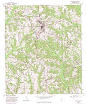
Brundidge Topo Map Alabama
To zoom in, hover over the map of Brundidge
USGS Topo Quad 31085f7 - 1:24,000 scale
| Topo Map Name: | Brundidge |
| USGS Topo Quad ID: | 31085f7 |
| Print Size: | ca. 21 1/4" wide x 27" high |
| Southeast Coordinates: | 31.625° N latitude / 85.75° W longitude |
| Map Center Coordinates: | 31.6875° N latitude / 85.8125° W longitude |
| U.S. State: | AL |
| Filename: | o31085f7.jpg |
| Download Map JPG Image: | Brundidge topo map 1:24,000 scale |
| Map Type: | Topographic |
| Topo Series: | 7.5´ |
| Map Scale: | 1:24,000 |
| Source of Map Images: | United States Geological Survey (USGS) |
| Alternate Map Versions: |
Brundidge AL 1960, updated 1963 Download PDF Buy paper map Brundidge AL 1960, updated 1981 Download PDF Buy paper map Brundidge AL 2011 Download PDF Buy paper map Brundidge AL 2014 Download PDF Buy paper map |
1:24,000 Topo Quads surrounding Brundidge
> Back to 31085e1 at 1:100,000 scale
> Back to 31084a1 at 1:250,000 scale
> Back to U.S. Topo Maps home
Brundidge topo map: Gazetteer
Brundidge: Airports
Brundidge Municipal Airport elevation 142m 465′Brundidge: Dams
Harris Lake Dam elevation 115m 377′Lake Foreen Dam elevation 129m 423′
Walter Bass Dam elevation 153m 501′
Brundidge: Parks
Armory Park elevation 156m 511′Brundidge Recreational Park elevation 127m 416′
Galloway Park elevation 144m 472′
Brundidge: Populated Places
Broad View elevation 139m 456′Brundidge elevation 144m 472′
Caldwell Subdivision elevation 141m 462′
Green Ridge elevation 134m 439′
Hamilton Crossroads elevation 139m 456′
Hillcrest elevation 152m 498′
Pierson Subdivision elevation 148m 485′
Ramage Subdivision elevation 134m 439′
Windmill Hills elevation 148m 485′
Brundidge: Post Offices
Brundidge Post Office elevation 144m 472′Brundidge: Reservoirs
Harris Lake elevation 115m 377′Lake Foreen elevation 129m 423′
Walter Bass Pond elevation 153m 501′
Brundidge: Streams
Bear Creek elevation 96m 314′Beaver Pond Branch elevation 103m 337′
Brundidge digital topo map on disk
Buy this Brundidge topo map showing relief, roads, GPS coordinates and other geographical features, as a high-resolution digital map file on DVD:
Gulf Coast (LA, MS, AL, FL) & Southwestern Georgia
Buy digital topo maps: Gulf Coast (LA, MS, AL, FL) & Southwestern Georgia


