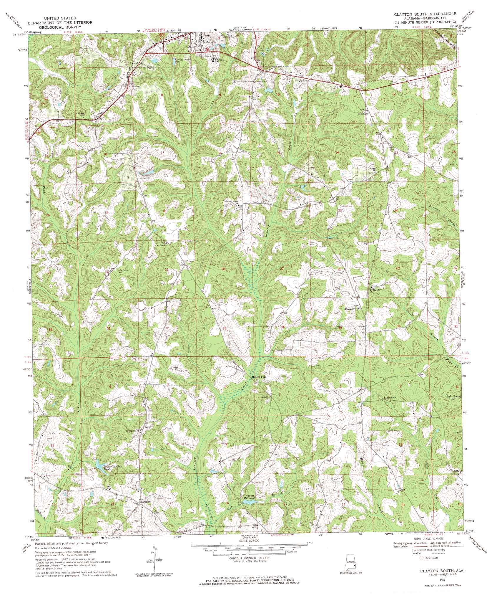
Clayton South Topo Map Alabama
To zoom in, hover over the map of Clayton South
USGS Topo Quad 31085g4 - 1:24,000 scale
| Topo Map Name: | Clayton South |
| USGS Topo Quad ID: | 31085g4 |
| Print Size: | ca. 21 1/4" wide x 27" high |
| Southeast Coordinates: | 31.75° N latitude / 85.375° W longitude |
| Map Center Coordinates: | 31.8125° N latitude / 85.4375° W longitude |
| U.S. State: | AL |
| Filename: | o31085g4.jpg |
| Download Map JPG Image: | Clayton South topo map 1:24,000 scale |
| Map Type: | Topographic |
| Topo Series: | 7.5´ |
| Map Scale: | 1:24,000 |
| Source of Map Images: | United States Geological Survey (USGS) |
| Alternate Map Versions: |
Clayton South AL 1967, updated 1970 Download PDF Buy paper map Clayton South AL 2011 Download PDF Buy paper map Clayton South AL 2014 Download PDF Buy paper map |
1:24,000 Topo Quads surrounding Clayton South
Aberfoil |
Midway |
Comer |
Batesville |
Howe |
Perote |
Mount Andrew |
Clayton North |
White Oak |
Eufaula North |
Josie |
Louisville |
Clayton South |
Baker Hill |
Eufaula South |
Elamville |
Clio |
Texasville |
Lawrenceville |
Fort Gaines Nw |
Ariton |
Skipperville |
Clopton |
Abbeville West |
Abbeville East |
> Back to 31085e1 at 1:100,000 scale
> Back to 31084a1 at 1:250,000 scale
> Back to U.S. Topo Maps home
Clayton South topo map: Gazetteer
Clayton South: Crossings
Millers Ford elevation 116m 380′Clayton South: Dams
Adams Mill Pond Dam elevation 114m 374′Louisville Club Pond Dam elevation 119m 390′
Clayton South: Lakes
Louisville Club Pond elevation 113m 370′Clayton South: Populated Places
Lime Sink elevation 137m 449′Lindsey elevation 142m 465′
Clayton South: Reservoirs
Adams Millpond elevation 112m 367′Clayton South: Streams
Jackson Creek elevation 103m 337′Mill Branch elevation 106m 347′
Pauls Creek elevation 103m 337′
Smith Branch elevation 123m 403′
Clayton South digital topo map on disk
Buy this Clayton South topo map showing relief, roads, GPS coordinates and other geographical features, as a high-resolution digital map file on DVD:
Gulf Coast (LA, MS, AL, FL) & Southwestern Georgia
Buy digital topo maps: Gulf Coast (LA, MS, AL, FL) & Southwestern Georgia
 & Southwestern Georgia map DVD")