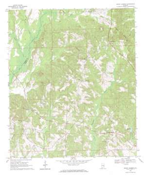
Mount Andrew Topo Map Alabama
To zoom in, hover over the map of Mount Andrew
USGS Topo Quad 31085h5 - 1:24,000 scale
| Topo Map Name: | Mount Andrew |
| USGS Topo Quad ID: | 31085h5 |
| Print Size: | ca. 21 1/4" wide x 27" high |
| Southeast Coordinates: | 31.875° N latitude / 85.5° W longitude |
| Map Center Coordinates: | 31.9375° N latitude / 85.5625° W longitude |
| U.S. State: | AL |
| Filename: | o31085h5.jpg |
| Download Map JPG Image: | Mount Andrew topo map 1:24,000 scale |
| Map Type: | Topographic |
| Topo Series: | 7.5´ |
| Map Scale: | 1:24,000 |
| Source of Map Images: | United States Geological Survey (USGS) |
| Alternate Map Versions: |
Mount Andrew AL 1968, updated 1971 Download PDF Buy paper map Mount Andrew AL 2011 Download PDF Buy paper map Mount Andrew AL 2014 Download PDF Buy paper map |
1:24,000 Topo Quads surrounding Mount Andrew
> Back to 31085e1 at 1:100,000 scale
> Back to 31084a1 at 1:250,000 scale
> Back to U.S. Topo Maps home
Mount Andrew topo map: Gazetteer
Mount Andrew: Bridges
Anglins Bridge (historical) elevation 115m 377′Cooks Ford Bridge elevation 111m 364′
Mount Andrew: Populated Places
Bells Crossroads elevation 170m 557′Garmon Crossroads elevation 185m 606′
Greens Crossroads elevation 143m 469′
Laurel Grove (historical) elevation 144m 472′
Mount Andrew elevation 168m 551′
Mount Andrew: Reservoirs
Williams Millpond elevation 130m 426′Mount Andrew: Ridges
Center Ridge elevation 171m 561′Mount Andrew: Streams
Little Indian Creek elevation 110m 360′North Fork Little Creek elevation 120m 393′
Polecat Branch elevation 134m 439′
Spring Creek elevation 112m 367′
Mount Andrew digital topo map on disk
Buy this Mount Andrew topo map showing relief, roads, GPS coordinates and other geographical features, as a high-resolution digital map file on DVD:
Gulf Coast (LA, MS, AL, FL) & Southwestern Georgia
Buy digital topo maps: Gulf Coast (LA, MS, AL, FL) & Southwestern Georgia


