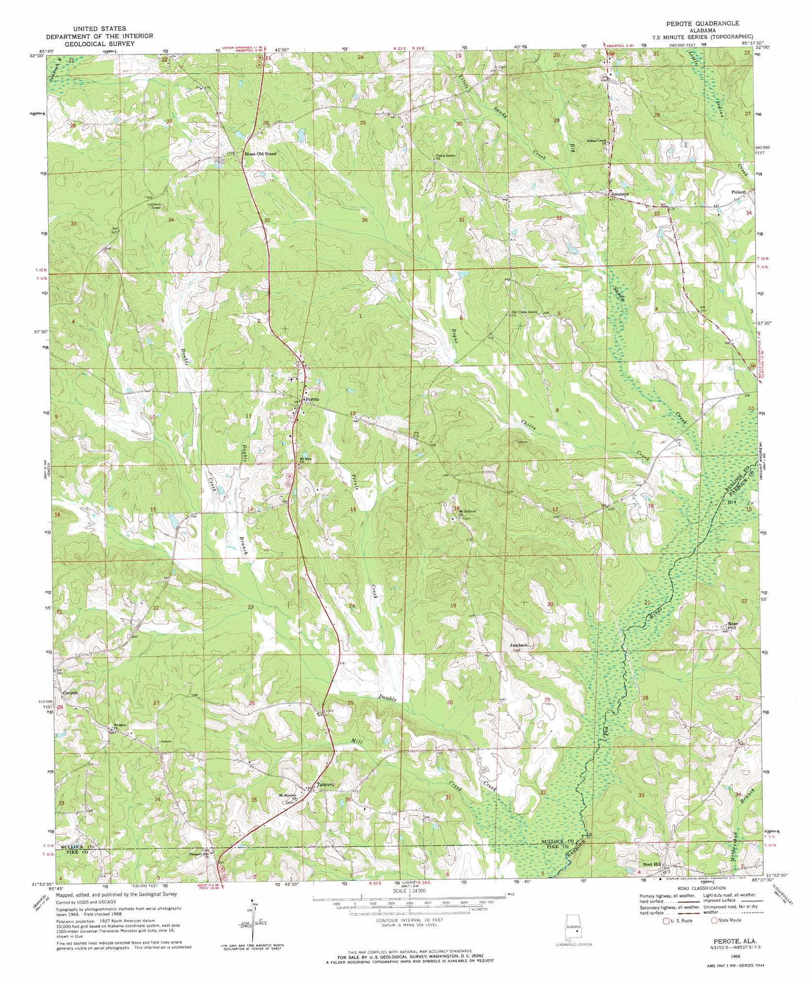
Perote Topo Map Alabama
To zoom in, hover over the map of Perote
USGS Topo Quad 31085h6 - 1:24,000 scale
| Topo Map Name: | Perote |
| USGS Topo Quad ID: | 31085h6 |
| Print Size: | ca. 21 1/4" wide x 27" high |
| Southeast Coordinates: | 31.875° N latitude / 85.625° W longitude |
| Map Center Coordinates: | 31.9375° N latitude / 85.6875° W longitude |
| U.S. State: | AL |
| Filename: | o31085h6.jpg |
| Download Map JPG Image: | Perote topo map 1:24,000 scale |
| Map Type: | Topographic |
| Topo Series: | 7.5´ |
| Map Scale: | 1:24,000 |
| Source of Map Images: | United States Geological Survey (USGS) |
| Alternate Map Versions: |
Perote AL 1968, updated 1970 Download PDF Buy paper map Perote AL 2011 Download PDF Buy paper map Perote AL 2014 Download PDF Buy paper map |
1:24,000 Topo Quads surrounding Perote
Fitzpatrick |
Thompson |
Union Springs |
Roba |
Hurtsboro |
China Grove |
Almeria |
Aberfoil |
Midway |
Comer |
Needmore |
Saco |
Perote |
Mount Andrew |
Clayton North |
Troy |
Banks |
Josie |
Louisville |
Clayton South |
Brundidge Nw |
Brundidge |
Elamville |
Clio |
Texasville |
> Back to 31085e1 at 1:100,000 scale
> Back to 31084a1 at 1:250,000 scale
> Back to U.S. Topo Maps home
Perote topo map: Gazetteer
Perote: Bridges
Littles Bridge (historical) elevation 105m 344′Richardsons Bridge (historical) elevation 103m 337′
Perote: Populated Places
Blues Old Stand elevation 144m 472′Boot Hill elevation 142m 465′
Jamback elevation 138m 452′
Perote elevation 147m 482′
Pickett elevation 131m 429′
Smuteye elevation 142m 465′
Star Hill elevation 153m 501′
Tanyard elevation 153m 501′
Perote: Streams
Big Sandy Creek elevation 106m 347′Bogue Chitta Creek elevation 105m 344′
Double Branch elevation 114m 374′
Double Creek elevation 103m 337′
Dry Creek elevation 107m 351′
Little Sandy Creek elevation 117m 383′
Mill Creek elevation 103m 337′
Perote Creek elevation 108m 354′
Perote digital topo map on disk
Buy this Perote topo map showing relief, roads, GPS coordinates and other geographical features, as a high-resolution digital map file on DVD:
Gulf Coast (LA, MS, AL, FL) & Southwestern Georgia
Buy digital topo maps: Gulf Coast (LA, MS, AL, FL) & Southwestern Georgia
 & Southwestern Georgia map DVD")